Meteorology is a branch of the atmospheric sciences which includes atmospheric chemistry and atmospheric physics, with a major focus on weather forecasting. The study of meteorology dates back millennia, though significant progress in meteorology did not occur until the 18th century. The 19th century saw modest progress in the field after weather observation networks were formed across broad regions. Prior attempts at prediction of weather depended on historical data. It was not until after the elucidation of the laws of physics and more particularly, the development of the computer, allowing for the automated solution of a great many equations that model the weather, in the latter half of the 20th century that significant breakthroughs in weather forecasting were achieved. An important domain of weather forecasting is marine weather forecasting as it relates to maritime and coastal safety, in which weather effects also include atmospheric interactions with large bodies of water.

Weather forecasting is the application of science and technology to predict the conditions of the atmosphere for a given location and time. People have attempted to predict the weather informally for millennia and formally since the 19th century. Weather forecasts are made by collecting quantitative data about the current state of the atmosphere at a given place and using meteorology to project how the atmosphere will change.

Skywarn is a program of the United States' National Weather Service (NWS). Its mission is to collect reports of localized severe weather. These reports are used to aid forecasters in issuing and verifying severe weather watches and warnings and to improve the forecasting and warning processes and the tools used to collect meteorological data. Reports are also used by local emergency managers and public safety officials.
The Special Broadcasting Service (SBS) is a hybrid-funded Australian public broadcasting radio, online and television network. About 80 per cent of funding for the SBS Corporation is derived from the Australian Government. SBS operates five TV channels and eight radio networks.

A weather station is a facility, either on land or sea, with instruments and equipment for measuring atmospheric conditions to provide information for weather forecasts and to study the weather and climate. The measurements taken include temperature, atmospheric pressure, humidity, wind speed, wind direction, and precipitation amounts. Wind measurements are taken with as few other obstructions as possible, while temperature and humidity measurements are kept free from direct solar radiation, or insolation. Manual observations are taken at least once daily, while automated measurements are taken at least once an hour. Weather conditions out at sea are taken by ships and buoys, which measure slightly different meteorological quantities such as sea surface temperature (SST), wave height, and wave period. Drifting weather buoys outnumber their moored versions by a significant amount.

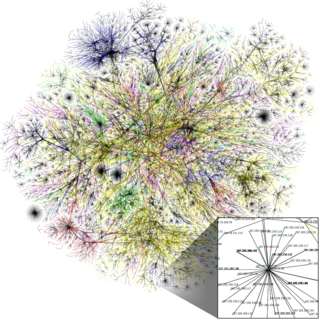
Internet access is the ability of individuals and organizations to connect to the Internet using computer terminals, computers, and other devices; and to access services such as email and the World Wide Web. Internet access is sold by Internet service providers (ISPs) delivering connectivity at a wide range of data transfer rates via various networking technologies. Many organizations, including a growing number of municipal entities, also provide cost-free wireless access.

Microsoft XNA is a freeware set of tools with a managed runtime environment provided by Microsoft that facilitates video game development and management. XNA is based on the .NET Framework, with versions that run on Windows NT, Windows Phone and the Xbox 360. XNA content is built with the XNA Game Studio, and played using the XNA Framework, or published as native executables.
Weather spotting is observing weather for the purpose of reporting to a larger group or organization. Examples include National Weather Service (NWS) co-op observers and Skywarn storm spotters.
The NSLU2 is a network-attached storage (NAS) device made by Linksys introduced in 2004 and discontinued in 2008. It makes USB flash memory and hard disks accessible over a network using the SMB protocol. It was superseded mainly by the NAS200 and in another sense by the WRT600N and WRT300N/350N which both combine a Wi-Fi router with a storage link.

The Association of American Weather Observers was a group of amateur weather observers from around the United States. Their aim was to educate the public on weather awareness and to simply share stories among themselves on recent extreme weather that they viewed at their location.
The NOAA Environmental Real-time Observation Network (NERON) is a project to establish a nationwide network of high quality near real-time weather monitoring stations across the United States. A 20-mile by 20-mile grid has been established, with the hopes of having one observation system within each grid cell. Effort is being put forth by local National Weather Service (NWS) offices and other state climate groups to ensure that sites in the network meet important criteria. The network will be composed of existing, and in some cases upgraded, sites as well as new sites being established for other local and state efforts. Many stations in New England and New York have already been installed.

In meteorology, a mesonet, portmanteau of mesoscale network, is a network of (typically) automated weather and environmental monitoring stations designed to observe mesoscale meteorological phenomena. Dry lines, squall lines, and sea breezes are examples of phenomena that can be observed by mesonets. Due to the space and time scales associated with mesoscale phenomena, weather stations comprising a mesonet will be spaced closer together and report more frequently than synoptic scale observing networks, such as ASOS. The term mesonet refers to the collective group of these weather stations, and are typically owned and operated by a common entity. Mesonets usually record in situ surface weather observations but some involve other observation platforms, particularly vertical profiles of the planetary boundary layer (PBL).

Meteorological instruments are the equipments used to sample the state of the atmosphere at a given time. Each science has its own unique sets of laboratory equipment. Meteorology, however, is a science which does not use much lab equipment but relies more on on-site observation and remote sensing equipment. In science, an observation, or observable, is an abstract idea that can be measured and for which data can be taken. Rain was one of the first quantities to be measured historically. Two other accurately measured weather-related variables are wind and humidity. Many attempts had been made prior to the 15th century to construct adequate equipment to measure atmospheric variables.

The Community Collaborative Rain, Hail and Snow Network, or CoCoRaHS, is a network of volunteer weather observers in the United States, Canada, and the Bahamas that take daily readings of precipitation and report them to a central data store over the internet.

Surface weather observations are the fundamental data used for safety as well as climatological reasons to forecast weather and issue warnings worldwide. They can be taken manually, by a weather observer, by computer through the use of automated weather stations, or in a hybrid scheme using weather observers to augment the otherwise automated weather station. The ICAO defines the International Standard Atmosphere (ISA), which is the model of the standard variation of pressure, temperature, density, and viscosity with altitude in the Earth's atmosphere, and is used to reduce a station pressure to sea level pressure. Airport observations can be transmitted worldwide through the use of the METAR observing code. Personal weather stations taking automated observations can transmit their data to the United States mesonet through the Citizen Weather Observer Program (CWOP), the UK Met Office through their Weather Observations Website (WOW), or internationally through the Weather Underground Internet site. A thirty-year average of a location's weather observations is traditionally used to determine the station's climate. In the US a network of Cooperative Observers make a daily record of summary weather and sometimes water level information.
Storm spotting is a form of weather spotting in which observers watch for the approach of severe weather, monitor its development and progression, and actively relay their findings to local authorities.
The Significant Weather Observing Program (SWOP) was created at the National Weather Service (NWS) Weather Forecast Office (WFO) in Central Illinois in order to provide forecasters with additional data during and after significant weather events.

The NOAA Cooperative Observer Program (COOP) is a citizen weather observer network run by the U.S. National Weather Service (NWS) and National Centers for Environmental Information (NCEI). Over 8,700 volunteers from the fifty states and all territories report at least daily a variety of weather conditions such as daily maximum and minimum temperatures, 24-hour precipitation totals, including snowfall, and significant weather occurrences throughout a day that are recorded via remarks in observer logs. Some stations also report stream stage or tidal levels.


