Wadi Abadilah

Last updated
Wadi Abadilah
United Arab Emirates location map.svg
Red pog.svg
Wadi Abadilah
Coordinates: 25°26′18″N56°11′29″E / 25.43833°N 56.19139°E
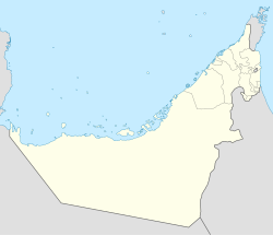
 / 25.43833; 56.19139
Country United Arab Emirates
Emirate Fujairah
Elevation
[1]
255 m (837 ft)

WadiAbadilah is a wadi in Fujairah, United Arab Emirates, which runs North East towards the coast at Dibba. [2] At Masafi, it forms a confluence with the Wadi Ham, which runs South East towards Fujairah City. [3]

See also

References

  1. “`Abadilah Map - United Arab Emirates - Mapcarta”, n.d. http://mapcarta.com/12931684.
  2. Stewart., Edgell, H. (2006). Arabian deserts : nature, origin and evolution. Dordrecht: Springer. p. 101. ISBN   9781402039706. OCLC   262691230.{{cite book}}: CS1 maint: multiple names: authors list (link)
  3. Proceedings of the Seminar for Arabian Studies : papers from the forty-third meeting of the Seminar for Arabian studies held at the British Museum, London, 23-25 July 2009. Oxford: Archaeopress. 2010. p. 121. ISBN   9781905739332. OCLC   659226583.