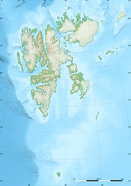
Indre Wijdefjorden National Park is located in a steep fjord landscape in northern Spitsbergen in Svalbard, Norway. It covers the inner part of Wijdefjorden—the longest fjord on Svalbard. The national park was established on 9 September 2005 and covers 1,127 km2 (435 sq mi), of which 745 km2 (288 sq mi) is on land and 382 km2 (147 sq mi) is sea. The marine environment changes vastly from the mouth of the fjord, through a still, cold, water basin, becoming deeper before reaching the glacier Mittag-Lefflerbreen at the inner-most sections of the fjord.

Torell Land is a land area at the southeast part of Spitsbergen, Svalbard. It is named after Otto Martin Torell. Two glaciers, Hornbreen and Hambergbreen, divide Torell Land from Sørkapp Land.
James I Land is a land area on the northwestern part of Spitsbergen, Svalbard. It is named after King James I of England and Scotland. The 30 kilometer long glacier Sveabreen divides James I Land from Oscar II Land.
Barentsjøkulen is a glacier on Barentsøya, Svalbard. The glacier covers an area of about 571 km2 (220 sq mi). It is named after the Barents Island, which again is named after Dutch explorer Willem Barentsz. Barents Island is on the Barents Sea.
St. Jonsfjorden is a fjord in Oscar II Land at Spitsbergen, Svalbard. It has a length of 21 kilometer, and opens westwards into the strait of Forlandsundet. Several glaciers debouche into the fjord, including Gaffelbreen and Konowbreen from the north, a merge of Osbornebreen, Devikbreen, Vintervegen, Paulbreen and Bukkebreen at the bottom, and Vegardbreen, Charlesbreen and Bullbreen from the south.
Vintervegen is a glacier in Oscar II Land at Spitsbergen, Svalbard. It has a length of about 7.5 kilometers (4.7 mi). The glacier borders to the mountain of Klampen, merges with Osbornebreen and other glaciers, and the merged glacier stream debouches into the head of St. Jonsfjorden.
Kjerulfbreen is a glacier in Oscar II Land at Spitsbergen, Svalbard. It has a length of about 7.5 kilometers, and is debouching into the Trygghamna bay at the northern side of Isfjorden. The glacier is named after Norwegian geologist Theodor Kjerulf.

Olsokbreen is a glacier in Sørkapp Land at Spitsbergen, Svalbard, in northern Norway. It has a length of about seventeen kilometers, and debouches into the bay Stormbukta at the western shore of Spitsbergen. The glacier front is about five kilometer long. Olsokbreen is a southern branch of the glacier Mefonna, which also has the northern branch Samarinbreen. Tributary glaciers to Olsokbreen are Kvithettbreen and Valettebreen, both coming from the east, from or between the mountains of Snøkrossen, Gråtinden, Kvithetta, Haitanna and Guilbaudtoppen.
Vasil'evbreen is a glacier in Sørkapp Land at Spitsbergen, Svalbard. It has an extension of about twenty kilometers, with several tributary glaciers. It is named after Russian astronomer Alexandr Semenovich Vasil'ev. The glacier has a wide front facing towards the eastern shore of Spitsbergen, including the bay of Isbukta. The southern part of Vasil'evbreen is called Randbreen, located north of Istoppane and Dumskolten, and south of Søre Randberget.

Recherchebreen is a glacier in Wedel Jarlsberg Land at Spitsbergen, Svalbard. The glacier has a length of about 16 kilometers (9.9 mi). It is located in a valley between Martinfjella and Observatoriefjellet, and debouches into Recherche Fjord. Among its tributary glaciers are Foldnutfonna, Varderyggfonna, Dollfusbreen, Ramondbreen and Bjørnbreen.
Keilhaubreen is a glacier in Sørkapp Land at Spitsbergen, Svalbard. It has a length of about five kilometers and is located north of Keilhaufjellet, flowing from Sørkappfonna towards the eastern coast of Spitsbergen. The glacier is named after Norwegian geologist Baltazar Mathias Keilhau. To the south of the glacier is the bay Austerbogen.
Comfortlessbreen is a glacier in Oscar II Land at Spitsbergen, Svalbard. It has a length of about fourteen kilometers, and a maximum width of three kilometers. The glacier debouches into Engelskbukta, after a merge with Uvêrsbreen. Comfortlessbreen is separated from Uvêrsbreen by the mountain range of Trondheimfjella.

Tinayrebreen is a glacier in Haakon VII Land at Spitsbergen, Svalbard. It has a length of about ten kilometers, and extends from the glacier cap of Isachsenfonna to Möllerfjorden, where it debouches into the bay of Tinayrebukta. The glacier is named after French painter Louis Tinayre.

Hayesbreen is a glacier in Sabine Land at Spitsbergen, Svalbard. It is named after American politician and Arctic explorer Isaac Israel Hayes. The glacier has a length of about eighteen kilometers, and debouches into the bay of Mohnbukta. Surrounding mountains are Aagaardfjellet to the north, Jebensfjellet to the south, and Panofskyfjellet where Hayesbreen joins the glacier of Königsbergbreen.
Linnébreen is a glacier in Nordenskiöld Land at Spitsbergen, Svalbard, Norway. It is named after Swedish botanist Carl Linnaeus. The glacier has a length of about 3.5 kilometers, and flows from the mountain of Systemafjellet towards the valley of Linnédalen. It is proximate to the mountain of Christensenfjella.
Hedgehogfonna is a glacier field in Sørkapp Land at Spitsbergen, Svalbard. It is located west of the mountain of Hedgehogfjellet, and is separated from the glacier of Vasil'evbreen by Skilfonna.
Paulabreen is a glacier in Nathorst Land and Heer Land at Spitsbergen, Svalbard. It has a length of about fifteen kilometers, extending from the mountain of Kjølberget to the bay of Rindersbukta. The glacier is named after Paula, the wife of shipmaster Richard Ritter von Barry. Paulabreen borders to the mountain area of Vriompeisen, and the mountain of Hollertoppen. A tributary glacier is Bakaninbreen.
Kvitskarvbreen is a glacier in Nathorst Land at Spitsbergen, Svalbard. It has a length of about 8.5 kilometers, and extend northwestwards from the mountain of Kvitskarvet to the valley of Bromelldalen. The glaciers of Lundbreen, Juvbreen and Zimmerbreen are all tributaries to Kvitskarvbreen.
Werenskioldbreen is a glacier in Wedel Jarlsberg Land, Svalbard, Norway. The glacier is named after Norwegian geologist and Arctic explorer Werner Werenskiold.