Related Research Articles

The Southland Plains is a general name given to several areas of low-lying land in the South Island of New Zealand, separated by the rise of the Hokonui Hills in the north. It forms a sizeable area of Southland region and encompasses its two principal settlements the city of Invercargill and the town of Gore. The Southland Plains include some of New Zealand's most fertile farmland.

The Waiau Toa / Clarence River is on northeast South Island of New Zealand. It is 230 kilometres (140 mi) long, which makes it the eighth longest river in New Zealand.
Hawke's Bay's Waiau River is one of at least four rivers of this name in New Zealand. It rises in the Kaingaroa Forest to the west of Lake Waikaremoana, and flows southeast for 60 kilometres before joining the Wairoa River.

Waiau River is the largest river in the Southland region of New Zealand. 'Waiau' translates to 'River of Swirling Currents'. It is the outflow of Lake Te Anau, flowing from it into Lake Manapouri 10 kilometres (6 mi) to the south, and from there flows south for 70 kilometres (43 mi) before reaching the Foveaux Strait 8 kilometres (5 mi) south of Tuatapere. It also takes water from Lake Monowai.

Waiau Uwha River, previously known as the Waiau River, is a river in north Canterbury in the South Island of New Zealand. The Waiau Uwha River rises in the Spenser Mountains and flows eastward to the Pacific Ocean. The Waiau Uwha River has the second largest catchment—3,310 square kilometres (1,280 sq mi)—of North Canterbury's rivers.

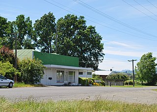
Waiau is a small town in north Canterbury, in the South Island of New Zealand. It lies 30 kilometres (19 mi) east of Hanmer Springs on the northern bank of the Waiau River, some 30 kilometres (19 mi) from the river's mouth.
The Waiau Branch was a branch line railway in the northern Canterbury region of New Zealand's South Island. Known as the Great Northern Railway for its first few decades of life, the Waiau Branch was seen as part of a main line north but was ultimately superseded by a coastal route. Opened in stages from 1882 to 1919, the line closed in 1978 but a portion has been retained as the Weka Pass Railway.
Parnassus is a town located in the Canterbury region's Hurunui District on the east coast of New Zealand's South Island. It is located on the north bank of the Waiau River and the 2001 New Zealand census gave its usually resident population as 900, a decline of 6.8% or 66 people since the 1996 census.

The Main North Line, sometimes referred to as part of the South Island Main Trunk Railway, is a railway line that runs north from Christchurch in New Zealand up the east coast of the South Island through Kaikōura and Blenheim to Picton. It is a major link in New Zealand's national rail network and offers a connection with roll-on roll-off ferries from Picton to Wellington. It was also the longest railway construction project in New Zealand's history, with the first stages built in the 1870s and not completed until 1945.

The Wairoa River of the Hawke's Bay region in New Zealand runs south for 65 kilometres from the inland east coast region of the North Island, west of Gisborne, before flowing into northern Hawke Bay at the town of Wairoa.

State Highway 7 is a major New Zealand state highway. One of the eight national highways, it crosses the Southern Alps to link the West Coast Region with Canterbury and to form a link between the South Island's two longest highways, State Highway 1 and State Highway 6. Distances are measured from east to west with the major junction list going from east to west.
Mangapapa is a suburb of the New Zealand city of Gisborne. It is located in the north of the city. Whataupoko lies to the southeast and Te Hapara to the south, separated from Mangapapa by the Taruheru River.

State Highway 38 is a road in the North Island of New Zealand that starts from SH 5 near Waiotapu, and ends at Wairoa, where it connects to SH 2. It is the shortest connection from the central North Island (Rotorua) to the East Coast (Gisborne), but it is not often used as such. Large parts of the road are narrow and winding, and about 74 kilometres (46 mi) of the road is unsealed. Travel on this highway takes roughly four hours.
The Castaly River is a river of New Zealand. It is in north Canterbury, northwest of the township of Parnassus, and flows generally east for 8 kilometres (5 mi) before joining the Leader River, itself a tributary of the Waiau River.
The Empson River is a stream in the Canterbury Region of New Zealand. It arises near Grey Hill in the Hanmer Range and flows south into the Waiau River. The name is not official.
The Manganuiohou River is a river of the northeast of New Zealand's North Island. It flows southwards from its source in Te Urewera National Park immediately to the northwest of Lake Waikaremoana, and joins with the Waiau River at the park's southwestern boundary.
The Stanton River is a river of the Canterbury region of New Zealand's South Island. IUt flows southeast through the Hundalee Hills, turning southwest to reach the Waiau River 7 kilometres (4 mi) east of Waiau.

The Waikaretāheke River is a river of the Hawke's Bay region of New Zealand's North Island. It serves as the outflow of Lake Waikaremoana, flowing southeast from the lake's southeastern shore to reach the Waiau River 20 kilometres northwest of Wairoa. State Highway 38 follows the river's course for much of its length.

The Hope River in Canterbury is one of three rivers by that name in the South Island of New Zealand. It is a tributary of the Waiau River.

The Stanley River is a river of the Canterbury region of New Zealand's South Island. An upper tributary of the Waiau River, it rises on the southern flanks of the St James Range and flows southwest to reach the Waiau 17 kilometres (11 mi) east of the Lewis Pass. Lake Guyon drains to the Stanley River via a swampy tributary named Stanley Vale. In its lower reaches the river passes through a gorge known as Stanley Gate. The Fowler Pass Track follows the river for much of its length.
References
- ↑ "Place name detail: Waiau River". New Zealand Gazetteer. Land Information New Zealand . Retrieved 25 June 2010.
Coordinates: 38°09′26″S178°14′59″E / 38.157304°S 178.249692°E
| This article about a river in the Gisborne District is a stub. You can help Wikipedia by expanding it. |