Waikato (disambiguation)

Last updated

Waikato is a top-tier local government region of New Zealand extending from Thames-Coromandel District to Taupo District.

Waikato region in New Zealands North Island

Waikato is a local government region of the upper North Island of New Zealand. It covers the Waikato District, Hauraki, Coromandel Peninsula, the northern King Country, much of the Taupo District, and parts of Rotorua District. It is governed by the Waikato Regional Council.

Waikato may also refer to:

Waikato District Territorial authority in Waikato, New Zealand

Waikato District is a territorial authority of New Zealand, in the northern part of Waikato Region, North Island. Waikato District is administered by the Waikato District Council, with headquarters in Ngaruawahia.

Invasion of the Waikato

The Invasion of the Waikato was the biggest and most important campaign of the 19th century New Zealand Wars, fought in the North Island of New Zealand between the military forces of the colonial government and a federation of Māori tribes known as the "Kingitanga Movement". The Waikato is a territorial region with a northern boundary somewhat south of the city of Auckland. Hostilities lasted for nine months, from July 1863 to April 1864. The invasion was aimed at crushing Kingite power, which was seen as a threat to British authority, and also at driving Waikato Māori from their territory in readiness for occupation and settlement by Europeans. The campaign was fought by a peak of about 14,000 Imperial and colonial troops and about 4,000 Māori warriors drawn from more than half the major North Island tribal groups.

Waikato River longest river in New Zealand

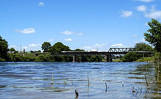
The Waikato River is the longest river in New Zealand, running for 425 kilometres (264 mi) through the North Island. It rises in the eastern slopes of Mount Ruapehu, joining the Tongariro River system and flowing through Lake Taupo, New Zealand's largest lake. It then drains Taupo at the lake's northeastern edge, creates the Huka Falls, and flows northwest through the Waikato Plains. It empties into the Tasman Sea south of Auckland, at Port Waikato. It gives its name to the Waikato Region that surrounds the Waikato Plains. The present course of the river was largely formed about 17,000 years ago. Contributing factors were climate warming, forest being reestablished in the river headwaters and the deepening, rather than widening, of the existing river channel. The channel was gradually eroded as far up river as Piarere, leaving the old Hinuera channel through the Hinuera Gap high and dry. The remains of the old river path can be clearly seen at Hinuera where the cliffs mark the ancient river edges. The river's main tributary is the Waipa River, which has its confluence with the Waikato at Ngaruawahia.

Organisations
Waikato Rugby Union sports club

The Waikato Rugby Union (WRU) is the official governing body of rugby union in the Waikato area in the North Island of New Zealand. Its senior representative team competes in the Mitre 10 Cup, and won the inaugural Air New Zealand Cup in 2006.

Waikato Rugby League

Waikato Rugby League is the local sporting body responsible for the administration of rugby league in the Waikato region of New Zealand. The WRL are represented by the Waikato rugby league team. They are currently part of the Upper Central Zone along with Coastline Rugby League and Bay of Plenty Rugby League.

Waikato AFL is an Australian rules football competition in Waikato, New Zealand and is one of the Leagues governed by AFL New Zealand.

Related Research Articles

Canterbury, New Zealand Region of New Zealand in South Island

Canterbury is a region of New Zealand, located in the central-eastern South Island. The region covers an area of 44,508 square kilometres (17,185 sq mi), and is home to a population of 624,000.

Tainui is a tribal waka confederation of New Zealand Māori iwi. The Tainui confederation comprises four principal related Māori iwi of the central North Island of New Zealand: Hauraki, Ngāti Maniapoto, Ngāti Raukawa and Waikato. There are other Tainui iwi whose tribal areas lay outside the traditional Tainui boundaries - Ngāi Tai in the Bay of Plenty, Ngati Raukawa, and Ngāti Toa in the Horowhenua, Kapiti region and Ngāti Rārua and Ngāti Koata in the northern South Island.

Cambridge, New Zealand Town in Waikato, New Zealand

Cambridge is a town in the Waipa District of the Waikato Region of the North Island of New Zealand. Situated 24 kilometres (15 mi) southeast of Hamilton, on the banks of the Waikato River, Cambridge is known as "The Town of Trees & Champions". The town has a population of 19,150, making it the largest town in the Waipa District, and third largest urban area in the Waikato.

Huntly, New Zealand Minor urban area in Waikato, New Zealand

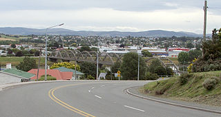
Huntly is a town in the Waikato district and region of the North Island of New Zealand. It is on State Highway 1, 95 kilometres (59 mi) south of Auckland and 32 kilometres (20 mi) north of Hamilton. It is situated on the North Island Main Trunk (NIMT) railway and straddles the Waikato River. Huntly is within the Waikato District which is in the northern part of the Waikato Region local government area.

Balclutha, New Zealand Town in Otago, New Zealand

Balclutha is a town in Otago, lying towards the end of the Clutha River, on the east coast of the South Island of New Zealand. It is about halfway between Dunedin and Invercargill on the Main South Line railway, State Highway 1 and the Southern Scenic Route. Balclutha has a population of 3,990, and is the largest town in South Otago.

Ngaruawahia Town

Ngaruawahia is a town in the Waikato region of the North Island of New Zealand. It is located 20 kilometres (12 mi) north-west of Hamilton at the confluence of the Waikato and Waipa Rivers, adjacent to the Hakarimata Range. Ngaruawahia lies within the Hamilton Urban Area, the fourth largest urban area in New Zealand. The location was once considered as a potential capital of New Zealand.

Whangarei Regional City in Northland, New Zealand

Whangarei is the northernmost city in New Zealand and the regional capital of Northland Region. It is part of the Whangarei District, a local body created in 1989 from the former Whangarei City, Whangarei County and Hikurangi Town councils, to administer both the city proper and its hinterland. The city population was estimated to be 58,800 in June 2018, an increase from 47,000 in 2001.

Pukekohe Secondary urban area in Auckland, New Zealand

Pukekohe is a town in the Auckland Region of the North Island of New Zealand. Located at the southern edge of the Auckland Region, it is in South Auckland, between the southern shore of the Manukau Harbour and the mouth of the Waikato River. The hills of Pukekohe and nearby Bombay Hills form the natural southern limit of the Auckland region. Pukekohe is located within the political boundaries of the Auckland Council, following the abolition of the Franklin District Council on 1 November 2010.

Tokoroa Place in Waikato, New Zealand

Tokoroa is the fifth-largest town in the Waikato region of the North Island of New Zealand and largest settlement in the South Waikato District. Located 30 km southwest of Rotorua, close to the foot of the Mamaku Ranges, it is midway between Taupo and Hamilton on State Highway One. Its 2006 census population was 13,600, a significant decline from the 2001 figure of 14,950.

The King Country is a region of the western North Island of New Zealand. It extends approximately from the Kawhia Harbour and the town of Otorohanga in the north to the upper reaches of the Whanganui River in the south, and from the Hauhungaroa and Rangitoto Ranges in the east to near the Tasman Sea in the west. It comprises hill country, large parts of which are forested.

Mangere suburb in Auckland, New Zealand

Mangere, is one of the largest suburbs in Auckland, in northern New Zealand. It is located on mainly flat land on the northeastern shore of the Manukau Harbour, to the northwest of Manukau City Centre and 15 kilometres south of the Auckland city centre. It is the location of Auckland Airport, which lies close to the harbour's edge to the south of the suburb.

New Zealand Māori rugby league team is a rugby league representative side made up of New Zealand Māori players. The side represents the New Zealand Māori Rugby league. Like its union counterpart, the rugby league team competes in international competitions.

Rugby league in New Zealand dates to the beginning of the sport in England.

Manaia may refer to:

Bay of Plenty Region in North Island, New Zealand

The Bay of Plenty is a large bight in the northern coast of New Zealand's North Island. It stretches from the Coromandel Peninsula in the west to Cape Runaway in the east, a wide stretch of some 259 km of open coastline. The Bay of Plenty Region is situated around this body of water, also incorporating several large islands in the bay. The bay was named by James Cook after he noticed the abundant food supplies at several Māori villages there, in stark contrast to the earlier observations he had made in Poverty Bay.

Taranaki is a region of New Zealand administered by the Taranaki Regional Council.

Local government in New Zealand

New Zealand is a unitary state rather than a federation—regions are created by the authority of the central government, rather than the central government being created by the authority of the regions. Local government in New Zealand has only the powers conferred upon it by Parliament. These powers have traditionally been distinctly fewer than in some other countries. For example, police and education are run by central government, while the provision of low-cost housing is optional for local councils.

History of rugby union in New Zealand

Rugby union has a long history in New Zealand. Today, New Zealand holds tier one status with World Rugby.