Related Research Articles
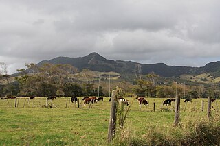
Taipa-Mangonui or Taipa Bay-Mangonui is a string of small resort settlements – Taipa, Cable Bay, Coopers Beach, and Mangōnui – that lie along the coast of Doubtless Bay and are so close together that they have run together to form one larger settlement.

Matauri Bay is a bay in New Zealand, situated 30 km north of Kerikeri, in Whangaroa county, just north of the Bay of Islands. It has over a kilometre of white sand and crystal clear water, making it a popular summer destinations for surfers, divers, fishers and holidaymakers.
Kaeo is a township in the Far North District of New Zealand, located some 22 km (14 mi) northwest of Kerikeri. The town takes its name from the kāeo or New Zealand freshwater mussel, which is found in the nearby rivers.
Pakaraka is a settlement in Northland, New Zealand, at the junction of State Highway 1 and 10, in the district the Ngāpuhi tribe called Tai-a-mai.

The Karikari Peninsula on the east coast of the far north of Northland, New Zealand, is between Rangaunu Harbour to the west, and Doubtless Bay to the southeast. It is a right-angled land mass of two relatively distinct parts. The rocky northern part, which has an east–west orientation and is approximately 17 km long, was originally an island but is now connected to the mainland by a low sandy tombolo approximately 11 km long, which has a north–south orientation. The spiritually significant Puwheke sits high above the north-facing beaches.

Ngāti Kahu is a Māori iwi of Northland, New Zealand. The iwi is one of the six Muriwhenua iwi of the far north of the North Island. Ngāti Kahu take their name from their founding ancestress, Kahutianui, and link their ancestry back to the waka Māmaru. The captain of Māmaru was Te Parata who married Kahutianui.
Waimamaku is a village and rural community, based along the banks of the Waimamaku River south of the Hokianga Harbour on the west coast of New Zealand's North Island. It is located in the Far North District and Northland Region on State Highway 12, south of Ōmāpere and north of Waipoua.
Anahera Herbert-Graves was the Chief Executive Officer of Te Runanga-a-Iwi o Ngāti Kahu from July 2006 to December 2021, the tribal parliament of the New Zealand Māori tribe Ngāti Kahu.

Ngāti Kahu ki Whangaroa are a Maori iwi (tribe) based at the Whangaroa Harbour harbour area in New Zealand's Northland Region.
Hihi or Hihi Beach is a village and rural community in the Far North District and Northland Region of New Zealand's North Island.
Ngapuna is a suburb in eastern Rotorua in the Bay of Plenty Region of New Zealand's North Island.
Ngararatunua or Ngāraratunua is a semi-rural community on the outskirts of Whangārei, in the Northland Region of New Zealand's North Island.
Nukutawhiti is a village and rural community in the Whangarei District and Northland Region of New Zealand's North Island. It is located on State Highway 15, south of Tautoro and north of Pakotai.
Parakao is a village and rural community in the Whangarei District and Northland Region of New Zealand's North Island. It is located on State Highway 15, southeast of Pakotai and northwest of Titoki.
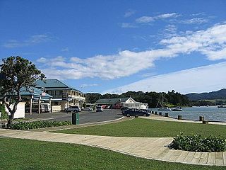
Mangōnui is a settlement on the west side of Mangōnui Harbour in Northland, New Zealand. State Highway 10 runs through it. It is the easternmost of the Taipa-Mangonui string of settlements, separated from Coopers Beach to the northwest by Mill Bay Road.
Ōtaua is a rural community in the Far North District and Northland Region of New Zealand's North Island.

Tākou Bay is a bay and rural community in the Far North District and Northland Region of New Zealand's North Island, beside the Tākou River. Tākou Bay is an official name, gazetted on 16 July 2020.

Taupō Bay is a bay, village and rural community in the Far North District and Northland Region of New Zealand's North Island. There are about 40 permanent residents, and 180 properties. The white sand beach is 1.5 km wide.

Takahue is a rural community in the Far North District and Northland Region of New Zealand's North Island, south of Kaitaia.
Taheke or Tāheke is a village and rural community in the Far North District and Northland Region of New Zealand's North Island. It is located west of Kaikohe and east of Waima on State Highway 12.
References
- ↑ Hariss, Gavin. "Waimahana Bay, Northland". topomap.co.nz. NZ Topo Map.
- ↑ "Māori Maps". maorimaps.com. Te Potiki National Trust.
- ↑ "Te Kāhui Māngai directory". tkm.govt.nz. Te Puni Kōkiri.
34°57′08″S173°36′59″E / 34.952356°S 173.616335°E
| | This Northland Region-related geography article is a stub. You can help Wikipedia by expanding it. |