The Waimea Cherry Blossom Heritage Festival is held each year in Waimea, Hawaii County, Hawaii, United States.

The Waimea Cherry Blossom Heritage Festival is held each year in Waimea, Hawaii County, Hawaii, United States.
The Waimea Cherry Blossom Festival is held on the first Saturday of February every year at Church Row Park, in the center of town on Hawaii State Route 19, and in Parker Ranch nearby. [1]
In addition to cherry blossom viewing, there are hula, Hawaiian music, local food stalls, and other exhibits and presentations on traditional Japanese culture, such as mochi pounding, origami classes, and bonsai. [2]
These cherry trees were brought from Okinawa by Nakanose of the Waipio Valley and were taken care of by Terao of Waimea in the early 1950s. [3] The first festival was held in 1993 by the initiation of James Tohara with the help of George Yoshida, Director of the Department of Parks & Recreation. [4]
Because Waimea is located in a highland area with strong seasonal winds from the east, the branches of the cherry and other trees are blown to the west. In February 2023, the 30th festival was held, after three years of cancellation due to the coronavirus pandemic.

Hawaii is the largest island in the United States, located in the eponymous state of Hawaii. It is the southeasternmost of the Hawaiian Islands, a chain of volcanic islands in the North Pacific Ocean. With an area of 4,028 square miles (10,430 km2), it has 63% of the Hawaiian archipelago's combined landmass. However, it has only 13% of the archipelago's population. The island of Hawaiʻi is the third largest island in Polynesia, behind the north and south islands of New Zealand.

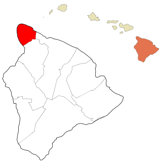
Waimea is a landlocked community in Hawaii County, Hawaii, United States. Waimea is the center for ranching activities and paniolo culture. The name Waimea means reddish water. For statistical purposes, the United States Census Bureau has defined that community as a census-designated place (CDP). The population was 7,028 at the 2000 census and 9,212 at the 2010 census. Since each U.S. state cannot have more than one post office of the same name, and there is a post office in Waimea, Kauai County, the official U.S. Post Office designation for Waimea is Kamuela, although this name is only used by the post office, not by locals or the local government.

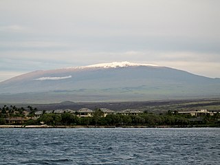
Mauna Kea is dormant shield volcano on the island of Hawaiʻi. Its peak is 4,207.3 m (13,803 ft) above sea level, making it the highest point in Hawaii and the island with the second highest high point, behind New Guinea, the world's largest tropical island with multiple peaks that are higher. The peak is about 38 m (125 ft) higher than Mauna Loa, its more massive neighbor. Mauna Kea is unusually topographically prominent for its height: its prominence from sea level is fifteenth in the world among mountains, at 4,207.3 m (13,803 ft); its prominence from under the ocean is 9,330 m (30,610 ft), rivaled only by Mount Everest. This dry prominence is greater than Everest's height above sea level of 8,848.86 m (29,032 ft), and some authorities have labeled Mauna Kea the tallest mountain in the world, from its underwater base. Mauna Kea is ranked 8th by topographic isolation.

Jinhae-gu is a district in Changwon City, South Korea. This region is served by the Korean National Railroad, and is famous for its annual cherry blossom festival every spring.

The cherry blossom, or sakura, is the flower of trees in Prunus subgenus Cerasus. Sakura usually refers to flowers of ornamental cherry trees, such as cultivars of Prunus serrulata, not trees grown for their fruit. Cherry blossoms have been described as having a vanilla-like smell, which is mainly attributed to coumarin.

Hanami is the Japanese traditional custom of enjoying the transient beauty of flowers; flowers in this case almost always refer to those of the cherry or, less frequently, plum trees. From the end of March to early May, cherry trees bloom all over Japan, and around the second week of January on the island of Okinawa. The blossom forecast "cherry blossom front" is announced each year by the Japan Meteorological Agency and watched carefully by those planning hanami, as the blossoms only last a week or two.

Kohala is the name of the northwest peninsula of the island of Hawaiʻi in the Hawaiian Archipelago. In ancient Hawaii it was often ruled by an independent High Chief called the Aliʻi Nui. In modern times it is divided into two districts of Hawaii County: North Kohala and South Kohala. Locals commonly use the name Kohala to refer to the census-designated places of Halaʻula, Hāwī, and Kapaʻau collectively. The dry western shore is commonly known as the Kohala Coast, which has golf courses and seaside resorts.

Route 200, known locally as Saddle Road, traverses the width of the Island of Hawaiʻi, from downtown Hilo to its junction with Hawaii Route 190 near Waimea. The road was once considered one of the most dangerous paved roads in the state, with many one-lane bridges and areas of marginally maintained pavement. Most of the road has now been repaved, and major parts have new re-alignments to modern standards. The highway is mostly one-lane in each direction, but there are two lanes on the uphill portions. The highway reaches a maximum elevation of 6,632 feet (2,021 m) and is subject to fog and low visibility. Many rental car companies used to prohibit use of their cars on Saddle Road, but now allow use of the road. The highway experiences heavy use as it provides the shortest driving route from Hilo to Kailua-Kona and access to the slopes of Mauna Loa and the Mauna Kea Observatories.

Hakalau is a small unincorporated community located along the Hamakua coast about 15 miles (24 km) north of Hilo on the Big Island of Hawaii in the U.S. state of Hawaii at 19°53′49″N155°7′35″W.

Hāmākua is a district on the northeast coast of Hawaiʻi's Big Island, administered by the County of Hawaiʻi in the state of Hawaiʻi. It is also the name given for the coastline in the region, the "Hāmākua Coast".

Parker Ranch is a working cattle ranch on the Island of Hawaii in the U.S. state of Hawaii, now run by a charitable trust.

Pōhakuloa Training Area (PTA) is a US military training base located on the high plateau between Mauna Loa, Mauna Kea and the Hualālai volcanic mountains of the island of Hawaiʻi. It includes a small military airstrip known as Bradshaw Army Airfield.

Kaunaʻoa Bay has one of the few white sand beaches of the Kohala Coast, the western side of the island of Hawaiʻi. A historic hotel, the Mauna Kea Beach Hotel, is located on beautiful Kauna'oa.

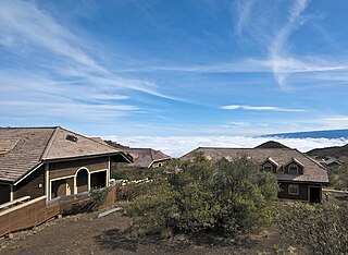
The Onizuka Center for International Astronomy, also known as Hale Pōhaku, is a complex of support facilities for the telescopes and other instruments that comprise the Mauna Kea Observatory atop Mauna Kea, on Hawaiʻi island.

Mauna Kea State Recreation Area also known as Mauna Kea State Park, is a state of Hawaii protected area at the southern base of Mauna Kea.
Ryukyukoku Matsuri Daiko Hawaii (琉球國祭り太鼓ハワイ支部) is a chapter of the Okinawan Eisā taiko ensemble Ryukyukoku Matsuri Daiko. Often called RMD Hawaii for short, the chapter has branches on Oahu, Kauai, Maui and the Big Island of Hawaii in Kohala and Waimea. The headquarters for the Hawaii chapter is on Oahu.
The Umauma Falls are located on the Umauma River on the Big Island of Hawaii, approximately 16 miles north of Hilo.

The cherry blossom front is the advance of the cherry blossoms across Japan. The Japan Meteorological Agency records the opening and full bloom of the blossoms from Kyūshū in late March to Hokkaidō in the middle of May. The advancing front is also the subject of regular reports by the major news agencies. The cherry blossom is of great public interest in Japan due to its symbolism and the custom of flower viewing known as hanami.

Puʻu Huluhulu is a volcanic cone located near the center of the Island of Hawaii in the State of Hawaii. It is located on the southern side of Hawaii Route 200, directly across from the highway's intersection with the Mauna Kea Access Road. Puʻu Huluhulu is Hawaiian for hairy hill.

Roen Halley Kahalewai McDonald Hufford is a Native Hawaiian Kapa artist who was named as one of nine National Heritage Fellows by the National Endowment for the Arts (NEA) in 2023. Her work has been displayed in the Bishop Museum and the Hawaii State Art Museum.
20°1′13″N155°40′4″W / 20.02028°N 155.66778°W