Related Research Articles

Agathis, commonly known as kauri or dammara, is a genus of evergreen coniferous trees, native to Australasia and Southeast Asia. It is one of three extant genera in the family Araucariaceae, alongside Wollemia and Araucaria. Its leaves are much broader than most conifers. Kauri gum is commercially harvested from New Zealand kauri.

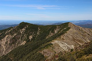
Waipoua Forest is a forest, on the west coast of the Northland Region of New Zealand's North Island. It preserves some of the best examples of kauri forest remaining in New Zealand. It is notable for having two of the largest living kauri trees, Tāne Mahuta and Te Matua Ngahere.

Tāne Mahuta, also called "God of the Forest", is a giant kauri tree in the Waipoua Forest of Northland Region, New Zealand. Its age is unknown but is estimated to be between 1,250 and 2,500 years. It is the largest living kauri tree known to stand today. It is named after Tāne, the Māori god of forests and of birds.

Te Matua Ngahere is a giant kauri coniferous tree in the Waipoua Forest of Northland Region, New Zealand. The tree's Māori name means "Father of the Forest". Although not as massive or tall as its neighbour Tāne Mahuta, Te Matua Ngahere is stouter, with a girth just over 16 metres (52 ft). It is believed to be the second largest living kauri tree, and to have the biggest girth of any kauri in the country. According to The New Zealand Herald, it has the biggest girth of any tree in New Zealand.

The environmental movement in New Zealand started in the 1950s, a period of rapid social change. Since then numerous high-profile national campaigns have contested various environmental issues including forest protection, transport decarbonisation, and coal mining. The environmental movement eventually spawned the Values Party, which was the first political party with a strong focus on environmental issues to contest national elections. The Values Party eventually morphed into the Green Party of Aotearoa New Zealand.
Conservation park is a type of specially protected land status held by the Crown in New Zealand for conservation purposes. The status is established under the Conservation Act 1987 and the parks are administered by the Department of Conservation (DoC).

Orsolobidae is a six-eyed spider family with about 180 described species in thirty genera. It was first described by J. A. L. Cooke in 1965, and was raised to family status from "Dysderidae" in 1985.

Opononi is a settlement on the south shore of Hokianga Harbour in Northland, New Zealand. State Highway 12 runs through Opononi. Ōmāpere is on the shore to the south of Opononi and Pakanae is to the northeast.

Te Roroa is a Māori iwi from the region between the Kaipara Harbour and the Hokianga Harbour in Northland, New Zealand. They are part of the Ngāti Whātua confederation of tribes.

The Kaihu River is a river of the far north of New Zealand's North Island. It originates in native forest near Trounson Kauri Park flows southeast from just south of Waipoua Forest, reaching the Wairoa River at the town of Dargaville.
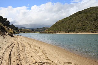
The Waimamaku River is a river in the Northland Region of New Zealand's North Island. It has a catchment of 133 square kilometres. Its name is Māori for "water of mamaku fern".
Waipoua River is the name of two rivers in New Zealand.
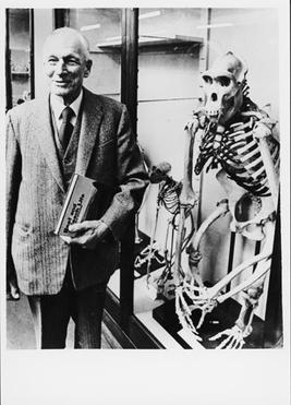
William Roy McGregor was a New Zealand zoologist and conservationist who was successful in halting forestry in the Waipoua forest and establishing the forest as a protected sanctuary.
The Waipoua River is a river of the Wellington Region of New Zealand's North Island. It flows south from the eastern flanks of the Tararua Range, passing through the town of Masterton before reaching the Ruamahanga River on the town's southeastern outskirts.

State Highway 12 is a New Zealand state highway in the far north of the North Island. It connects with SH 1 at both its northern and southern end. It runs close to the west coast of the Northland Region of New Zealand.
Waipoua is a genus of Polynesian araneomorph spiders in the family Orsolobidae, and was first described by Raymond Robert Forster & Norman I. Platnick in 1985.

Waipoua Settlement is a rural community in the Kaipara District of Northland, in New Zealand's North Island.
Northland Conservation Park is a group of protected areas in the Northland Region of New Zealand's North Island.
A sanctuary area is a type of New Zealand protected area. They exist to preserve populations of important forest types, like the remnants of kauri forests in Northland.

Oxyethira waipoua is a species of caddisfly belonging to the family Hydroptilidae. The species was first described by Keith Arthur John Wise in 1998, and is endemic to New Zealand.
References
- ↑ "Place name detail: Waipoua River". New Zealand Gazetteer. New Zealand Geographic Board . Retrieved 18 March 2018.