Arunachal Pradesh is a state in northeast India. It was formed from the North-East Frontier Agency (NEFA) region, and India declared it as a state on 20 February 1987. Itanagar is its capital and largest town. It borders the Indian states of Assam and Nagaland to the south. It shares international borders with Bhutan in the west, Myanmar in the east, and a disputed 1,129 km border with China's Tibet Autonomous Region in the north at the McMahon Line. Arunachal Pradesh is claimed in its entirety by China as South Tibet as part of the Tibet Autonomous Region; China occupied some regions of Arunachal Pradesh in 1962 but later withdrew its forces.

Dibang Valley is a district of the Indian state of Arunachal Pradesh named after the Dibang River or the Talon as the Mishmis call it. It is the least populated district in India and has an area of 9,129 square kilometres (3,525 sq mi).

Changlang district (Pron:/tʃæŋˈlæŋ/) is located in the Indian state of Arunachal Pradesh, located south of Lohit district and north of Tirap district. Naga people reside here. As of 2011 it is the second most populous district of Arunachal Pradesh, after Papum Pare. It has become one of the major districts in the area owing to the presence of crude oil, coal and mineral resources in addition to tourism and hydropower.

Lohit is an administrative district in the state of Arunachal Pradesh in India. The district headquarters is located at Tezu. As of 2011 it is the third most populous district of Arunachal Pradesh, after Papum Pare and Changlang.
Tezu is a census town and the headquarters of Lohit district in the Indian state of Arunachal Pradesh. It is the fifth largest town in Arunachal Pradesh and one of its most developed.

Roing is the district headquarter of Lower Dibang Valley district in the Indian state of Arunachal Pradesh. It is the last major township at the north-eastern frontier of India.

Anjaw District (Pron:/ˈændʒɔ:/) is an administrative district in the state of Arunachal Pradesh in north-east India. It was created as a district in 2004, by splitting off from the Lohit district under the Arunachal Pradesh Re-organization of Districts Amendment Act. The district borders China on the north. Hawai, at an altitude of 1296 m above sea level, is the district headquarters, located on the banks of the Lohit River, a tributary of the Brahmaputra River. Anjaw is the easternmost district in India. The furthest villages towards the border with China are Dong, Walong, Kibithu and Kaho.

Hawai is the district headquarters of Anjaw District in the state of Arunachal Pradesh in north-east India.

The Lower Dibang Valley district is an administrative district in the state of Arunachal Pradesh in northeastern India. It is the tenth least populous district in the country.
The Trans-Arunachal Highway (TAH), which includes an existing 1,811 km (1,125 mi) route comprising NH-13 and parts of NH-15, NH-215 and SH-25, is an under-construction 2-lane more than 2,407 km (1,496 mi) long highway passing through 16 districts in Arunachal Pradesh state in India. It runs from LAC in Tawang in northwest to Kanubari in southeast at tri-junction of Assam-Nagaland-Arunachal Pradesh. It connects at least 16 districts of Arunachal Pradesh.

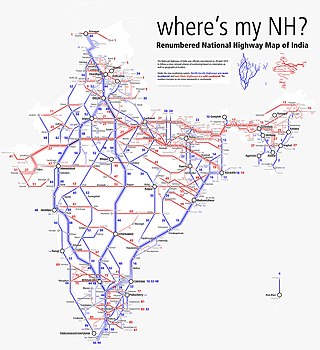
National Highway 15 is a National Highway in India.

The following outline is provided as an overview of and topical guide to Arunachal Pradesh:
Kaho is a small village on the banks of the Lohit River on the India-China Line of Actual Control in the Anjaw district in the Indian state of Arunachal Pradesh.
Arifke or Arif Ke, is a village in Firozepur tehsil of the Firozpur district in Punjab, India. Arifke is located on the junction of new national highways NH 354 and NH 703A.

Harike is a village in Patti Tehsil in Tarn Taran district of the Indian state of Punjab. It is located 33 km from Tarn Taran Sahib city. The PIN code of Wakro is 143412. Harike is connected by two national highways, National Highway 54 and National Highway 703B.
Mipi is a village and the headquarters of the Mipi Circle in the Dibang Valley district of the Indian state of Arunachal Pradesh. Mipi HQ is located near the confluence of Andra River with the Mathun or Dibang River. The main Mipi village, called Mipido, is 2 km to the south.
Lohitpur is a village in Lohit district, Arunachal Pradesh, India. As per 2011 Census of India, Lohitpur has a population of 1,514 people including 1,029 males and 485 females, with a literacy rate of 89.54%.
Sunpura is a census Town and Sub-division in Lohit district, Arunachal Pradesh, India. Sunpura is bordering with the state Assam. Sunpura sub-division has a total of 17 villages. As per the 2011 Census of India, it has a total population of 5,529 people including 2,847 males and 2,682 females.
Tafra Gam is a census village and Gram Panchayat in Lohit district, Arunachal Pradesh, India. As per the 2011 Census of India, Tafra Gam has total population of 1,805 people, including 785 males and 1,020 females.


