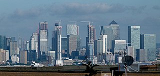
London Docklands is the riverfront and former docks in London. It is located in inner east and southeast London, in the boroughs of Southwark, Tower Hamlets, Lewisham, Newham and Greenwich. The docks were formerly part of the Port of London, at one time the world's largest port. After the docks closed, the area had become derelict and poverty-ridden by the 1980s. The Docklands' regeneration began later that decade; it has been redeveloped principally for commercial and residential use. The name "London Docklands" was used for the first time in a government report on redevelopment plans in 1971 and has since been almost universally adopted. The redevelopment created wealth, but also led to some conflict between the new and old communities in the area.

A wharf, quay, staith, or staithe is a structure on the shore of a harbour or on the bank of a river or canal where ships may dock to load and unload cargo or passengers. Such a structure includes one or more berths, and may also include piers, warehouses, or other facilities necessary for handling the ships. Wharves are often considered to be a series of docks at which boats are stationed. A marginal wharf is connected to the shore along its full length.
The Port of London is that part of the River Thames in England lying between Teddington Lock and the defined boundary with the North Sea and including any associated docks. Once the largest port in the world, it was the United Kingdom's largest port as of 2020. Usage is largely governed by the Port of London Authority ("PLA"), a public trust established in 1908; while mainly responsible for coordination and enforcement of activities it also has some minor operations of its own.

The Port of London Authority (PLA) is a self-funding public trust established on 31 March 1909 in accordance with the Port of London Act 1908 to govern the Port of London. Its responsibility extends over the Tideway of the River Thames and its continuation. It maintains and supervises navigation, and protects the river's environment.

Blackwall is an area of Poplar, in the London Borough of Tower Hamlets, East London. The neighbourhood includes Leamouth and the Coldharbour conservation area.

Narrow Street is a narrow road running parallel to the River Thames through the Limehouse area of east London, England. It used to be much narrower, and is the oldest part of Limehouse, with many buildings originating from the eighteenth century.

The Howland Hook Marine Terminal, operating as Port Liberty New York, is a container port facility in the Port of New York and New Jersey located at Howland Hook in northwestern Staten Island, New York City. It is situated on the east side of the Arthur Kill, at the entrance to Newark Bay, just north of the Goethals Bridge and Arthur Kill Vertical Lift Bridge.

Hay's Galleria is a mixed use building in the London Borough of Southwark situated on the south bank of the River Thames featuring offices, restaurants, shops, and flats. Originally a warehouse and associated wharf for the port of London, it was redeveloped in the 1980s. It is a Grade II listed structure.
South Dock was a railway station on the Isle of Dogs in east London. It was between Millwall Junction and Millwall Docks on the Millwall Extension Railway (MER) branch of the London and Blackwall Railway (LBR) which opened to goods traffic on 18 December 1871 and to passenger services on 29 July 1872. The station was on the northern side of the South Dock of the West India Docks, near the eastern end. It had an island platform as it was the only passing loop on the branch. The station buildings were of timber with a slate roof. Platform was brick faced. Station was staffed entirely by dock employees, company issued its own tickets.

Grosvenor Canal was a canal in the Pimlico area of London, opened in 1824. It was progressively shortened, as first the railways to Victoria Station and then the Ebury Bridge housing estate were built over it. It remained in use until 1995, enabling barges to be loaded with refuse for removal from the city, making it the last canal in London to operate commercially. A small part of it remains within the Grosvenor Waterside development.

Mucking Marshes landfill was a major landfill site servicing London, close to the hamlet of Mucking, in Thurrock, Essex. Covering hundreds of acres of former gravel quarry, it was one of the largest landfills in Western Europe and had been filled for decades with municipal and commercial waste floated thirty miles down the River Thames in barges to Mucking Wharf. The barges, each carrying dozens of distinctive yellow containers, were a familiar, though rarely commented-upon, sight along the Thames through Central London. Once the barges had travelled 30 miles (48 km) downstream from Walbrook Wharf, mechanical cranes at Mucking Wharf unloaded the containers onto trucks. The trucks made their way up the artificial mound created by decades of garbage compaction that still towers over the surrounding flat landscape. Flocks of seagulls and other scavenging estuarine birds were a familiar sight as the trucks disgorged their contents.

Puddle Dock is a street in Blackfriars in the City of London. It was once the site of one of London's docks, and was later the site of the Mermaid Theatre. The dock was filled in during redevelopment in the 1960s and 1970s.

The Port of Hull is a port at the confluence of the River Hull and the Humber Estuary in Kingston upon Hull, in the East Riding of Yorkshire, England.

Victoria Harbour is a harbour, seaport, and seaplane airport in the Canadian city of Victoria, British Columbia. It serves as a cruise ship and ferry destination for tourists and visitors to the city and Vancouver Island. It is both a port of entry and an airport of entry for general aviation. Historically it was a shipbuilding and commercial fishing centre. While the Inner Harbour is fully within the City of Victoria, separating the city's downtown on its east side from the Victoria West neighbourhood, the Upper Harbour serves as the boundary between the City of Victoria and the district municipality of Esquimalt. The inner reaches are also bordered by the district of Saanich and the town of View Royal. Victoria is a federal "public harbour" as defined by Transport Canada. Several port facilities in the harbour are overseen and developed by the Greater Victoria Harbour Authority, however the harbour master's position is with Transport Canada.

Queen Victoria Street, named after the British monarch who reigned from 1837 to 1901, is a street in London that runs east by north from its junction with New Bridge Street and Victoria Embankment in the Castle Baynard ward of the City of London, along a section that divides the wards of Queenhithe and Bread Street, then lastly through the middle of Cordwainer ward, until it reaches Mansion House Street at Bank junction. Beyond Bank junction, the street continues north-east as Threadneedle Street which joins Bishopsgate. Other streets linked to Queen Victoria Street include Puddle Dock, Cannon Street, Walbrook and Poultry.

Oliver's Island is a tree-covered 0.9-acre (0.36 ha) ait, in the River Thames in England. It is in the London Borough of Hounslow, on the Tideway, facing Kew and Strand-on-the-Green in the London Borough of Richmond upon Thames, and is owned by the Port of London Authority.

Safeguarded wharves are those wharves in London which have been given special status by the Mayor of London and the Port of London Authority (PLA) which ensures they are retained as working wharves and are protected from redevelopment into non-port use.

Brentford Dock in Brentford, west London, was a major trans-shipment point between the Great Western Railway (GWR) and barges on the River Thames. The building of Brentford Dock was started in 1855 and it was formally opened in 1859. The former dock yard was redeveloped in 1972 and is now Brentford Dock Marina and Brentford Dock Estate.

Whittington's Longhouse was a public toilet in Cheapside, London, constructed with money given or bequeathed by Richard Whittington, Lord Mayor of London. The toilet had 128 seats: 64 for men and 64 for women. It operated from around 1 May 1421, until the seventeenth century.

