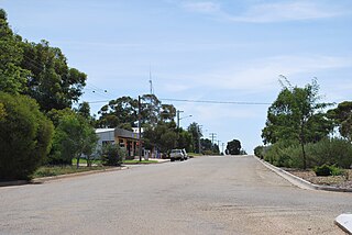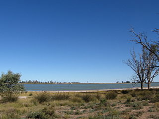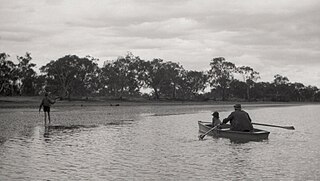
The Mungo National Park is a protected national park that is located in south-western New South Wales, in eastern Australia. The 110,967-hectare (274,210-acre) national park is situated approximately 875 kilometres (544 mi) west of Sydney in the Balranald Shire. Mungo National Park is the traditional meeting place of the Muthi Muthi, Nyiampaar and Barkinji Aboriginal Nations. People are no longer able to climb the sand dunes as stricter rules have been enforced.
Sebastopol is a city on the Crimean peninsula.

Cumberland County is a county in the State of New South Wales, Australia. Most of the Sydney metropolitan area is located within the County of Cumberland.

The Field of Mars Reserve is a protected nature reserve located in the north–western suburbs of Sydney, in the state of New South Wales, Australia. The 50 Hectare reserve is a remnant of bushland situated between the Lane Cove and Parramatta rivers within the suburb of East Ryde and near Gladesville, Hunters Hill and Ryde.

Euston is a small town on the banks of the Murray River, southern New South Wales, Australia in Balranald Shire. The twin town of Robinvale is on the other side of the river in the state of Victoria.

Koraleigh is a small village in the west of the Riverina region of New South Wales, Australia. The village is on the Murray River and in Murray River Council local government area. Koraleigh is 6 kilometres (3.7 mi) northeast of Nyah, Victoria and 15 kilometres (9.3 mi) south of Tooleybuc.

Booligal is a village in the Riverina area of western New South Wales (NSW), Australia. It is located on the Cobb Highway, on the Lachlan River north of Hay. Booligal is a part of Hay Shire local government area.

Penarie is a small settlement about 32 kilometres north of Balranald, in the Riverina district of New South Wales, Australia. It is part of Balranald Shire. Penarie is situated at a junction on the road between Balranald and Ivanhoe, where a branch road leads to Oxley. Penarie was formerly known as Homebush.

Oxley is a community on the lower Lachlan River in the Riverina district of New South Wales, Australia near the junction of the Lachlan and Murrumbidgee Rivers. The township which developed in the mid-1860s was named after the noted Australian explorer, John Oxley. At the 2006 census, Oxley had a population of 159 people.

Darbalara is a rural community on the east bank of the junction of the Murrumbidgee River and Tumut River in the Riverina. It is situated by road, about 25 kilometres north east of Gundagai and 25 kilometres south of Coolac.

Gloucester County was one of the original Nineteen Counties in New South Wales, and is now one of the 141 cadastral divisions of New South Wales. It includes the area around Port Stephens. It is bounded on the north and west by the Manning River, and on the south-west by the Williams River.

St Vincent County was one of the original Nineteen Counties in New South Wales and is now one of the 141 Cadastral divisions of New South Wales. It included the south coast area encompassing Batemans Bay, Ulladulla, Jervis Bay and inland to Braidwood. The Shoalhaven River is the boundary to the north and west, and the Deua River the boundary to the south.

Waljeers County is one of the 141 Cadastral divisions of New South Wales. It contains the town of Booligal.

The Nari-Nari are an Indigenous Australian group in the Riverina region of New South Wales, Australia. The Nari-Nari are believed by historians to have formed in the Balranald area on the lower Murrumbidgee River, from the amalgamation of a number of groups in neighbouring areas such as the Wiradjuri and the Watiwati. The Nari-Nari share a western border with the Muthi Muthi tribe.
Madhi-Madhi, also known as Muthimuthi or Madi Madi, is an Indigenous Australian language spoken by the Muthi Muthi Aboriginal people of New South Wales.

The Muthi Muthi people are an indigenous Australian people whose traditional lands are located in the Northern Riverina and Far West regions of New South Wales.
The Jitajita, otherwise spelt Yitayita, are an indigenous Australian people of southern New South Wales.

Yandumblin is a rural locality of Hay Shire Council and a civil parish of Nicholson County, in the Riverina region of Australia.

Goona Warra is a civil parish of Waljeers County in the Riverina area Far West, New South Wales.
Campbell Parish is a civil parish of Waljeers County in New South Wales between Ivanhoe and Booligal on the Hay Plain. The parish is on the Lauchlin River at 33°29'14.0"S 144°30'18.0"E.


