
Union County is a county located in the U.S. state of Tennessee. As of the 2010 census, the population was 19,109. Its county seat is Maynardville.

Lauderdale County is a county located on the western edge of the U.S. state of Tennessee, with its border the Mississippi River. As of the 2010 census, the population was 27,815. Its county seat is Ripley. Since the antebellum years, it has been developed for cotton as a major commodity crop.

Haywood County is a county located in the U.S. state of Tennessee. As of the 2010 census, the population was 18,787. Its county seat and largest city is Brownsville. It is one of only two remaining counties in Tennessee with a majority African-American population, along with Shelby County.

Hancock County is a county located in the northeastern part of the U.S. state of Tennessee. As of the 2010 census, the population was 6,819, making it the fourth-least populous county in Tennessee. Its county seat is Sneedville.

Cocke County is a county on the eastern border of the U.S. state of Tennessee. As of the 2010 census, the population was 35,662. Its county seat is Newport.

Tazewell is a town in and the county seat of Claiborne County, Tennessee, United States. The population was 2,165 at the 2000 census and 2,218 at the 2010 census. The town is named for Henry Tazewell (1753–1799), a U.S. senator from Virginia.

Blaine is a town in Grainger County, Tennessee, United States. It is part of the Morristown, Tennessee Metropolitan Statistical Area. The population was 1,856 at the 2010 census, an increase of 271 individuals since the 2000 census.

Sneedville is a town in Hancock County, Tennessee, United States. The population was 1,387 at the 2010 census. It is the county seat of Hancock County, located in the mountainous northeastern section of the state.

The French Broad River flows 218 miles (351 km) from near the town of Rosman in Transylvania County, North Carolina, into the state of Tennessee. Its confluence with the Holston River at Knoxville is the beginning of the Tennessee River. The river flows through the counties of Transylvania, Buncombe, Henderson, and Madison in North Carolina, and Cocke, Jefferson, Sevier, and Knox in Tennessee, and drains large portions of the Pisgah National Forest and the Cherokee National Forest.

Fountain City is a neighborhood in northern Knoxville, Tennessee, in the southeastern United States. Although not a census-designated place, the populations of the two ZIP codes that serve Fountain City— 37918 and 37912— were 36,815 and 18,695, respectively, as of the 2000 U.S. census. At the time of its annexation by the city of Knoxville in 1962, Fountain City was the largest unincorporated community in the United States.

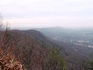
Bays Mountain is a ridge of the Ridge-and-Valley Appalachians, located in eastern Tennessee. It runs southwest to northeast, from just south of Knoxville to Kingsport.
Powell Mountain is a mountain ridge of the Ridge-and-valley Appalachians of the Appalachian Mountains. It is a long and narrow ridge, running northeast to southwest, from about Norton, Virginia to near Tazewell, Tennessee. It separates the Clinch River basin and the Powell River basin of Powell Valley. It was named for an 18th-century explorer.
Walden Ridge is a mountain ridge and escarpment located in Tennessee, in the United States. It marks the eastern edge of the Cumberland Plateau and is generally considered part of it. Walden Ridge is about 74 miles (119 km) long, running generally north-south. Its highest point is at Hinch Mountain, which reaches 3,048 feet (929 m) above sea level.

Fort Adair was a stockade fortification that served as a supply depot for early settlers migrating west. The structure was constructed in 1788 or around 1791 at Grassy Valley, an early European settlement in the Appalachian Ridge-and-Valley region of East Tennessee. The presence of a supply station encouraged more Europeans to settle in the vicinity. The town of Fountain Head was founded around Fort Adair by settlers of Grassy Valley and later renamed to Fountain City. Since its annexation in 1962, Fountain City is a neighborhood of northern Knoxville, Tennessee.
The North Fork Clinch River is a river in the U.S. states of Virginia and Tennessee. It rises along the slopes of Wallen Ridge in Lee County, Virginia, and empties into the Clinch River at Hancock County, Tennessee, just across the Tennessee/Virginia state line.
Beaver Creek is a tributary of the Clinch River in Knox County in East Tennessee. It drains a watershed area of 86.5 square miles (224 km2) between Copper Ridge and Black Oak Ridge. It flows from northeast to southwest from the Gibbs High School area, through the Halls, Powell, Karns, Solway, and Hardin Valley communities, entering the Clinch downstream from Solway.
Austins Mill is an unincorporated community in Hawkins County, Tennessee, in the United States. It is located south of Rogersville along the Holston River.
Belmont is an unincorporated community in Jefferson County, in the U.S. state of Tennessee.
Newman Ridge is a ridge in the U.S. state of Tennessee.
Greasy Rock Creek is a stream in the U.S. state of Tennessee.


