The Huari Province is one of twenty provinces of the Ancash Region in Peru. Its seat is Huari.
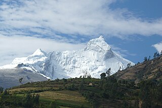
The Yungay Province is one of twenty provinces of the Ancash Region in Peru.
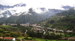
San Marcos District is one of sixteen districts of the Huari Province in Peru.

The Huallanca mountain range (possibly from Quechua, wallanka mountain range; a cactus plant ; also called Chaupi Janca or Shicra Shicra lies in the Andes of Peru. It is located in the Ancash Region, Bolognesi Province. The Huallanca mountain range is a small range southeast of the Cordillera Blanca and north of the Huayhuash mountain range extending between 9°52' and 10°03'S and 76°58' and 77°04'W for about 19 km in a northeasterly direction.

Wamanrasu is a mountain in the Chunta mountain range in the Andes of Peru, about 5,304 metres (17,402 ft) high. It is located in the Huancavelica Region, Castrovirreyna Province, Santa Ana District and in the Huancavelica Province, Huancavelica District. Wamanrasu lies northeast of the mountain Antarasu and northwest of the mountain Qarwarasu (Carhuarazo) of the Huancavelica Region.

Kikash or Pampash is a mountain in the Wallanka mountain range in the Andes of Peru, about 5,338 m (17,513 ft)) high. It is located in the Ancash Region, Bolognesi Province, Aquia District. It is situated southwest of the main range in a small subrange called Waman Wiqi. There is a small lake named Waman Wiqi southeast of Kikash. The stream Pampash originates on the west side of the mountain,flowing west to the Patiwillka River.
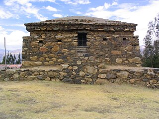
Willkawayin is an archaeological site in Peru. It is located in the Ancash Region, Huaraz Province, Independencia District, in the village of Paria. It is situated at a height of about 3,400 m (11,200 ft).

Pumahuaín is a 5,008-metre-high (16,430 ft) mountain in the southern part of the Cordillera Blanca in the Andes of Peru. It is situated in the Ancash Region, Recuay Province, Catac District. Puma Wayin lies southwest of Mururahu and Kunkush and northwest of Pukarahu.

Kuntur Wayi or Kuntur Wayin is a 5,171-metre-high (16,965 ft) mountain in the Wallanka mountain range in the Andes of Peru. It is situated in the Ancash Region, Bolognesi Province, on the border of the districts of Aquia and Huallanca. Kuntur Wayi lies east of the Minapata valley, southwest of Kunkush, south of Wallanka and southeast of Minapata.
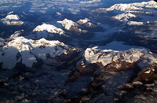
Auqui is a mountain in the Cordillera Blanca in the Andes of Peru, about 4,800 m (15,748 ft) high. It is situated in the Ancash Region, Huari Province, Huari District. Auqui lies southeast of Jacabamba.

Arteza is a mountain in the Cordillera Blanca in the Andes of Peru, about 5,000 metres (16,404 ft) high. It is situated in the Ancash Region, Huari Province, Huantar District. Arteza lies at the Qarwakancha valley, southeast of Andavite and Cayesh and northeast of Qarwakancha and Maparaju.
Kuntur Wayi or Kuntur Wayin may refer to:

Puma Wayin is a mountain in the Andes of Peru which reaches a height of approximately 4,200 m (13,780 ft). It is located in the Huánuco Region, Huamalíes Province, Singa District.

Puma Wayin is a mountain in the Andes of Peru which reaches a height of approximately 4,400 m (14,436 ft). It is located in the Ancash Region, Bolognesi Province, Huallanca District, east of Ismu Cruz.

Puma Wayin is a mountain in the Cordillera Negra in the Andes of Peru which reaches a height of approximately 4,400 m (14,436 ft). It is located in the Ancash Region, Aija Province, La Merced District.

Jatunjirca is a mountain in the eastern part of the Cordillera Blanca in the Andes of Peru which reaches a height of approximately 3,800 m (12,500 ft). It is located in the Ancash Region, Huari Province, Huari District, southwest of Huari and west of the village of Yacya.

Rumi Wayin Punta is a mountain in the Andes of Peru which reaches a height of approximately 4,600 m (15,100 ft). It is located in the Ancash Region, Bolognesi Province, Chiquian District, southwest of Chiquian.

Kuntur Wayin is a mountain in the Cordillera Negra in the Andes of Peru which reaches a height of approximately 4,200 m (13,800 ft). It lies in the Ancash Region, Recuay Province, Catac District. Kuntur Wayin is also the name of an intermittent stream which originates west of the mountain. It is a left affluent of the Santa River.

Muya Wayin is a mountain in the eastern extensions of the Wallanka mountain range in the Andes of Peru which reaches a height of approximately 4,600 m (15,092 ft). It is located in the Ancash Region, Bolognesi Province, Huallanca District. Muya Wayin lies on a ridge east of Wallanka, west of Yana Pukyu.

Rupha Wayi is a mountain in the Andes of Peru which reaches a height of approximately 4,400 m (14,436 ft). It is located in the Ancash Region, Bolognesi Province, Huallanca District.
