
Wandsworth Town is a district of south London, within the London Borough of Wandsworth 4.2 miles (6.8 km) southwest of Charing Cross. The area is identified in the London Plan as one of 35 major centres in Greater London.

Fulham is an ancient and historic settlement within the London Borough of Hammersmith & Fulham in West London, England, 3.6 miles (5.8 km) southwest of Charing Cross. It lies in a loop on the north bank of the River Thames, bordering Hammersmith, Kensington and Chelsea, with which it shares the area known as West Brompton. Over the Thames Fulham faces Wandsworth, Putney, the London Wetland Centre in Barnes in the London Borough of Richmond upon Thames.
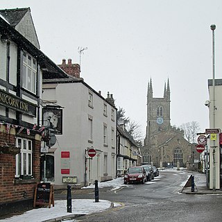
Lutterworth is an historic market town and civil parish in the Harborough district of Leicestershire, England. The town is located in southern Leicestershire, close to the borders with Warwickshire and Northamptonshire. It is located 6.4 miles north of Rugby, Warwickshire and 12 miles south of Leicester.

Llantwit Major is a town and community in Wales on the Bristol Channel coast. It is one of four towns in the Vale of Glamorgan, with the third largest population after Barry and Penarth, and ahead of Cowbridge. It is 4+1⁄2 miles (7.2 km) from Cowbridge, 9 miles (14 km) from Bridgend, 10 miles (16 km) from Barry, and 15 miles (24 km) from Cardiff. It had a population of 9,530 in 2021.

Merrow is a suburb in the north-east of Guildford, in Surrey, England. It is 2 miles (3.2 km) from the town's centre, on the edge of the ridge of hills that forms the North Downs. Although now a relatively obscure suburb, the village can trace its origins back many hundreds of years. Merrow is separated from Burpham by the New Guildford Line, the second railway line between Guildford and London.

Edmonton is a town in north London, England within the London Borough of Enfield, a local government district of Greater London. The northern part of the town is known as Lower Edmonton or Edmonton Green, and the southern part as Upper Edmonton. Situated 8.4 miles (13.5 km) north-northeast of Charing Cross, it borders Enfield to the north, Chingford to the east, and Tottenham to the south, with Palmers Green and Winchmore Hill to the west. The population of Edmonton was 82,472 as of 2011.

Young's is a British pub chain operating nearly 220 pubs.

Coade stone or Lithodipyra or Lithodipra is stoneware that was often described as an artificial stone in the late 18th and early 19th centuries. It was used for moulding neoclassical statues, architectural decorations and garden ornaments of the highest quality that remain virtually weatherproof today.
The A3036 is an A road in London, England, running from Waterloo to Wandsworth.

The Brewery Shades is a public house on the High Street in Crawley, a town and borough in West Sussex, England. The building, which stands on a corner site at the point where the town's ancient High Street meets the commercial developments of the postwar New Town, has been altered and extended several times; but at its centre is a 15th-century timber-framed open hall-house of a type common in the Crawley area in the Middle Ages. Few now survive, and the Brewery Shades has been protected as a Grade II listed building.

The Stag Inn is a public house in the Old Town area of Hastings, a port and seaside resort in East Sussex, England. One of many ancient buildings on All Saints Street, the 16th-century timber-framed inn was refronted in the 18th century, but many of its original features remain. The preserved bodies of two smoke-blackened mummified cats have been displayed on a wall since their discovery in the 19th century; witchcraft has been suggested as an explanation for this "grisly sight". The inn, which claims to be Hastings' oldest surviving pub, is operated as a tied house by the Shepherd Neame Brewery, and has been listed at Grade II by English Heritage for its architectural and historical importance.
John Leopold DenmanFRIBA was an architect from the English seaside resort of Brighton, now part of the city of Brighton and Hove. He had a prolific career in the area during the 20th century, both on his own and as part of the Denman & Son firm in partnership with his son John Bluet Denman. Described as "the master of ... mid-century Neo-Georgian", Denman was responsible for a range of commercial, civic and religious buildings in Brighton, and pubs and hotels there and elsewhere on the south coast of England on behalf of Brighton's Kemp Town Brewery. He used other architectural styles as well, and was responsible for at least one mansion, several smaller houses, various buildings in cemeteries and crematoria, and alterations to many churches. His work on church restorations has been praised, and he has been called "the leading church architect of his time in Sussex"; he also wrote a book on the ecclesiastical architecture of the county.

The White Lion is a Grade II listed public house in Putney, in the London Borough of Wandsworth.
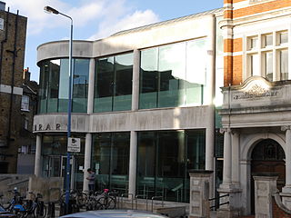
Putney Library is a Grade II listed public library in the London Borough of Wandsworth.

The Falcon is a Grade II listed public house at 2 St John's Hill, Battersea, London.

The Ram Inn is a historic pub at 68 Wandsworth High Street, Wandsworth, London SW18.

Chiswick Mall is a waterfront street on the north bank of the river Thames in the oldest part of Chiswick in West London, with a row of large houses from the Georgian and Victorian eras overlooking the street on the north side, and their gardens on the other side of the street beside the river and Chiswick Eyot.

Chiswick High Road is the principal shopping and dining street of Chiswick, a district in the west of London. It was part of the main Roman road running west out of London, and remained the main road until the 1950s when the A4 was built across Chiswick. By the 19th century the road through the village of Turnham Green had grand houses beside it. The road developed into a shopping centre when Chiswick became built up with new streets and housing to the north of Old Chiswick, late in the 19th century. There are several listed buildings including public houses, churches, and a former power station, built to supply electricity to the tram network.
Henry Stock (1824/5–1909) was a British architect. He served as the county surveyor for Essex for nearly 50 years, and as the surveyor and architect to the Worshipful Company of Haberdashers. The latter appointment led Stock to undertake a considerable number of educational commissions, but his primary field of activity was in the construction of manufacturing sites and warehouses in London.

