Wangou

Last updated
Wangou
Country Cameroon Flag of Cameroon.svg
Region Adamawa
Department Mbéré

Wangou is a village in the commune of Djohong in the Adamawa Region of Cameroon.

Communes of Cameroon

The Arrondissements of Cameroon are the third-level units of administration in Cameroon. The arrondissements are organised by divisions and sub divisions of each province.

Djohong is a town and commune in Cameroon.

Adamawa Region region of Cameroon

The Adamawa Region is a constituent region of the Republic of Cameroon. It borders the Centre and East regions to the south, the Northwest and West regions to the southwest, Nigeria to the west, the Central African Republic (CAR) to the east, and the North Region to the north.

Contents

Climate

The climate of Wangou is temperate like most of the villages in the Adamawa Region, as a result of the landscape of small hills covered with savannah.

Administration

Wangou is administered by a traditional chief of the 3rd degree. The main political parties are the Cameroon People's Democratic Movement and the Social Democratic Front.

Cameroon Peoples Democratic Movement political party; name adopted by the Union Nationale Camerounaise in 1985.

The Cameroon People's Democratic Movement is the ruling political party in Cameroon. Previously known as the Cameroonian National Union, which had dominated Cameroon politics since independence in 1960, it was renamed in 1985. The National President of the CPDM is Paul Biya, the President of Cameroon, while the Secretary-General of the RDPC's Central Committee is Jean Nkuete.

Social Democratic Front (Cameroon) political party

The Social Democratic Front is the main opposition party of Cameroon. It is led by Ni John Fru Ndi and receives significant support from the Anglophone regions of the western part of the country.

Demographics

The population of Wangou consists of Gbaya people, who are Catholic and Lutheran.

Gbaya people ethnic group (designates the Gbaya who inhabit Cameroon, the Central African Republic, the Democratic Republic of Congo and Congo (Brazzaville) and who speak an Adamawa language. )

The Gbaya, also Gbeya or Baya, are a people of western region of Central African Republic, east-central Cameroon, the north of the Republic of Congo, and the northwest of the Democratic Republic of Congo. Numbering about 970,000 by the late 1800s, they originated in northern Nigeria. The Gbaya were known for their strong resistance to the French and slavery, and revolted against them for three years starting in 1928 when they were conscripted to work on the Congo-Ocean railway.

The traditional dance of the Gbaya is practiced at many ceremonies and Gbaya is the main spoken language.

The Gbaya languages, also known as Gbaya–Manza–Ngbaka, are a family of perhaps a dozen languages spoken mainly in the western Central African Republic and across the border in Cameroon, with one language (Ngbaka) in the Democratic Republic of the Congo, with a few small languages in the Republic of the Congo. Many of the languages go by the ethnic name Gbaya, though the largest, with over a million speakers, is called Ngbaka, a name shared with the Ngbaka languages of the Ubangian family.

Marriages are accompanied by a dowry, [1] which is carried out by the contribution of a sum of local oney (100 CFA francs) and an arrow-head from the prospective husband to the bride's grandfather.

CFA franc two African currencies

The CFA franc is the name of two currencies, the West African CFA franc, used in eight West African countries, and the Central African CFA franc, used in six Central African countries. Both currencies are guaranteed by the French treasury. Although separate, the two CFA franc currencies have always been at parity and are effectively interchangeable. The ISO currency codes are XAF for the Central African CFA franc and XOF for the West African CFA franc.

Economy

The economy is based on the sale of agricultural products (maize, yams, manioc). Transport is by automobile or foot, depending on the route.

Related Research Articles

Bawaka Place in Adamawa, Cameroon

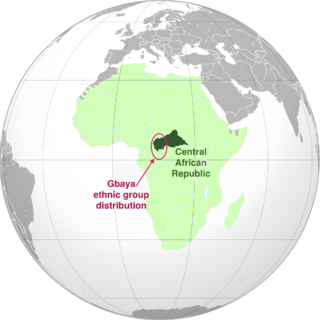
Bawaka is a village in the commune of Ngaoui in the Adamawa Region of Cameroon, near the border with the Central African Republic.

Djalecti Place in Adamawa, Cameroon

Djalecti is a village in Almé locality in the commune of Mayo-Baléo, in the Adamawa Region of Cameroon, near the border with Nigeria and Park of Polie in the North Region. The village, as indicated in the map is too small with 222 inhabitants in 2017. Like all other African villages, all the villagers are mostly from one clan. The main activity is traditional agriculture.

Bembarang Place in Adamawa, Cameroon

Bembarang is a village in the commune of Meiganga in the Adamawa Region of Cameroon, near the border with Central African Republic.

Boybaya Place in Adamawa, Cameroon

Boybaya is a village in the commune of Dir in the Adamawa Region of Cameroon.

Dankali, Cameroon Place in Adamawa, Cameroon

Dankali is a village in the commune of Meiganga in the Adamawa Region of Cameroon, near the border with the Central African Republic.

Daré Place in Adamawa, Cameroon

Daré is a village in the commune of Djohong in the Adamawa Region of Cameroon, near the border with the Central African Republic

Dozui Place in Adamawa, Cameroon

Dozui is a village in the commune of Meiganga in the Adamawa Region of Cameroon, near the border with the Central African Republic.

Gangkombol Place in Adamawa, Cameroon

Gangkombol is a village in the commune of Meiganga in the Adamawa Region of Cameroon, near the border with the Central African Republic.

Kalaldi Place in Adamawa, Cameroon

Kalaldi is a village in the commune of Dir in the Adamawa Region of Cameroon.

Kélasami Place in Adamawa, Cameroon

Kélasami is a village in the commune of Dir in the Adamawa Region of Cameroon.

Koundé Place in Adamawa, Cameroon

Koundé is a village in the commune of Dir in the Adamawa Region of Cameroon.

Lamou Place in Adamawa, Cameroon

Lamou is a village in the commune of Dir in the Adamawa Region of Cameroon.

Malingara Place in Adamawa, Cameroon

Malingara is a village in the commune de Dir in the Adamawa Region of Cameroon.

Malombo Place in Adamawa, Cameroon

Malombo is a village in the commune of Nyambaka in the Adamawa Region of Cameroon.

Mbamti-Laïnde Place in Adamawa, Cameroon

Mbamti-Laïnde is a village in the commune of Banyo in the Adamawa Region of Cameroon.

Mbella-Ngou Place in Adamawa, Cameroon

Mbella-Ngou is a village in the commune of Djohong in the Adamawa Region of Cameroon, near the border with the Central African Republic

Nandéké Place in Adamawa, Cameroon

Nandéké is a village in the commune of Meiganga in the Adamawa Region of Cameroon, near the border with the Central African Republic.

Ndawé Place in Adamawa, Cameroon

Ndawé is a village in the commune of Djohong in the Adamawa Region of Cameroon, near the border with the Central African Republic

Ngaouyanga Place in Adamawa, Cameroon

Ngaouyanga is a village in the commune of Mbe in the Adamawa Region of Cameroon. et le département de la Vina au Cameroun, on the road from Ngaoundéré to Mbe and Garoua.

Tello, Cameroon Place in Adamawa, Cameroon

Tello is a village in the commune of Belel in the Adamawa Region of Cameroon.

References

  1. Bayala, Florence. "La dot, un élément déterminant dans le mariage traditionnel en Afrique" . Retrieved 2016-07-31.