Lae (German: Preußen-Reede, later Lehe) is the capital of Morobe Province and is the second-largest city in Papua New Guinea. It is located near the delta of the Markham River on the northern coast of Huon Gulf. It is at the start of the Highlands Highway, which is the main land transport corridor between the Highlands Region and the coast. Lae is the largest cargo port of the country and is the industrial hub of Papua New Guinea. The city is known as the Garden City and home of the Papua New Guinea University of Technology.

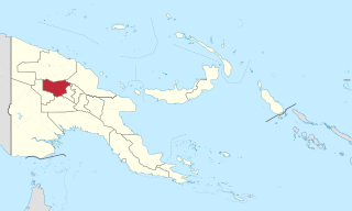
Enga is one of the provinces in Papua New Guinea (PNG). Enga is geographically situated in the northern region of Papua New Guinea and was separated from the adjacent Western Highlands at the time of national independence in 1975. The majority ethnic group are Engans. Approximately 500,000 people live within the province, which has one spoken language in all five of its districts. A small minority of Engans' land on the eastern side of the region remained in the Western Highlands, their territory being accessible by road from Mount Hagen but not directly from elsewhere in Enga territory.

The Gutnius Lutheran Church, formerly the Wabag Lutheran Church, is a Lutheran body existing in Papua New Guinea. Gutnius means "Good News" in Tok Pisin. It was established by the Lutheran Church–Missouri Synod in 1948, shortly after the Australian administration of the Territory of Papua and New Guinea permitted missionary activity to spread into the western highlands. The church counts 125.000 parishioners, largely confined to Enga Province in the western highlands. It operates Immanuel Lutheran Hospital and St. Paul's Lutheran Secondary School (Pausa) at Wapenamanda, Enga Province. The church has other health and educational institutions as well.

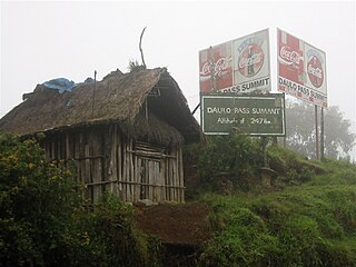
The Highlands Highway, sometimes known as the Okuk Highway, is the main land highway in Papua New Guinea. It connects several major cities and is vital for the movement of people and goods between the populous Highlands region and the coast.

Southern Highlands is a province in Papua New Guinea. Its provincial capital is the town of Mendi. According to Papua New Guinea's national 2021 census, the total population of Southern Highlands province is 927,306.

Mount Hagen is the third largest city in Papua New Guinea, with a population of 46,250. It is the capital of the Western Highlands Province and is located in the large fertile Wahgi Valley in central mainland Papua New Guinea, at an elevation of 1,677 m (5,502 ft).

The Evangelical Lutheran Church of Papua New Guinea is a Protestant church denomination located in Papua New Guinea that professes the Lutheran branch of the Christian faith. The Church is incorporated by a 1991 Act of the Parliament of Papua New Guinea and it has a baptized membership of approximately 900,000 members.

Wabag is the capital of Enga Province, Papua New Guinea. It is the least populous provincial capital in the country. It is on the Lai River; the Highlands Highway passes through the town, between Mount Hagen and Porgera. Europeans first visited the site in 1938-39 A radio camp and airstrip were established in 1938-39 but restrictions on transportation and the surrounding land's infertility long inhibited Wabag's development.
Nadzab Village is in the Markham Valley, Morobe Province, Papua New Guinea on the Highlands Highway. Administratively, it is located in Gabsongkeg ward of Wampar Rural LLG. The Nadzab Airport is located East of Nadzab Village and was the site of the only Allied paratrooper assault in New Guinea on 5 September 1943.

Kandep District is one of the five districts of Enga Province in Papua New Guinea. It is located in the southern part of Wabag, capital town of Enga. Kandep shares land borders between Laiagam-Porgera district, Wabag, and Wapenamanda District. It also shares borders with Southern Highlands, Western Highlands and the newly breakaway Hela Province. Kandep is accessible by road, and the Kandep–Laiagam Road links to Wabag which is 3 hours drive back and forth. The Kandep–Mendi road, a newly sealed road can be used to travel to Mt. Hagen via Mendi. The Kandep–Magarima Road is also connected.
Kerowagi District is one of six districts of the Simbu Province in Papua New Guinea. Its capital is Kerowagi and the district has three Local Level Government (LLG) areas: Gena-Waugla Rural, Kerowagi Rural, and Kup Rural.
Wage Rural LLG in Kandep District is one of the two Local-Level Governments (LLGs) of the Kandep District of Enga Province, Papua New Guinea. It is located at Southern part of Wabag, capital town of [Enga Province]. Kandep shares land borders between Laiagam - Porgera, Wabag, and Wapenimanda District. Also shares borders with Southern Highland, Western highlands and newly breakaway Provinces of Hela.

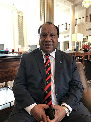
Rimbink Pato OBE is a Papua New Guinean constitutional lawyer and politician. He was Minister for Foreign Affairs and Trade from 2012 to 2019. Pato is the head of the United Party and its sole MP, representing Wapenamanda Open.
Pilikambi Rural LLG is one of the four Local-Level Government Areas (LLGs) of Lagaip Porgera Electorate in Enga Province, Papua New Guinea. The other three LLGs in the district are Maip-Mulitaka Rural, Paiela-Hewa Rural and Porgera.

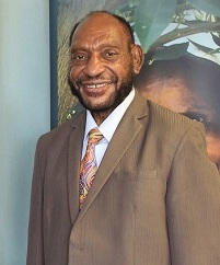
The Right Honourable Chief Sir Peter Ipatas, KBE, GCL, MP is a Papua New Guinean politician and businessman, and is the current governor of Enga province. Ipatas has been re-elected to the parliament for six consecutive terms since 1997. He is commonly known throughout the country as the "Action Governor". Chief Ipatas is also known as the Father of Free Education Policy in the country. He first assumed office in 1997.
Willie Minoga in Wapenamanda, Enga Province is a Papua New Guinean professional rugby league footballer who played for the Barrow Raiders in the Championship. He rejoined the Papua New Guinea Hunters at the end of 2016 after spending one season playing for the Townsville Blackhawks in the same competition. A Papua New Guinean national representative, Minoga was selected in PNG's squad for the 2017 World Cup.
Wapenamanda Rural LLG is a local-level government (LLG) of Enga Province, Papua New Guinea.
Tsak Rural LLG is a local-level government (LLG) of Enga Province, Papua New Guinea. Tsak Valley has a total population of more than 20,000 people, and most of them depending on subsistence farming. Tsak Valley has four big tribes: The Waimin tribe, the Paukak tribe, the Yambaran tribe and the Sikin tribe which are further divided into sub tribes. There are other smaller tribes too.
Sir Tei Abal was a member of the parliament of Papua New Guinea (PNG) between 1964 and 1982, during which time he both served as a government minister in several positions and was leader of the opposition. He was known as an unsuccessful advocate of slowing down the process of PNG's Independence, because he considered that the population from the Highlands areas, of which he was one, were unready for independence.


