
Ayacucho is a department of Peru, located in the south-central Andes of the country. Its capital is the city of Ayacucho. The region was one of the hardest hit by terrorism in the 1980s during the guerrilla war waged by Shining Path known as the internal conflict in Peru.

The Cangallo Province is a province located in the Ayacucho Region of Peru. It is one of the eleven that make up the region. The province has a population of 36,977 inhabitants as of census 2005. The capital of the province is the city of Cangallo.
Inka Wasi or Inkawasi may refer to:
Totos District is one of six districts of the province Cangallo in Peru.
Yanaqucha is a lake in Peru located in the Ayacucho Region, Cangallo Province, Chuschi District. It is situated at a height of about 4,409 metres (14,465 ft), about 0.75 km long and 0.29 km at its widest point.
Yanaqucha is a lake in Peru located in the Ayacucho Region, Huanta Province, Huanta District. It is situated at a height of about 4,205 metres (13,796 ft), about 0.84 km long and 0.37 km at its widest point. Yanaqucha lies south of the mountain Rasuwillka and northeast of the lake Pampaqucha.

Chiqllarasu Portugueza or Portuguesa is a mountain in the Andes of Peru, about 5,167 metres (16,952 ft) high. It is situated in the Ayacucho Region, Cangallo Province, Paras District. Chiqllarasu lies north-east of the mountain Saywa Q'asa, between the villages Patawasi (Patahuasi) in the northwest and Kichkawasi (Quichcahuasi) in the southeast.

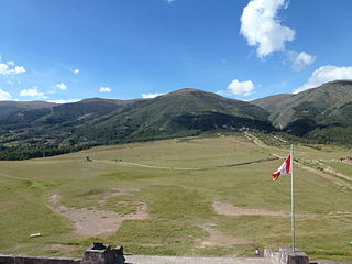
Inti Watana, Intiwatana or Pumaqucha is an archaeological site in Peru. It is located in the Ayacucho Region, Vilcas Huamán Province, Vischongo District, at the lake Pumaqucha.
Kunturkunka is a mountain in the Andes of Peru. It is located in the Ayacucho Region, Huamanga Province, Quinua District. Kunturkunka lies southwest of the mountain Saraqucha Q'asa, Hispanicized Saracochajasa) at the plain named Pampa de Quinua or Pampa de Ayacucho. This is where the Battle of Ayacucho took place. Today it is a protected area known as Pampa de Ayacucho Historical Sanctuary.
Rit'ipata is a mountain in the Andes of Peru, about 5,000 metres (16,404 ft) high. It is situated in the Ayacucho Region, Cangallo Province, Paras District. Rit'ipata lies south-west of the mountain Saywa Q'asa and north of the mountain Waranwallqa.
Saywa Q'asa is a mountain in the Andes of Peru, about 5,000 metres (16,404 ft) high. It is situated in the Ayacucho Region, Cangallo Province, in the north of the Paras District. Saywa Q'asa lies south-west of the mountain Chiqllarasu, west of the mountain Saywa (Sayhua), north-east of the mountain Waranwallqa and east of the mountain Rit'ipata.
Yana Chaka is a 5,002 m (16,411 ft) mountain in the Andes of Peru. It is situated in the Ayacucho Region, Cangallo Province, Paras District. Yana Chaka lies northwest of Tikti Wañusqa and east of Millpu.
Atuq Wachana is a mountain in the Andes of Peru, about 4,000 metres (13,123 ft) high. It is situated in the Ayacucho Region, Cangallo Province, Totos District, northwest of Totos.
“‘Huch'uy Puka Q'asa’” is a mountain in the Andes of Peru, about 4,400 metres (14,436 ft) high. It is situated in the Ayacucho Region, Cangallo Province, Totos District, northeast of Totos. Huch'uy Puka Q'asa lies south of Chawpi Urqu. The lake north of it is named Llulluchaqucha (Llullucha Ccocha).
Chawpi Urqu is a mountain in the Andes of Peru, about 4,400 metres (14,436 ft) high. It is situated in the Ayacucho Region, Cangallo Province, Totos District, northeast of Totos. Chawpi Urqu lies north of Huch'uy Puka Q'asa. The lake east of it is named Llulluchaqucha (Llullucha Ccocha).
Chawpi Urqu may refer to:
Muqu Wasi is a mountain in the Andes of Peru, about 4,000 metres (13,123 ft) high. It is situated in the Ayacucho Region, Cangallo Province, Totos District, northeast of Totos. Muqu Wasi lies west of Kiswara, east of Huch'uy Puka Q'asa and southeast of Chawpi Urqu.
Kiswara is a mountain in the Andes of Peru, about 4,400 metres (14,436 ft) high. It is situated in the Ayacucho Region, Cangallo Province, Totos District. Kiswara lies east of Huch'uy Puka Q'asa and Muqu Wasi, and southeast of Chawpi Urqu.


