Related Research Articles

Warren is a city in Macomb County, Michigan, United States. An inner-ring suburb of Detroit, Warren borders Detroit to the north, roughly 13 miles (20.9 km) north of downtown Detroit. As of the 2020 census, the city had a population of 139,387, making Warren the largest community in Macomb County, the third-largest city in Michigan, and Detroit's largest suburb.

Macomb County is a county located in the eastern portion of the U.S. state of Michigan, bordering Lake St. Clair, and is part of northern Metro Detroit. As of the 2020 Census, the population was 881,217, making it the third-most populous county in the state. The county seat is Mt. Clemens. Macomb County is part of the Detroit-Warren-Dearborn, MI Metropolitan Statistical Area. The city of Detroit is located on the county's southern border. Macomb County contains 27 cities, townships and villages, including three of the top ten most-populous municipalities in Michigan as of the 2020 census: Warren (#3), Sterling Heights (#4) and Clinton Township (#8). Most of this population is concentrated south of Hall Road (M-59), one of the county's main thoroughfares.

Inland Township is a civil township of Benzie County in the U.S. state of Michigan. The population was 2,386 at the 2020 census. The township is located in the east of the county, and shares a border with Grand Traverse County. The Platte River flows through the north of the township.

Lake Charter Township is a charter township of Berrien County in the U.S. state of Michigan. The population was 3,316 at the 2020 census. The township is located in the west central portion of the county. Lake Michigan and the city of Bridgman are to the west, Lincoln Township to the north, Baroda Township to the east, Weesaw Township to the south, and Chikaming Township to the southwest.
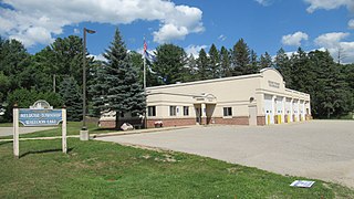
Melrose Township is a civil township of Charlevoix County in the U.S. state of Michigan. The population was 1,405 at the 2020 census.

Center Line is a city in Macomb County in the U.S. state of Michigan. An inner-ring suburb of Detroit, Center Line is located roughly 11 miles (17.7 km) north of downtown Detroit, and is completely surrounded by the larger city of Warren. As of the 2020 census, the city had a population of 8,552.

Chesterfield Charter Township is a charter township of Macomb County in the U.S. state of Michigan. As of the 2020 census the population was 45,376.

Clinton Township is a charter township in Macomb County in the U.S. state of Michigan. A northern suburb of Detroit, Clinton Township is located about 22 miles (35 km) northeast of downtown Detroit. As of the 2020 census, the township had a population of 100,513, making it the most populous township in Michigan, and the state's 8th-most populous community overall.
Roseville is a city in Macomb County in the U.S. state of Michigan. A northern suburb of Detroit, Roseville is located roughly 13 miles (20.9 km) northeast of downtown Detroit. As of the 2020 census, the city had a population of 47,710.

Shelby Charter Township, officially the Charter Township of Shelby, is a charter township located in Macomb County in the U.S. state of Michigan. The township is an affluent northern suburb of Detroit. As of the 2020 census, the population was 79,408, up from 73,804 in 2010. Shelby Charter Township is one of the fastest-growing communities in Metro Detroit.
Marilla Township is a civil township of Manistee County in the U.S. state of Michigan. The population was 398 at the 2020 census.

Ann Arbor Charter Township is a charter township of Washtenaw County in the U.S. state of Michigan. The population was 4,673 at the 2020 census. The township borders the city of Ann Arbor and contains numerous exclaves, but the two are administered autonomously.

Romulus is a city in Wayne County in the U.S. state of Michigan. The population was 23,989 at the 2010 census. Romulus is a western suburb of Metro Detroit and is also considered part of the Downriver collection of communities. It is most notable as the location of the Detroit Metropolitan Airport, a major hub for Delta Air Lines.

Richmond is a city within Metro Detroit in the U.S. state of Michigan. The population was 5,878 at the 2020 census. Most of the city is located in Macomb County, though there is a small portion in neighboring St. Clair County.

Metro Detroit is a major metropolitan area in the U.S. state of Michigan, consisting of the city of Detroit and over 200 municipalities in the surrounding area with its largest employer being Oakland County. There are varied definitions of the area, including the official statistical areas designated by the Office of Management and Budget, a federal agency of the United States.

Cannonsburg is an unincorporated community and census-designated place (CDP) in Kent County in the U.S. state of Michigan. The community is within Cannon Township about 10 miles (16.1 km) northeast of the city of Grand Rapids.

Southeast Michigan, also called southeastern Michigan, is a region in the Lower Peninsula of Michigan that is home to a majority of the state's businesses and industries as well as slightly over half of the state's population, most of whom are concentrated in Metro Detroit.
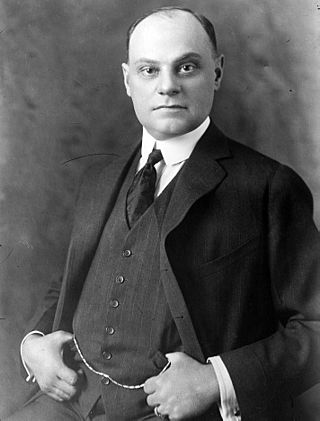
Alexander Joseph Groesbeck was an American politician who served as attorney general and the 30th governor of Michigan.

M-97 is a state trunkline highway in the U.S. state of Michigan. It runs from Detroit to north of Mt. Clemens following Groesbeck Highway. The highway starts south of 7 Mile Road and runs northeasterly through Macomb County suburbs to Hall Road, which takes the place of 20 Mile Road in the Mile Road System. In between the termini, Groesbeck Highway runs through suburban residential and commercial areas.
Benjamin Franklin Hawkins Witherell was a jurist in the U.S. state of Michigan. He served as a justice of the Michigan Supreme Court in 1857.
References
- Brown, Mason L. (2005) [19--?]. "Map showing location of post offices and distances from Detroit". Wayne County and part of Oakland and Macomb. Ann Arbor, Mich.: University of Michigan Library. pp. Unnumbered page. Retrieved 2007-11-11.
- Eldredge, Robert F (2005) [1905]. Past and present of Macomb County, Michigan. Ann Arbor, Mich.: University of Michigan Library. Retrieved 2007-11-11.
- Geo. A. Ogle & Co. (2005) [1895]. Standard atlas of Macomb County, Michigan. Ann Arbor, Mich.: University of Michigan Library. Retrieved 2007-11-11.
- Leeson, Michael A. (2005) [1882]. History of Macomb County, Michigan. Ann Arbor, Mich.: University of Michigan Library. Retrieved 2007-11-11.
- Romig, Walter (1986) [1973]. Michigan Place Names. Detroit, Michigan: Wayne State University Press. ISBN 0-8143-1838-X.
- Stewart, D. J. (2005) [1875]. Combination atlas map of Macomb County, Michigan. Ann Arbor, Mich.: University of Michigan Library. Retrieved 2007-11-11.