
The River Mersey is a major river in North West England. Its name derives from Old English and means "boundary river", possibly referring to its having been a border between the ancient kingdoms of Mercia and Northumbria. For centuries it has formed part of the boundary between the historic counties of Lancashire and Cheshire.

The Manchester Ship Canal is a 36 mi-long (58 km) inland waterway in the North West of England linking Manchester to the Irish Sea. Starting at the Mersey Estuary at Eastham, near Ellesmere Port, Cheshire, it generally follows the original routes of the rivers Mersey and Irwell through the historic counties of Cheshire and Lancashire. Several sets of locks lift vessels about 60 ft (18 m) to the canal's terminus in Manchester. Landmarks along its route include the Barton Swing Aqueduct, the world's only swing aqueduct, and Trafford Park, the world's first planned industrial estate and still the largest in Europe.
Latchford is a suburb and electoral ward of Warrington, Cheshire, England. It is around one mile south-east of Warrington town centre and has a total resident population of 7,856.

The Ellesmere Canal was a waterway in England and Wales that was planned to carry boat traffic between the rivers Mersey and Severn. The proposal would create a link between the Port of Liverpool and the mineral industries in north east Wales and the manufacturing centres in the West Midlands. However, the canal was never completed as intended because of its rising costs and failure to generate the expected commercial traffic.

The Shropshire Union Canal, nicknamed the "Shroppie", is a navigable canal in England. The Llangollen and Montgomery canals are the modern names of branches of the Shropshire Union (SU) system and lie partially in Wales.

Limehouse Basin is a body of water 2 miles east of London Bridge that is also a navigable link between the River Thames and two of London's canals. First dug in 1820 as the eastern terminus of the new Regent's Canal, its wet area was less than 5 acres originally, but it was gradually enlarged in the Victorian era, reaching a maximum of double that size, when it was given its characteristic oblique entrance lock, big enough to admit 2,000-ton ships.

The Mersey Docks and Harbour Company (MDHC), formerly the Mersey Docks and Harbour Board (MDHB), owns and administers the dock facilities of the Port of Liverpool, on the River Mersey, England. These include the operation of the enclosed northern dock system that runs from Prince's Dock to Seaforth Dock, in the city of Liverpool and the dock facilities built around the Great Float of the Wirral Peninsula, located on the west side of the river.
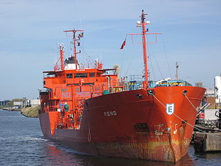
Runcorn Docks, originally the Bridgewater Docks, is an inland port on the Manchester Ship Canal in the town of Runcorn, Cheshire, England. It is operated by Peel Ports and handles bulk and project cargo.

Bromborough Dock was situated on the River Mersey at Bromborough, on the Wirral Peninsula, England. Owned by the manufacturer Lever Brothers, it served the company's factory at Port Sunlight. The facility was once the largest private dock in the world.

Queen Elizabeth II Dock is a dock situated on the River Mersey at Eastham, in the Metropolitan Borough of Wirral, Merseyside, England.

The National Waterways Museum (NWM) is in Ellesmere Port, Cheshire, England, at the northern end of the Shropshire Union Canal where it meets the Manchester Ship Canal. The NWM's collections and archives focus on the Britain's navigable inland waterways, including its rivers and canals, and include canal boats, traditional clothing, painted canal decorative ware and tools. It is one of several museums and attractions operated by the Canal & River Trust, the successor to The Waterways Trust.

The St Helens and Runcorn Gap Railway was an early railway line owned by a company of the same name in Lancashire, England, which opened in 1833. It was later known as St Helens Railway. It ran originally from the town of St Helens to the area which would later develop into the town of Widnes. Branches were opened to Garston, Warrington and Rainford. The company was taken over by the London and North Western Railway in 1864. The line from St Helens to Widnes and the branch to Rainford are now closed, the latter terminating at the Pilkington Glass' Cowley Hill works siding near Gerard's Bridge, but part of the lines to Garston and to Warrington are still in operation.

A large number of canals were built in Cheshire, England, during the early phases of the Industrial Revolution to transport goods and raw materials. This resulted in a significant canal network which is now enjoyed by holiday-makers, anglers, walkers, and others.

The Liverpool Canal Link is an English waterway link that connects the Leeds and Liverpool Canal, at the Liverpool Pier Head, to the city's South Docks. It cost £22m and was opened in March 2009. The new link adds 1.4 miles (2.3 km) of navigable waterway to the canal system.
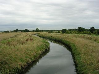
Glaze Brook is a minor river in the River Mersey catchment area, England. From Leigh, Greater Manchester to the River Mersey it forms the county boundary with Cheshire. It is 22 miles (35 km) long and its main tributaries are the Astley, Bedford, Hey, Pennington, Shaw and Westleigh Brooks.

The Runcorn and Weston Canal was a short canal near Runcorn in Cheshire, England, constructed to link the Weston Canal, which is part of the River Weaver Navigation, to the Bridgewater Canal and Runcorn Docks. It was completed in 1859, but was little used. Around half of it became the Arnold Dock in 1876, when it was made wider and deeper, and linked to Fenton Dock by a ship lock. The dock section and some of the remaining canal were filled in during the 1960s, and the remainder is in a derelict state.

The Mersey and Irwell Navigation was a river navigation in North West England, which provided a navigable route from the Mersey estuary to Salford and Manchester, by improving the course of the River Irwell and the River Mersey. Eight locks were constructed between 1724 and 1734, and the rivers were improved by the construction of new cuts several times subsequently. Use of the navigation declined from the 1870s, and it was ultimately superseded by the Manchester Ship Canal, the construction of which destroyed most of the Irwell section of the navigation and the long cut between Latchford and Runcorn.

The Runcorn to Latchford Canal was a man-made canal that ran from Runcorn, to the Latchford area of Warrington. It connected the Mersey and Irwell Navigation to the River Mersey at Runcorn.

The Hulme Locks Branch Canal is a canal in the city of Manchester. It is 200m in length and was built to provide a direct waterway between the Mersey and Irwell Navigation and the Bridgewater Canal. The canal opened in 1838 and was superseded in 1995 by a new lock at Pomona Dock 3. As both of its locks remain closed, the canal is now overgrown.
Atlantic Gateway, sometimes referred to as Ocean Gateway, is a proposed redevelopment strategy for North West England, centering on the corridor between Greater Manchester and Merseyside. The proposal is for development backed by £50 billion of investment over 50 years, making it one of the most expensive and expansive development projects in UK history.
