Czerwińsk nad Wisłą is a village in Płońsk County, Masovian Voivodeship, in east-central Poland. It is the seat of the gmina called Gmina Czerwińsk nad Wisłą. It lies on the Vistula (Wisła) river, approximately 29 kilometres (18 mi) south of Płońsk and 52 km (32 mi) west of Warsaw. The village has a population of 1,200.
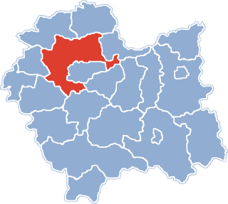
Gmina Igołomia-Wawrzeńczyce is a rural gmina in Kraków County, Lesser Poland Voivodeship, in southern Poland. Its seat is the village of Wawrzeńczyce, which lies approximately 29 kilometres (18 mi) east of the regional capital Kraków.

Paradyż is a village in Opoczno County, Łódź Voivodeship, in central Poland. It is the seat of the gmina called Gmina Paradyż. It lies in northwestern corner of historic Lesser Poland, approximately 15 kilometres (9 mi) south-west of Opoczno and 70 km (43 mi) south-east of the regional capital Łódź. The village has a population of 530.

Dobranowice is a village in the administrative district of Gmina Igołomia-Wawrzeńczyce, within Kraków County, Lesser Poland Voivodeship, in southern Poland. It lies approximately 4 kilometres (2 mi) north of Wawrzeńczyce and 28 km (17 mi) east of the regional capital Kraków.

Igołomia is a village in the administrative district of Gmina Igołomia-Wawrzeńczyce, within Kraków County, Lesser Poland Voivodeship, in southern Poland. It lies approximately 7 kilometres (4 mi) south-west of Wawrzeńczyce and 22 km (14 mi) east of the regional capital Kraków.
Koźlica is a village in the administrative district of Gmina Igołomia-Wawrzeńczyce, within Kraków County, Lesser Poland Voivodeship, in southern Poland.
Odwiśle is a village in the administrative district of Gmina Igołomia-Wawrzeńczyce, within Kraków County, Lesser Poland Voivodeship, in southern Poland.
Pobiednik Mały is a village in the administrative district of Gmina Igołomia-Wawrzeńczyce, within Kraków County, Lesser Poland Voivodeship, in southern Poland.

Pobiednik Wielki is a village in the administrative district of Gmina Igołomia-Wawrzeńczyce, within Kraków County, Lesser Poland Voivodeship, in southern Poland. It lies approximately 10 kilometres (6 mi) west of Wawrzeńczyce and 19 km (12 mi) east of the regional capital Kraków.

Rudno Górne is a village in the administrative district of Gmina Igołomia-Wawrzeńczyce, within Kraków County, Lesser Poland Voivodeship, in southern Poland. It lies approximately 6 kilometres (4 mi) north-west of Wawrzeńczyce and 27 km (17 mi) east of the regional capital Kraków.

Tropiszów is a village in the administrative district of Gmina Igołomia-Wawrzeńczyce, within Kraków County, Lesser Poland Voivodeship, in southern Poland. It lies approximately 9 kilometres (6 mi) west of Wawrzeńczyce and 20 km (12 mi) east of the regional capital Kraków.

Wygnanów is a village in the administrative district of Gmina Igołomia-Wawrzeńczyce, within Kraków County, Lesser Poland Voivodeship, in southern Poland. It lies approximately 2 kilometres (1 mi) north-west of Wawrzeńczyce and 28 km (17 mi) east of the regional capital Kraków.

Złotniki is a village in the administrative district of Gmina Igołomia-Wawrzeńczyce, within Kraków County, Lesser Poland Voivodeship, in southern Poland. It lies approximately 5 kilometres (3 mi) west of Wawrzeńczyce and 24 km (15 mi) east of the regional capital Kraków.

Zofipole is a village in the administrative district of Gmina Igołomia-Wawrzeńczyce, within Kraków County, Lesser Poland Voivodeship, in southern Poland. It lies approximately 8 kilometres (5 mi) south-west of Wawrzeńczyce and 21 km (13 mi) east of the regional capital Kraków.

Żydów is a village in the administrative district of Gmina Igołomia-Wawrzeńczyce, within Kraków County, Lesser Poland Voivodeship, in southern Poland. It lies approximately 5 kilometres (3 mi) west of Wawrzeńczyce and 25 km (16 mi) east of the regional capital Kraków.

Luborzyca is a village in Kraków County, Lesser Poland Voivodeship, in southern Poland. It is the seat of the gmina called Gmina Kocmyrzów-Luborzyca. It lies approximately 16 km (10 mi) north-east of the regional capital Kraków.

Łowinia is a village in the administrative district of Gmina Sędziszów, within Jędrzejów County, Świętokrzyskie Voivodeship, in south-central Poland. It lies approximately 4 kilometres (2 mi) north-east of Sędziszów, 14 km (9 mi) west of Jędrzejów, and 48 km (30 mi) south-west of the regional capital Kielce.

Łysów is a village in the administrative district of Gmina Radoszyce, within Końskie County, Świętokrzyskie Voivodeship, in south-central Poland. It lies approximately 9 kilometres (6 mi) south-east of Radoszyce, 22 km (14 mi) south of Końskie, and 26 km (16 mi) north-west of the regional capital Kielce.

Wawrzeńczyce is a village in the administrative district of Gmina Pawłów, within Starachowice County, Świętokrzyskie Voivodeship, in south-central Poland. It lies approximately 5 kilometres (3 mi) south of Pawłów, 14 km (9 mi) south of Starachowice, and 35 km (22 mi) east of the regional capital Kielce.

Przykory is a village in the administrative district of Gmina Mała Wieś, within Płock County, Masovian Voivodeship, in east-central Poland. It lies approximately 31 kilometres (19 mi) southeast of Płock and 66 km (41 mi) northwest of Warsaw.


