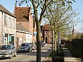
Boechout is a municipality of Belgium located in the Flemish province of Antwerp.
Oud-Turnhout is a municipality located in the Belgian province of Antwerp. The municipality only comprises the town of Oud-Turnhout proper. In 2021, Oud-Turnhout had a total population of 14,201. The total area is 38.80 km².

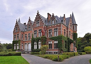
Bazel is a village in Belgium, in the municipality of Kruibeke in the province of East Flanders. The village is home to the Wissekerke Castle. The municipality of Bazel merged into Kruibeke in 1977.

Welden is a village in the municipality of Oudenaarde in the province of East Flanders, Belgium, and is situated along the Scheldt. It is located about 20 kilometres (12 mi) south of Ghent.

Beerzel is a Belgian village in Antwerp Province and a deelgemeente of the municipality Putte. Beerzel was a municipality until 1977, at which time it had an area of 7.83 square kilometres (3.02 sq mi) with 4,971 inhabitants in 1995. At 51.6 metres (169 ft), Antwerp's highest point—the Beerzelberg—is located in Beerzel.

Hingene is a village and deelgemeente (sub-municipality) of the municipality of Bornem in the province of Antwerp, Belgium. The village is bordered to the north by the Scheldt and to the east by the Rupel. It is located about 16 kilometres (9.9 mi) south-west of the city of Antwerp.
Oelegem is a village and deelgemeente (sub-municipality) of the municipality of Ranst in the province of Antwerp, Belgium. The village is located about 14 kilometres (8.7 mi) east of the city of Antwerp.
Verrebroek is a village and deelgemeente in the municipality of Beveren in East Flanders, Belgium. Verrebroek was an independent municipality until 1 January 1977, when it merged with Beveren as part of the fusion of municipalities in Belgium.

Poppel is a village in the municipality of Ravels, in the province of Antwerp, Belgium. As of 2021, it was home to 3,489 people. Poppel was a municipality until 1977. Poppel borders the Dutch province of North Brabant.

Kieldrecht is a village and deelgemeente (sub-municipality) of Beveren in East Flanders, Belgium. Kieldrecht was an independent municipality until 1977, when it merged with Beveren as part of the fusion of municipalities in Belgium. The village is located on the border with the Netherlands, and forms a single urban area with the Dutch village of Nieuw-Namen.
Vrasene is a village in the municipality of Beveren in the Belgian province of East Flanders. It is located about 15 kilometres (9.3 mi) west of Antwerp.

Haasdonk is a village and deelgemeente (sub-municipality) of Beveren in East Flanders, Belgium. Haasdonk was an independent municipality until 1 January 1977, when it merged with Beveren as part of the fusion of municipalities in Belgium. It is located about 12 kilometres (7.5 mi) west of Antwerp.

Waarloos is a village and deelgemeente (sub-municipality) of the municipality of Kontich in the province of Antwerp, Belgium. The village is located about 13 kilometres (8.1 mi) south of the city of Antwerp.

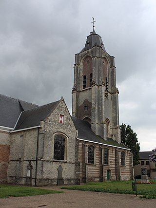
Liezele is a village and deelgemeente (sub-municipality) of the municipality of Puurs-Sint-Amands in the province of Antwerp, Belgium. The village is located about 20 kilometres (12 mi) south-south-west of the city of Antwerp. On the night of 4 to 5 September 1914, the entire village was destroyed by the Belgian Army to deny the Germany Army cover.

Meer is a village in the Belgian municipality of Hoogstraten in the province of Antwerp. As of 2021, it has 3,542 inhabitants.
Meerle is a village in the Belgian municipality of Hoogstraten in the province of Antwerp. As of 2021, it has about 3,871 inhabitants.

Minderhout is a village in the Belgian municipality of Hoogstraten in the province of Antwerp close to the border with the Netherlands. As of 2021, it has about 4,420 inhabitants.

Kallo is a village and deelgemeente (sub-municipality) of Beveren in East Flanders, Belgium. Kallo was an independent municipality until 1 January 1977, when it merged with Beveren as part of the fusion of municipalities in Belgium. Most of the deelgemeente consists of harbours and industrial zones.
Ruisbroek is a village in the municipality of Puurs-Sint-Amands located in the Antwerp Province of Belgium.

Tongerlo is a village and deelgemeente (sub-municipality) of the municipality of Westerlo in the province of Antwerp, Belgium. The village is located about 10 kilometres (6.2 mi) south-east of the city of Herentals. Tongerlo is best known for Tongerlo Abbey founded in 1128 which became one of the most important abbeys of Belgium.