Related Research Articles

Thuringia, officially the Free State of Thuringia, is a state of central Germany, covering 16,171 square kilometres (6,244 sq mi), the sixth smallest of the sixteen German states. It has a population of about 2.1 million.

The Werra, a river in central Germany, is the right-bank headwater of the Weser. "Weser" is a synonym in an old dialect of German. The Werra has its source near Eisfeld in southern Thuringia. After 293 kilometres (182 mi) the Werra joins the river Fulda in the town of Hann. Münden, forming the Weser. If the Werra is included as part of the Weser, the Weser is the longest river entirely within German territory at 744 kilometres (462 mi).

The Thuringian Forest, is a mountain range in the southern parts of the German state of Thuringia, running northwest to southeast. Skirting from its southerly source in foothills to a gorge on its north-west side is the Werra valley. On the other side of the Forest is an upper outcrop of the North German Plain, the Thuringian Basin, which includes the city Erfurt. The south and south-east continuation of the range is the highland often called the Thuringian-Vogtlandian Slate Mountains.
Schmalkalden-Meiningen is a Landkreis in the southwest of Thuringia, Germany. Its neighboring districts are the districts Wartburgkreis, Gotha, Ilm-Kreis, the district-free city Suhl, the district Hildburghausen, the Bavarian district Rhön-Grabfeld, and the district Fulda in Hesse.

The Rhön Mountains are a group of low mountains in central Germany, located around the border area where the states of Hesse, Bavaria and Thuringia come together. These mountains, which are at the extreme southeast end of the East Hesse Highlands, are partly a result of ancient volcanic activity. They are separated from the Vogelsberg Mountains by the river Fulda and its valley. The highest mountain in the Rhön is the Wasserkuppe, which is in Hesse. The Rhön Mountains are a popular tourist destination and walking area.
The Weihe Viaduct is a bridge of the A 4 motorway near Richelsdorf, Germany. It is located in the stretch of the A 4 between Bad Hersfeld (Hesse) and Eisenach (Thuringia), between the exits Wildeck-Obersuhl and Gerstungen. It crosses the valley of the small river Weihe.
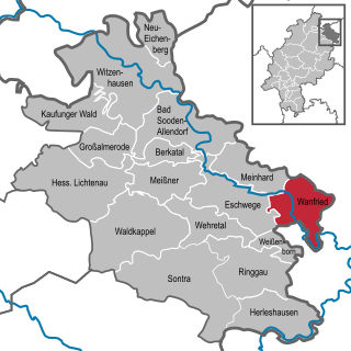
Wanfried is a town in the Werra-Meißner-Kreis in northeasternmost Hesse, Germany. It is classified as a Landstadt, a designation given in Germany to a municipality that is officially a town (Stadt), but whose population is below 5,000. It literally means “country town”.

Barchfeld is a village and a former municipality in the Wartburgkreis district of Thuringia, Germany. Since 31 December 2012, it is part of the municipality Barchfeld-Immelborn.

Herleshausen is a municipality in the Werra-Meißner-Kreis in Hesse, Germany.

The Hörsel is a 56 km (35 mi) long river in Thuringia, Germany, right tributary of the Werra. It is formed by the confluence of two smaller rivers in Leinatal, at the northern edge of the Thuringian Forest. The Hörsel flows generally northwest through the towns Hörselgau, Wutha-Farnroda and Eisenach. It flows into the Werra in Hörschel, a village near Eisenach.
The East Hesse Highlands describes a heavily wooded range of hills lying mainly in the German state of Hesse, but also extending a little way into Lower Saxony to the north, Thuringia to the east and Bavaria to the southeast. The region is sandwiched between the West Hesse Depression to the west, the Weser Uplands to the north, the Thuringian Basin to the northeast, the northwestern edge of the Thuringian Forest to the east, the Spessart to the south and the Wetterau to the southwest.

The Rennsteig is a ridge walk as well as an historical boundary path in the Thuringian Forest, Thuringian Highland and Franconian Forest in Central Germany. The long-distance trail runs for about 170 km from Eisenach and the Werra valley in the northwest to Blankenstein and the Selbitz river in the southeast.
The Halle–Bebra railway, known in German as the Thüringer Bahn, is a 210 kilometre-long railway line from Halle (Saale) via Erfurt and Gerstungen to Bebra, mainly in Thuringia. As far as Gerstungen the line originally belonged to the Thuringian Railway Company. From Gerstungen to Bebra, it was owned by the Frederick William Northern Railway (Friedrich-Wilhelms-Nordbahn), named after the Prussian king, Frederick William IV. It is now a two-track, electrified, standard gauge mainline operated by DB Netze. It was opened between 1846 and 1849 and was the first railway line in Thuringia. All types of trains from Regionalbahn to ICE currently run on the line except Interregio-Express. Four of the six largest cities in Thuringia are located on the line.
The Bebra–Baunatal-Guntershausen railway is a two-track, electrified main line in the German state of Hesse, connecting Kassel with Bebra and Gerstungen on the border with Thuringia, as well as with Bad Karlshafen (formerly) and Warburg on the border with Westphalia. It was originally part of the Friedrich-Wilhelms-Nordbahn, which was completed in 1849. It was one of the first railway lines in the Electorate of Hesse and in Germany.
Suhl is a river of Hesse and Thuringia, Germany. It flows into the Weihe near Berka/Werra.
Suhl is a river of Thuringia, Germany. It flows into the Werra near Berka/Werra.
Suhl is a town in Thuringia, Germany.
Gerstungen station is located in the town of Gerstungen on the western border of the German state of Thuringia on the Halle–Bebra railway. The station has been particularly notable for its history as a border station between different states and railway administrations.

The Salzungen Werra Upland is a natural region in Germany that forms part of the East Hesse Highlands in the German states of Hesse and Thuringia.
The Seulingswald is a hill range in the German Central Uplands which reaches heights of up to 480.3 m above sea level (NHN). It is part of the Fulda-Werra Uplands in the East Hesse Highlands within the Hessian county of Hersfeld-Rotenburg; small ridges extend into the Thuringian county of Wartburgkreis. It is a sandstone range and one of the largest contiguous woodland areas in Hesse.