
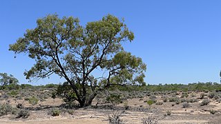
Weinteriga, New South Wales is a remote rural locality of Central Darling Shire and civil parish of Tandora County. It is located on the Menindee Lakes to the north west of the Darling River, to the area to the north of Menindee.
Weinteriga, New South Wales is a remote rural locality of Central Darling Shire and civil parish of Tandora County. It is located on the Menindee Lakes to the north west of the Darling River, to the area to the north of Menindee.
The Kinchega National Park is a protected national park that is located in the Far West region of New South Wales, in eastern Australia.The 44,259-hectare (109,370-acre) national park is located approximately 840 kilometres (520 mi) west of Sydney and 111 kilometres (69 mi) south-east of Broken Hill. The park adjoins the town of Menindee. The eastern edge of the Kinchega National Park is formed by the Darling River.

The Darling River is the third-longest river in Australia, measuring 1,472 kilometres (915 mi) from its source in northern New South Wales to its confluence with the Murray River at Wentworth. Including its longest contiguous tributaries it is 2,844 km (1,767 mi) long, making it the longest river system in Australia. The Darling River is the outback's most famous waterway.
The Murray–Darling Basin is a large geographical area in the interior of southeastern Australia, encompassing the drainage basin of the tributaries of the Murray River, Australia's longest river, and the Darling River, a right tributary of the Murray and Australia's third-longest river. The Basin, which includes six of Australia's seven longest rivers and covers around one-seventh of the Australian landmass, is one of the country's most significant agricultural areas providing one-third of Australia's food supply. Located west of the Great Dividing Range, it drains southwest into the Great Australian Bight and spans most of the states of New South Wales and Victoria, the Australian Capital Territory, and parts of the states of Queensland and South Australia.
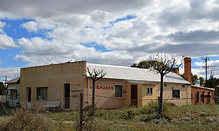
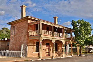
Menindee is a small town in the far west of New South Wales, Australia, in Central Darling Shire, on the banks of the Darling River, with a sign-posted population of 980 and a 2021 census population of 537. Menindee was the first town to be established on the Darling River. There are two distinct theories for the derivation of the township’s name: (a) from the Barkindji word "minandichi" for the shallow ephemeral lake north-west of the present-day township; (b) from the Barkindji word 'milhthaka', meaning "yolk of an egg".
The Division of Barrier was an Australian electoral division in the state of New South Wales. The division was proclaimed in 1900, and was one of the original 65 divisions to be contested at the first federal election. It was named for the Barrier Ranges near the city of Broken Hill in western New South Wales. In 1901, it included Broken Hill, Wilcannia, White Cliffs and Tibooburra and the surrounding pastoral areas. In 1906, it gained Menindee, Wentworth from Riverina and in 1913, it gained Balranald and Deniliquin from Riverina. It was abolished in 1922 with Broken Hill, Wentworth and Balranald being transferred to Darling and Deniliquin transferred to Riverina. It was a very safe seat for the Australian Labor Party, although both its members left the ALP at the end their terms: Josiah Thomas to join the Nationalists, and Michael Considine to sit as an independent.
Australia Felix was an early name given by Thomas Mitchell to lush pasture in parts of western Victoria he explored in 1836 on his third expedition.
Central Darling Shire is a local government area in the Far West region of New South Wales, Australia. The Shire is located adjacent to the Barrier Highway. Central Darling Shire was constituted in 1959 and at 53,511 square kilometres (20,661 sq mi), it is the largest incorporated local government area in New South Wales.
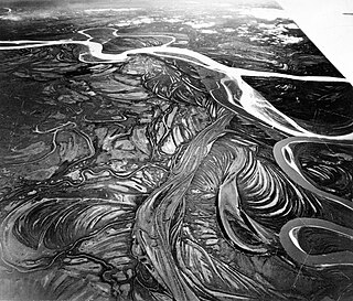
An anabranch is a section of a river or stream that diverts from the main channel or stem of the watercourse and rejoins the main stem downstream. Local anabranches can be the result of small islands in the watercourse. In larger anabranches, the flow can diverge for a distance of several or even hundreds of kilometers before rejoining the main channel.

Pooncarie is a village in south-western New South Wales, Australia in Wentworth Shire. It is on the eastern side of the Darling River between Wentworth and Menindee. The surrounding region of Pooncarie is semi-arid with an outback landscape rich in eucalypt woodlands. At the 2021 census, Pooncarie had a poulation of 226 people.
Livingstone County is one of the 141 cadastral divisions of New South Wales. The Darling River is the western and north-western boundary, near Menindee.

Menindee County is one of the 141 cadastral divisions of New South Wales. It is located between the Darling River and the South Australian border. Menindee is at its north-eastern edge. The Menindee Lakes are located there.

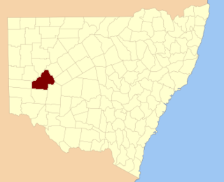
Tandora County is one of the 141 cadastral divisions of New South Wales. It is located to the north west of the Darling River, to the area to the north Menindee.

The Menindee Lakes is a system of 9 large, but relatively shallow lakes, located in south-west New South Wales on the Darling (Barka) River, about 200 kilometres (120 mi) upstream of the Darling River's junction with the Murray River. The Darling River is fed by nine major tributary river systems flowing from south-east Queensland and north and central NSW. The town of Menindee is close to the lakes and Sunset Strip township is on the northern shore of Lake Menindee. The nearest city is Broken Hill.

The Great Darling Anabranch, commonly called the Darling Anabranch, is an anabranch and ancestral path of the Darling River in the lower Murray-Darling basin in the Far West and Riverina regions of New South Wales, Australia.

The Dig Tree is a heritage-listed, blazed, eucalyptus tree at Nappa Merrie Station, Durham, Shire of Bulloo, Queensland, Australia. It was blazed on 21 April 1861. It was added to the Queensland Heritage Register on 28 February 2003.

Titabaira, New South Wales is a remote rural locality of Central Darling Shire and civil parish of Tandora County located at 32°15′01″S 142°28′48″E on the Menindee Lakes. It is located to the north west of the Darling River, to the area to the north of Menindee.

Tandore, New South Wales is a remote rural locality of Central Darling Shire and civil parish of Tandora County. It is located on the Menindee Lakes to the north west of the Darling River, to the area to the north of Menindee.
Hume Parish, New South Wales is a remote rural locality of Central Darling Shire and civil parish of Tandora County in far West New South Wales. The Parish is located at 32°18′43″S 142°22′37″E on Lake Menindee, on the out-skirts of Menindee township.

The Darling Riverine Plains is an interim Australian bioregion located in southern Queensland and northern New South Wales. It has an area of 10,699,769 hectares. South Eastern Queensland bioregion is part of the Southeast Australia temperate savanna ecoregion.

Sunset Strip is a township on the northern shore of Lake Menindee in the far west of New South Wales, Australia. It is located in the Central Darling Shire about 20 km northwest of Menindee and about 90 km from Broken Hill. At the 2021 census, the town had a population of 42. It was named for the sunsets observed over the shoreline of the lake.
| | This New South Wales geography article is a stub. You can help Wikipedia by expanding it. |