The Cambrian Heritage Railways is a heritage railway company, trust and society based at both Llynclys and Oswestry in its newly restored railway station, Shropshire, England.

The Telford Steam Railway (TSR) is a heritage railway located at Horsehay, Telford in Shropshire, England, formed in 1976.

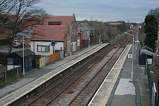
Penkridge railway station is a station serving the town of Penkridge in Staffordshire, England.

Ash Vale is a railway station serving the village of Ash Vale in Surrey, England. It is situated at the junction of the London to Alton line and the Ascot to Guildford line, 32 miles 38 chains (52.3 km) down the line from London Waterloo. The station and all trains serving it are operated by South Western Railway.

Bingham railway station serves the market town of Bingham, Nottinghamshire, England. The station is 8½ miles (14 km) east of Nottingham on the Nottingham-Skegness Line. The station is operated and served by East Midlands Trains.
Millwall Junction was a railway station in Poplar, east London, on the London and Blackwall Railway (LBR). Despite the name, it was not in Millwall, but rather it marked where the LBR southern branch to Millwall and North Greenwich, which served the West India Docks, branched off the main line. It was between West India Docks station and Poplar station, 2 miles 64 chains (4.5 km) down-line from Fenchurch Street, with South Dock the next stop on the Millwall branch.

The Malton and Driffield Junction Railway, later known as the Malton and Driffield branch was a railway line in Yorkshire that ran between the towns of Malton, North Yorkshire and Driffield in the East Riding of Yorkshire.
There are 22 disused railway stations in the 75 miles (121 km) between Bristol Temple Meads and Exeter St Davids, 12 of which have structures that can still be seen from passing trains. Most were closed in the 1960s but four of them, especially around Weston-super-Mare, were replaced by stations on new sites. 13 stations remain open on the line today, but there have been proposals to reopen stations at Cullompton and Wellington.

Bentley railway station was a railway station built by the Wolverhampton and Walsall Railway in 1872, and was operated by the Midland Railway from 1876 onwards. Situated on Bloxwich Lane, it served the area of Bentley, located between Willenhall and Walsall in the English West Midlands. The station closed in 1898.
The A6121 is a short cross-country road in the counties of Lincolnshire and Rutland, England. It forms the principal route between Bourne and Stamford and the A1 in Lincolnshire, continuing on through Ketton in Rutland to its junction with the A47 at Morcott. Its south-western end is at 52°35.5860′N0°38.0820′W and its north-eastern end is at 52°45.9120′N0°24.0660′W. The road has increased in importance with the rapid expansion of housing in this part of South Kesteven.

Weston railway station was a station in Weston, Lincolnshire on the Midland and Great Northern Joint Railway, Built by the Norwich and Spalding Railway and opened on 15 November 1858. It was on the main line between the Midlands and the Norfolk Coast, a route commonly used by holidaymakers in the summer months. It closed to passengers on 2 March 1959. The line divided west of here, some trains running in to terminate at Spalding and others carrying on west into the Midlands.

Nassington railway station is a former railway station in Nassington, Northamptonshire. It was owned by the London and North Western Railway but from 1883 to 1916 was also served by trains of the Great Northern Railway. It opened for passengers along with Wakerley and Barrowden railway station and Kingscliffe railway station on 1 November 1879, on a new section of line constructed from Wansford Line Junction at Seaton to Yarwell Junction at Wansford.

Ashley and Weston railway station was a station in Northamptonshire, serving the settlements of Ashley and Weston. It was located a few miles east of Market Harborough.
Hallaton railway station was a former railway station serving the village of Hallaton, Leicestershire, on the Great Northern and London and North Western Joint Railway. The station was located about a quarter of a mile east of the village on the road to Horninghold. The station opened in 1879 and closed to regular traffic in 1953. The Leicester to Peterborough service was withdrawn in 1916. To the south-west was Welham Junction.

Ilkeston North railway station was a railway station in Ilkeston, Derbyshire. It was opened by the Great Northern Railway on its Derbyshire Extension in 1878 and closed in 1964.
The Great Northern and London and North Western Joint Railway was a joint railway owned by the Great Northern Railway (GNR) and the London and North Western Railway (LNWR) in east Leicestershire.

The Selby–Goole line was a standard gauge branch line connecting Selby and Goole, built in 1910 by the North Eastern Railway. The line closed in the 1960s as part of the Beeching cuts.

The Railways in Ely are an important interchange point between several routes in England. There are junctions north and south of the city where rail routes from Suffolk and Norfolk connect with routes to London, the Midlands, the north of England, and Scotland. Several rail freight operating companies use these routes and four passenger train operating companies provide services through Ely.

The Bristol to Exeter line is a major branch of the Great Western Main Line in the West of England and runs from Bristol, to Exeter, from where it continues as the Exeter to Plymouth line. It was one of the principal routes of the pre-1948 Great Western Railway which were subsequently taken over by the Western Region of British Railways and are now part of the Network Rail system.

The Wellington and Drayton Railway was a standard gauge line in Central England which carried through freight and local passenger traffic until closure in the 1960s. It was part of the Great Western Railway's double track Wellington-Crewe line, linking the Midlands to the north and northwest.


