
North Rhine-Westphalia, commonly shortened to NRW in both written and spoken language, is a German state (Land) in Western Germany. With more than 17.9 million inhabitants, it is the most populous state of Germany. Covering an area of 34,084 square kilometres (13,160 sq mi), it is the fourth-largest German state by size. Apart from the city-states, it is also the most densely populated state in Germany.

The Ruhr is a river in western Germany, a right tributary (east-side) of the Rhine.

The Sieg is a river in North Rhine-Westphalia and Rhineland-Palatinate, Germany. It is a right tributary of the Rhine.
The Aabach is a 14-kilometre-long (8.7 mi) river in Germany, a left tributary of the river Afte. It rises near the village Madfeld, part of the town Brilon, in eastern North Rhine-Westphalia near the border with Hesse. From there it flows north between mountains up to 503 metres (1,650 ft) high through a forested landscape, partly in the natural park Diemelsee. After a few kilometers it flows into the artificial lake Aabachstausee. It flows to the north and empties only about 3.5 kilometres (2.2 mi) further north after Bad Wünnenberg, where it flows into the Afte.

The Heller is a 30 km long river in western Germany. It is a left tributary of the Sieg. The source is located near Haiger in Hesse. It flows through Burbach and Neunkirchen in North Rhine-Westphalia. It flows into the river Sieg in Betzdorf, Rhineland-Palatinate. Its basin area is 204 km².

The Wurm is a river in the state of North Rhine-Westphalia in western Germany. It rises in the Eifel mountains and flows for 57 kilometres before discharging into the Rur.
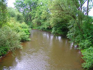
The Kyll, noted by the Roman poet Ausonius as Celbis, is a 128-kilometre-long (80 mi) river in western Germany, left tributary of the Moselle. It rises in the Eifel mountains, near the border with Belgium and flows generally south through the towns Stadtkyll, Gerolstein, Kyllburg and east of Bitburg. It flows into the Moselle in Ehrang, a suburb of Trier.

The Agger is a river in Germany, a right tributary of the Sieg in North Rhine-Westphalia. It is 69.5 kilometres (43.2 mi) long. Its source is in the Sauerland hills, near Meinerzhagen. It winds through the towns Engelskirchen, Overath and Lohmar. Near Siegburg the Agger flows into the Sieg.

The Stemweder Berg is a ridge 181.4 metres (595 ft) above sea level on the border of North Rhine-Westphalia and Lower Saxony in Germany. It is the northernmost and smallest of Germany's Central Uplands ranges.
Arpe is a river of North Rhine-Westphalia, Germany, in the west of the Hochsauerlandkreis. It is a left tributary of the Wenne which it joins at Berge, a district of Meschede. It should not be confused with the Arpe, also a left tributary of the Wenne in the Hochsauerlandkreis, but joining at Niederberndorf, a district of Schmallenberg.

Arpe is a river of North Rhine-Westphalia, Germany, in the West of the Hochsauerlandkreis. It is a left tributary of the Wenne which it joins at Niederberndorf, a district of Schmallenberg. It should not be confused with the Arpe, also left a tributary of the Wenne in the Hochsauerlandkreis, but joining at Berge, a district of Meschede.
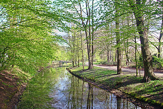
Dalke is a river of North Rhine-Westphalia, Germany. It flows into the Ems near Gütersloh.

Dhünn is a 40 km (25 mi)-long river located in North Rhine-Westphalia, Germany. Its main source is near Wipperfürth in the Bergisches Land area. It runs in a south-westerly direction, and its mouth into the river Wupper is near Leverkusen, appr. 10 km (6.2 mi) north of Cologne.
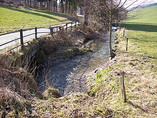
Ilpe is a river of North Rhine-Westphalia, Germany. The source of the Ilpe is near the town of Altenilpe in the mountainous Sauerland region, at an elevation of approximately 511 m. The river flows on its 8,5 km lang way primarily in northwestern directions into the Wenne in Bremke.
Leiße is a river of North Rhine-Westphalia, Germany. It flows into the Wenne in Frielinghausen.
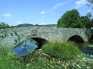
Nethe is a river of North Rhine-Westphalia, Germany. It flows into the Weser near Höxter.

Pöppelsche is a river of North Rhine-Westphalia, Germany. It flows into the Gieseler near Erwitte.
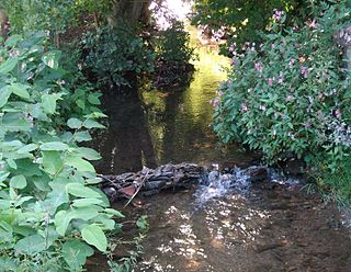
Salwey is a river of North Rhine-Westphalia, Germany. It flows into the Wenne near Eslohe.
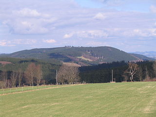
The Homert, at 656.1 m above sea level (NN), is the highest of the Sauerland's Lenne Mountains and lies in the county of Hochsauerlandkreis, North Rhine-Westphalia, Germany. It is also the highest mountain and namesake for the Homert Nature Park and the highest point on the southeastern ridge, the Homert.


