W. 3 St (stadium) | |||||||||||
---|---|---|---|---|---|---|---|---|---|---|---|
General information | |||||||||||
Location | 200 West 3rd Street Cleveland, Ohio | ||||||||||
Coordinates | 41°30′15″N81°41′57″W / 41.50417°N 81.69917°W | ||||||||||
Owned by | Greater Cleveland Regional Transit Authority | ||||||||||
Platforms | 2 side platforms | ||||||||||
Tracks | 2 | ||||||||||
Construction | |||||||||||
Structure type | At-grade | ||||||||||
Parking | Paid parking nearby | ||||||||||
Accessible | Yes [1] | ||||||||||
Other information | |||||||||||
Website | riderta | ||||||||||
History | |||||||||||
Opened | August 12, 1999 [2] | ||||||||||
Services | |||||||||||
|
West 3rd station (signed as W. 3 St (stadium)) is a station on the RTA Waterfront Line in Cleveland, Ohio. The station is located below and on the east side of West 3rd Street, after which the station is named. It is located just south of Cleveland Browns Stadium and has been designed to accommodate large event crowds.
Foundations for the station were put in place when the Waterfront Line was constructed, but the station did not open with the rest of the Waterfront Line on July 10, 1996, since Cleveland Municipal Stadium was being demolished and construction of Cleveland Browns Stadium had not yet begun. The $5 million station was built closer to the opening of the stadium and opened on August 12, 1999, [2] in time for the first home game. [3]
From 2013 to 2023, the platform was signed as West Third Street FirstEnergy Stadium to correspond with the renaming of Cleveland Browns Stadium to FirstEnergy Stadium. The stadium name reverted to Cleveland Browns Stadium on April 13, 2023. [4] [5]
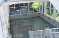
The station has two side platforms, each with a mini-high platform which allow passengers with disabilities to access trains. At street level, the station has a glass enclosed station house with a fare booth (usually unattended) and an elevator and stairs leading down to the inbound side platform. Access to the outbound platform is by crossings that extend across both tracks at each end of the platform.
On the north side of the station there is also a 680-foot-long (210 m) ramp that is used exclusively after events. Passengers are asked to queue in different lines based on their destination to facilitate rapid loading of trains and attendants at booths located at the end of the ramp sell RTA tickets and inspect fares.
G | Street level | Entrance/exit, station house, fare booth, Cleveland Browns Stadium |
Ramp | Fare booths, boarding queues | |
P Platform level | Side platform ; doors open on the right | |
Westbound | ← Waterfront Line toward Tower City (Flats East Bank) | |
Eastbound | Waterfront Line toward South Harbor (Amtrak) → | |
Side platform ; doors open on the right | ||
Chicago Line | ← NS freight service → | |
← NS freight service; Amtrak services do not stop here → | ||
Cleveland Line | ← NS freight service → | |
← NS freight service → |
RTA Rapid Transit is a rapid transit and light rail system owned and operated by the Greater Cleveland Regional Transit Authority (GCRTA).
The Greater Cleveland Regional Transit Authority is the public transit agency for Cleveland, Ohio, United States and the surrounding suburbs of Cuyahoga County. RTA is the largest transit agency in Ohio, with a ridership of 19,104,900, or about 62,600 per weekday as of the second quarter of 2023.
The Waterfront Line is a light rail line of the RTA Rapid Transit system in Cleveland, Ohio, running from Tower City Center downtown, then north and northeast to South Harbor station, adjacent to the Cleveland Municipal Parking Lot. The Waterfront Line is the newest rail line in Cleveland, having opened in 1996. The 2.2 mile line is unique in that it is an extension of the Blue and Green lines, but has its own naming designation. All RTA light rail lines use overhead lines and pantographs to draw power.
The Blue Line is a light rail line of the RTA Rapid Transit system in Cleveland and Shaker Heights, Ohio, running from Tower City Center downtown, then east and southeast to Warrensville Center Blvd near Chagrin Blvd. 2.6 miles (4.2 km) of track, including two stations, are shared with the rapid transit Red Line, the stations have low platforms for the Blue Line and high platforms for the Red Line. The Blue Line shares the right-of-way with the Green Line in Cleveland, and splits off after passing through Shaker Square. All RTA light rail lines use overhead lines and pantographs to draw power.
The Green Line is a light rail line of the RTA Rapid Transit system in Cleveland and Shaker Heights, Ohio, running from Tower City Center downtown, then east to Green Road near Beachwood. 2.6 miles (4.2 km) of track, including two stations, are shared with the rapid transit Red Line, the stations have low platforms for the Green Line and high platforms for the Red Line. The Green Line shares the right-of-way with the Blue Line in Cleveland, and splits off after passing through Shaker Square. All RTA light rail lines use overhead lines and pantographs to draw power.
The Red Line is a rapid transit line of the RTA Rapid Transit system in Cleveland, Ohio, running from Cleveland Hopkins International Airport northeast to Tower City in downtown Cleveland, then east and northeast to Windermere. 2.6 miles (4.2 km) of track, including two stations, are shared with the light rail Blue and Green Lines; the stations have high platforms for the Red Line and low platforms for the Blue and Green Lines. The whole Red Line is built next to former freight railroads. It follows former intercity passenger rail as well, using the pre-1930 right-of-way of the New York Central from Brookpark to West 117th, the Nickel Plate from West 98th to West 65th, and the post-1930 NYC right-of-way from West 25th to Windermere. The Red Line uses overhead lines and pantographs to draw power and trains operate using One-man operation. In 2022, the line had a ridership of 2,808,200, or about 6,500 per weekday as of the second quarter of 2023.
Tower City station, known alternatively as Tower City–Public Square and Tower City Center is a rapid transit station in Cleveland, Ohio, part of Tower City Center. It is the central station of the RTA Rapid Transit system, served by all lines: Blue, Green, Red and Waterfront. The station is located directly beneath Prospect Avenue in the middle of the Avenue shopping mall. The station is only accessible through the Tower City Center shopping complex, and, for this reason, the public concourse of the shopping mall is open at all times that the RTA Rapid Transit is in operation.
Shaker Square station is a station on the RTA Blue and Green Lines in Cleveland, Ohio, located in the median of Shaker Boulevard at its intersection with Shaker Square, after which the station is named. It is the first station west of the junction of the Blue and Green Lines and serves as a transfer point between the two lines.
East 9th–North Coast station is a station on the RTA Waterfront Line in Cleveland, Ohio. The station is located west of East 9th Street and serves the North Coast Harbor area, after which the station is named. The station also serves the northern portion of Downtown Cleveland, including Cleveland City Hall.
Tri-C–Campus District station is station on the RTA Rapid Transit system in Cleveland, Ohio, serving the Red, Blue, and Green Lines. It is located just east of East 34th Street near the intersection of East 34th and Broadway, on the north side of the CSX railway tracks, and below the bridge that carries East 34th Street over the railway tracks. Tri-C refers to Cuyahoga Community College.
East 105th–Quincy station is a station on the RTA Red Line in Cleveland, Ohio. It is located in the Fairfax neighborhood on the city's east side. The station has a small entrance on the north side of Quincy Avenue.
East 79th station is a station on the RTA Red Line in Cleveland, Ohio. It is located on the west side of East 79th Street between Woodland Avenue and Grand Avenue. The entrance is on the east side of East 79th Street.
East 55th station is a station on the RTA Red, Blue, and Green Lines in Cleveland, Ohio. The station entrance is located on the east side of East 55th Street just north of the intersection with Bower Avenue and the eastern terminus of Interstate 490.
Puritas–West 150th station is a station on the RTA Red Line in Cleveland, Ohio. It is located at off West 150th Street just north of Interstate 71. The entrance to the station parking lot is off exit/entrance ramp to Interstate 71. There is also an entrance from West 154th Street, connecting the station directly to Puritas Avenue.
South Woodland station is a stop on the RTA Blue Line on the border between Cleveland and Shaker Heights, Ohio, located in the median of Van Aken Boulevard at its intersection with South Woodland Road, after which the station is named.
Avalon station is a stop on the RTA Blue Line in Shaker Heights, Ohio, located in the median of Van Aken Boulevard at its intersection with Avalon Road, after which the station is named.
Lynnfield station is a stop on the RTA Blue Line in Shaker Heights, Ohio, located in the median of Van Aken Boulevard at its intersection with Lynnfield Road, after which the station is named, along with Parkland Drive and Norwood Road.
Buckeye–Woodhill station is a station on the RTA Blue and Green Lines in Cleveland, Ohio. To the east of this station, the line enters the median of Shaker Boulevard. It is located below the intersection of Shaker Boulevard with Buckeye Road and Woodhill Road, after which the station is named.
East 116th–St. Luke's station is a station on the RTA Blue and Green Lines in Cleveland, Ohio, located in the median of Shaker Boulevard below at its intersection with East 116th Street, after which the station is named.
Warrensville–Van Aken station is a station on the RTA light rail Blue Line in Shaker Heights, Ohio. It is the eastern terminus of the Blue Line. Unlike most of the stations in Shaker Heights, Warrensville–Van Aken is located off street, not in the median of Van Aken Boulevard. It is located in a block surrounded by Chagrin Boulevard, Van Aken Boulevard, and Northfield Road and Tuttle Road in the midst of a dense retail/commercial area. The station is located one block west of Warrensville Center Road, after which it named.
Media related to West 3rd station at Wikimedia Commons