West Goscote

Last updated

West Goscote was a hundred of Leicestershire, that arose from the division of the ancient Goscote hundred into two. It covers the north west of the county, an area broadly corresponding to the western part of Charnwood district along with North West Leicestershire.

Leicestershire County of England

Leicestershire is a landlocked county in the English Midlands. The county borders Nottinghamshire to the north, Lincolnshire to the north-east, Rutland to the east, Northamptonshire to the south-east, Warwickshire to the south-west, Staffordshire to the west, and Derbyshire to the north-west. The border with most of Warwickshire is Watling Street.

North West Leicestershire District in England

North West Leicestershire is a local government district in Leicestershire, England. The population of the Local Authority at the 2011 census was 93,348. Its main towns are Ashby-de-la-Zouch and Coalville.

The hundred's main town was Loughborough. Other settlements include Ashby-de-la-Zouch, Coalville and Overseal (now in Derbyshire).

Loughborough town within the Charnwood borough of Leicestershire, England

Loughborough is a town in the Charnwood borough of Leicestershire, England, seat of Charnwood Borough Council, and home to Loughborough University. The town had a population of 57,600 in 2004, making it the second largest settlement in Leicestershire. It is close to the Nottinghamshire border and within short distances of Nottingham, East Midlands Airport and Derby. The town has the world's largest bell foundry – John Taylor Bellfounders – which made bells for the Carillon war memorial, a landmark in the Queens Park in the town, of Great Paul for St Paul's Cathedral, and for York Minster.

Ashby-de-la-Zouch A small market town in Leicestershire, England

Ashby-de-la-Zouch, often shortened to Ashby, is an English market town and civil parish in North West Leicestershire, close to the Derbyshire border. It is twinned with Pithiviers in north-central France. Its 2001 census population of 11,410 increased to 12,370 in 2011. Ashby-de-la-Zouch Castle had importance in the 15th–17th centuries. In the 19th century the town's main industries were ribbon manufacture, coal mining, and brickmaking. It was served by the Leicester–Burton upon Trent line of the Midland Railway from 1849. The civil parish includes the hamlets of Shellbrook to the west and Boundary to the north-west. Nearby villages include Lount, Normanton le Heath, Smisby, Packington, Donisthorpe, Oakthorpe, Moira, Measham and Coleorton. Swadlincote, Burton-upon-Trent, Melbourne and Coalville are within 10 miles (16 km), with Derby 11 12 miles (19 km) due north. Ashby lies at the heart of The National Forest, about 24 miles (39 km) south of the Peak District National Park, on the A42 between Tamworth and Nottingham.

Coalville town in Leicestershire, England

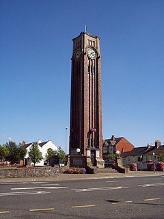
Coalville is a market town in North West Leicestershire, England, with a population at the 2011 census of 34,575. It lies on the A511 trunk road between Leicester and Burton-upon-Trent, close to junction 22 of the M1 motorway where the A511 meets the A50 between Ashby-de-la-Zouch and Leicester. It borders the upland area of Charnwood Forest to the east of the town.

The hundred was created by the subdivision of the Goscote hundred in 1346. [1]

Related Research Articles

Borough of Charnwood Borough in England

The Borough of Charnwood is a local government district with borough status in the north of Leicestershire, England, which has a population of 166,100 as of the 2011 census. It borders Melton to the east, Harborough to the south east, Leicester and Blaby to the south, Hinckley and Bosworth to the south west, North West Leicestershire to the west and Rushcliffe in Nottinghamshire to the north. It is named after Charnwood Forest, an area which the borough contains much of.

Sparkenhoe was a hundred of Leicestershire, England in the south-west of the county, covering Market Bosworth and Hinckley, broadly corresponding to the modern districts of Blaby and Hinckley and Bosworth. The meeting place of the Sparkenhoe Hundred was probably at Shericles Farm near Desford (SK467026), which derives from scirac meaning "the hundred oak". Sparkenhoe hundred was not recorded in the Domesday Book as a wapentake, being formed in 1346 from part of Guthlaxton and Goscote.

Gartree was a hundred of Leicestershire.

Goscote was a wapentake in the county of Leicestershire, England; consisting of the north and north-west of the county. It was recorded in the Domesday Book, but as the wapentakes evolved to form hundreds, was split into East Goscote Hundred and West Goscote Hundred in 1346.

The first recorded use of the name Laegrecastrescir was in 1087. In the Anglo-Saxon period the area was originally in the territory of the Middle Angles and later Mercia. After the Danish invasions it was included in the Danelaw, whose boundary ran on the south-western boundary of the shire.

Rutland and Melton (UK Parliament constituency) Parliamentary constituency in the United Kingdom

Rutland and Melton is a county constituency spanning Leicestershire and Rutland, represented in the House of Commons of the Parliament of the United Kingdom. It elects one Member of Parliament (MP) by the first-past-the-post system of election. The constituency was first contested in 1983. The current MP is Sir Alan Duncan. It has been considered a safe Conservative seat since its creation, continuing to elect a Conservative with a significant margin even with the 1997 national swing towards the Labour Party.

Charnwood (UK Parliament constituency) Parliamentary constituency in the United Kingdom

Charnwood is a constituency represented in the House of Commons of the UK Parliament since 2015 by Ed Argar of the Conservative Party.

Diocese of Leicester

The Diocese of Leicester is a Church of England diocese based in Leicester and including the current county of Leicestershire. The cathedral is Leicester Cathedral, where the Bishop of Leicester has his episcopal chair.

Ratcliffe on the Wreake village in Leicestershire, England, United Kingdom

Ratcliffe on the Wreake is a village and civil parish in the Charnwood district of Leicestershire, England. The population of the civil parish at the 2011 census was 179. It is just to the north of the River Wreake, opposite East Goscote.

Seagrave village in Leicestershire, England

Seagrave is a village and civil parish in the Charnwood district of Leicestershire, England. It has a population of around 500, measured at the 2011 census as 546, It is north of Sileby and close to Thrussington and Barrow upon Soar.

Rushey Mead electoral ward of the unitary authority of Leicester

Rushey Mead is an electoral ward and administrative division of the city of Leicester, England. The population of the ward at the 2011 census was 15,962. It comprises the northern Leicester suburb of Rushey Mead in its entirety, as well as historical parts of Northfields and Thurmaston.

East Goscote village in the United Kingdom

East Goscote is a modern village and civil parish in the Borough of Charnwood district of Leicestershire, England, just north of the market town of Syston. It is a medium-sized village, with a population measured at 2,866 in the 2011 census. The village is twinned with Fleury-sur-Andelle, France.

East Goscote Hundred was a hundred of Leicestershire, that arose from the division of the ancient Goscote hundred into two. It covered the eastern part of today's Charnwood district, along with the northern part of Harborough District, and extended south-east to meet Rutland.

Goscote, Walsall human settlement in United Kingdom

Goscote is a residential area of Walsall in the West Midlands of England. The Goscote name dates back several centuries and as recently as 1920 it was a rural area that had survived the recent Industrial Revolution which dramatically altered the face of the region.

North Leicestershire, formally the "Northern Division of Leicestershire", was a county constituency represented in the House of Commons of the Parliament of the United Kingdom. It elected two Members of Parliament (MPs) by the bloc vote system of election.

Coleorton village in the United Kingdom

Coleorton is a village and civil parish in North West Leicestershire, England. It is situated on the A512 road approximately 2 miles (3.2 km) east of Ashby de la Zouch. Nearby villages include Newbold, to the north, Thringstone to the east, and Swannington to the south-east.

Chilcote village in the United Kingdom

Chilcote is a village and civil parish in the North West Leicestershire district of Leicestershire, England. Until 1897 it was in Derbyshire. The parish had a population of 108 according to the 2001 census, including Stretton-en-le-Field and increasing to 200 at the 2011 census.

Isley cum Langley is a civil parish in the North West Leicestershire district of Leicestershire, England. According to the 2001 census it had a population of 64. At the 2011 census the population of the civil parish remained less than 100 and is included in the civil parish of Breedon on the Hill.

Rothley Imperial Football Club is a football club based in Rothley, Leicestershire England. They are currently members of the North Leicestershire League Premier Division.

References

  1. John Curtis, A Topographical History of the County of Leicester (1831)

Coordinates: 52°45′N01°20′W / 52.750°N 1.333°W / 52.750; -1.333

Geographic coordinate system Coordinate system

A geographic coordinate system is a coordinate system that enables every location on Earth to be specified by a set of numbers, letters or symbols. The coordinates are often chosen such that one of the numbers represents a vertical position and two or three of the numbers represent a horizontal position; alternatively, a geographic position may be expressed in a combined three-dimensional Cartesian vector. A common choice of coordinates is latitude, longitude and elevation. To specify a location on a plane requires a map projection.