
Garrett County is the westernmost county of the U.S. state of Maryland. As of the 2020 census, the population was 28,806, making it the third-least populous county in Maryland. Its county seat is Oakland. The county was named for John Work Garrett (1820–1884), president of the Baltimore and Ohio Railroad. Created from Allegany County, Maryland in 1873, it was the last Maryland county to be formed.

The National Road was the first major improved highway in the United States built by the federal government. Built between 1811 and 1837, the 620-mile (1,000 km) road connected the Potomac and Ohio Rivers and was a main transport path to the West for thousands of settlers. When improved in the 1830s, it became the second U.S. road surfaced with the macadam process pioneered by Scotsman John Loudon McAdam.

West Homestead is a borough in Allegheny County, Pennsylvania, 8 miles (13 km) southeast of Pittsburgh, on the Monongahela River. Heavy industries associated with nearby steel mills existed here. Established were axle works, brickworks, and manufactories of machinery, car wheels, etc. The largest concern was Mesta Machinery which was one of the world's leading industrial manufacturers from 1898 until 1983. The population was 1,929 at the 2010 census.

Connellsville is a city in Fayette County, Pennsylvania, United States, 50 miles (80 km) southeast of Pittsburgh on the Youghiogheny River, a tributary of the Monongahela River. It is part of the Pittsburgh Metro Area. The population was 7,637 at the 2010 census, down from 9,146 at the 2000 census.

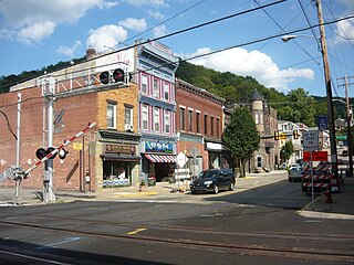
Dawson is a borough in Fayette County, Pennsylvania, United States. The population was 367 at the 2010 census, down from 451 at the 2000 census.

Rostraver Township is a township in Westmoreland County, Pennsylvania, United States. The population was 11,634 at the 2000 census.
West Newton, located 24.5 miles (39.4 km) southeast of Pittsburgh, is a borough in Westmoreland County in the U.S. state of Pennsylvania. Formerly, the manufacture of radiators and boilers were the chief industries. The population was 2,633 at the 2010 census.

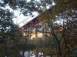
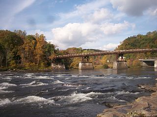
The Youghiogheny River, or the Yough for short, is a 134-mile-long (216 km) tributary of the Monongahela River in the U.S. states of West Virginia, Maryland, and Pennsylvania. It drains an area on the west side of the Allegheny Mountains northward into Pennsylvania, providing a small watershed in extreme western Maryland into the tributaries of the Mississippi River. Youghiogheny is a Lenape word meaning "a stream flowing in a contrary direction".

Fort Necessity National Battlefield is a National Battlefield in Fayette County, Pennsylvania, United States, which preserves the site of the Battle of Fort Necessity. The battle, which took place on July 3, 1754, was an early battle of the French and Indian War, and resulted in the surrender of British colonial forces under Colonel George Washington, to the French and Indians, under Louis Coulon de Villiers.

The Youghiogheny River Lake is a flood control reservoir in southwestern Pennsylvania and western Maryland. The lake is a significant tourist attraction, bringing over one million visitors a year to the area.
The Smithton High-Level Bridge is a structure that crosses the Youghiogheny River between South Huntingdon Township and Rostraver Township.

The Boston Bridge is a structure that crosses the Youghiogheny River between Versailles and Elizabeth Township, Pennsylvania. Its name is derived from the Massachusetts city only indirectly: the bridge is named for the Boston neighborhood of Elizabeth Township, which in turn was named for the New England city.
The Memorial Bridge is a structure that crosses the Youghiogheny River, connecting the eastern and western shores of Connellsville, Pennsylvania, USA.
The P&LE McKeesport Bridge is a truss bridge across the Youghiogheny River connecting the east and west banks of the Pittsburgh industrial suburb of McKeesport, Pennsylvania. In 1968, the Pittsburgh & Lake Erie Railroad undertook a major construction project in conjunction with the B&O Railroad to clear tracks from downtown McKeesport. These tracks caused traffic congestion and posed a safety hazard. As a result, both this bridge and the nearby P&LE Liberty Boro Bridge were created to direct rail traffic to the west bank of the river, which featured a less confusing street grid.
The Fifteenth Street Bridge is a girder bridge across the Youghiogheny River connecting the Pittsburgh industrial suburbs of Port Vue and McKeesport, Pennsylvania. The 1995 structure replaced a 1906 truss bridge. The bridge's length is significantly longer than that of several surrounding structures because its crosses both the river and a large water treatment facility.
The P&LE Liberty Boro Bridge is a girder bridge across the Youghiogheny River connecting the Pittsburgh industrial suburbs of Liberty and McKeesport, Pennsylvania. In 1968, the Pittsburgh & Lake Erie Railroad undertook a major construction project in conjunction with the B&O Railroad to clear tracks from downtown McKeesport. These tracks caused traffic congestion and posed a safety hazard. As a result, both this bridge and the nearby P&LE McKeesport Bridge were created to direct rail traffic to the west bank of the river, which featured a less confusing street grid.
The Sutersville Bridge is a structure that crosses the Youghiogheny River between Sutersville and Elizabeth Township, Pennsylvania. It connects a rural southeastern corner of Allegheny County with a small Westmoreland County town.
The Ohiopyle Low Bridge is a structure that carries the Great Allegheny Passage trail across the Youghiogheny River in Ohiopyle, Pennsylvania.
The Ohiopyle High Bridge is a structure that carries the Great Allegheny Passage trail across the Youghiogheny River in Ohiopyle, Pennsylvania.
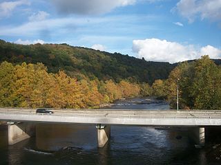
The Ohiopyle Highway Bridge is a structure that carries two lanes of Pennsylvania Route 381 Youghiogheny River in Ohiopyle, Pennsylvania

