
The MBTA Commuter Rail system serves as the commuter rail arm of the Massachusetts Bay Transportation Authority's (MBTA's) transportation coverage of Greater Boston in the United States. Trains run over 394 mi (634 km) of track to 135 stations. It is operated under contract by Keolis, which took over operations on July 1, 2014, from the Massachusetts Bay Commuter Railroad Company (MBCR).

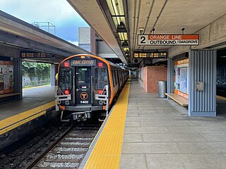
Oak Grove station is a Massachusetts Bay Transportation Authority (MBTA) intermodal transit station in the northern section of Malden, Massachusetts, just south of the Melrose border. It is the northern terminus of the rapid transit Orange Line and a stop on the Haverhill Line commuter rail service. The accessible station has a 788-space park and ride lot and is served by three MBTA bus routes.

Ruggles station is an intermodal transfer station in Boston, Massachusetts. It serves Massachusetts Bay Transportation Authority (MBTA) rapid transit, bus, and commuter rail services and is located at the intersection of Ruggles and Tremont streets, where the Roxbury, Fenway–Kenmore, and Mission Hill neighborhoods meet. It is surrounded by the campus of Northeastern University. Ruggles is a station stop for the Orange Line subway, as well as the Providence/Stoughton Line, Franklin/Foxboro Line, and Needham Line of the MBTA Commuter Rail system. Thirteen MBTA bus routes stop at Ruggles.

Malden Center station is a Massachusetts Bay Transportation Authority (MBTA) intermodal transit station in Malden, Massachusetts. Located on an elevated grade above Pleasant Street in downtown Malden, it serves the rapid transit Orange Line and the MBTA Commuter Rail Haverhill Line. The station has one island platform for the two Orange Line tracks and a single side platform for the single commuter rail track. Two busways are used by 12 MBTA bus routes.
Sullivan Square station is a rapid transit station on the MBTA subway Orange Line, located adjacent to Sullivan Square in the Charlestown neighborhood of Boston, Massachusetts. It is a major transfer point for MBTA bus service, with 12 routes using a two-level busway. The station has two island platforms serving the two active Orange Line tracks plus an unused third track. The Haverhill Line and Newburyport/Rockport Line pass through the station on separate tracks but do not stop.

The Framingham/Worcester Line of the MBTA Commuter Rail system runs west from Boston, Massachusetts to Worcester, Massachusetts through the MetroWest region, serving 17 station stops in Boston, Newton, Wellesley, Natick, Framingham, Ashland, Southborough, Westborough, Grafton, and Worcester. It is the third longest and third busiest line in the MBTA Commuter Rail system. Service on the line is a mix of local and express trains serving Worcester plus short-turn Framingham locals.

Waban station is a surface-level light rail station on the Massachusetts Bay Transportation Authority's Green Line D branch, located just south of Beacon Street at Waban Square in the Waban section of Newton, Massachusetts. The station is located below grade; access to both platforms is via Wyman Street on the outbound side of the tracks or a stairway from Beacon Street. Waban is not accessible.

Fenway station is a light rail stop on the MBTA Green Line D branch, located under Park Drive near the Riverway in the Fenway–Kenmore neighborhood of Boston, Massachusetts. It opened along with the rest of the D branch on July 4, 1959, when trolleys replaced Highland branch commuter rail service. The station is fully accessible from Park Drive via the Landmark Center parking lot, as well as from Miner Street. Named after the Fenway neighborhood rather than Fenway Park, it is slightly further from the stadium than Kenmore, though still heavily used during events.

Beaconsfield station is an MBTA light rail station in Brookline, Massachusetts. It serves the Green Line D branch. It is located off Dean Road and Beaconsfield Road just south of Beacon Street. Like the other stops on the line, it was a commuter rail station on the Boston and Albany Railroad's Highland branch until 1958, when the line was closed and converted to a branch of what is now the Green Line. The station reopened along with the rest of the line in 1959. Beaconsfield is not accessible, though a reconstruction for accessibility is planned.

Natick Center station is an MBTA Commuter Rail station in Natick, Massachusetts served by the Framingham/Worcester Line. The station, located below grade in a wide cut adjacent to North Main Street, has two side platforms serving the line's two tracks. The second-busiest non-accessible station on the system, it is undergoing a major accessibility renovation and modernization from 2020 to 2024.

Newton Highlands station is a surface-level light rail station located in Newton, Massachusetts on the Green Line D branch of the Massachusetts Bay Transportation Authority.

Lansdowne station is an MBTA Commuter Rail station in Boston, Massachusetts. It serves the Framingham/Worcester Line. Lansdowne is located next to the Massachusetts Turnpike in the Fenway–Kenmore neighborhood near Kenmore Square, below grade between Beacon Street and Brookline Avenue.

Brookline Hills station is a light rail station on the Massachusetts Bay Transportation Authority (MBTA) Green Line D branch in the Brookline Hills neighborhood of Brookline, Massachusetts. The station has two side platforms serving the line's two tracks. It was closed from April 2021 to January 2022 as part of adjacent construction on a Brookline High School building, which included renovations to make the station accessible.

Lynn station is an intermodal transit station in downtown Lynn, Massachusetts. It is a station on the MBTA Commuter Rail Newburyport/Rockport Line and a hub for the MBTA bus system.

Newtonville station is a commuter rail station on the MBTA Commuter Rail Framingham/Worcester Line, located between the Massachusetts Turnpike and Washington Street at Newtonville Square in the village of Newtonville in Newton, Massachusetts. Stairway entrances are located on the bridges over the Turnpike at Walnut Street and Harvard Street. Newtonville station is not accessible; renovations for accessibility are planned.

Auburndale station is an MBTA Commuter Rail station in Auburndale, Massachusetts. It serves the Framingham/Worcester Line. It is located next to the Massachusetts Turnpike near Lasell College. The modern station platform, built around 1961, replaced a highly acclaimed 1881 depot building designed by H. H. Richardson. A full renovation of the station for accessibility is planned.

Wellesley Square station is a commuter rail station on the MBTA Commuter Rail Framingham/Worcester Line, located just north of the MA 16-MA 135 intersection in downtown Wellesley, Massachusetts. It serves both walk-up and park-and-ride commuters, with a 224-space parking lot for the latter group. The station has low-level platforms and is not accessible.

Chestnut Hill station is a light rail station on the MBTA Green Line D branch, located off Hammond Street north of Massachusetts Route 9 in the Chestnut Hill neighborhood of Newton, Massachusetts. The station has two side platforms serving the line's two tracks. Chestnut Hill station is not accessible, but renovations are planned.

Union Station is a railway station located at Washington Square in downtown Worcester, Massachusetts. It is the western terminus of the MBTA Commuter Rail Framingham/Worcester Line and a stop for the Amtrak Lake Shore Limited service. A bus terminal adjacent to the station is the hub for Worcester Regional Transit Authority (WRTA) local bus service; it is also used by PVTA, MART, Peter Pan, and Greyhound intercity buses.

Back Bay station is an intermodal passenger station in Boston, Massachusetts. It is located just south of Copley Square in Boston's Back Bay and South End neighborhoods. It serves MBTA Commuter Rail and MBTA subway routes, and also serves as a secondary Amtrak intercity rail station for Boston. The present building, designed by Kallmann McKinnell & Wood, opened in 1987. It replaced the New Haven Railroad's older Back Bay station – which opened in 1928 as a replacement for an 1899-built station – as well as the New York Central's Huntington Avenue and Trinity Place stations which had been demolished in 1964.


