
Easterwood Airport is a regional airport in College Station, Texas, serving Texas A&M University, Bryan-College Station, and Brazos County, Texas. Accessed via FM 60, it is 3 miles (4.8 km) southwest of the center of College Station, and 0.25 miles (0.40 km) from Texas A&M University. There is no public transportation from Easterwood Airport to the surrounding cities; however, in the fall of 2019, a new university bus route was established to connect Easterwood Airport with the Engineering Quad and the Texas A&M Hotel and Conference Center. The airport bus route is ostensibly available only to those with a University ID or Brazos Transit District ID, however, this requirement is not enforced. Despite owning and managing the airport, the university offers no aviation courses.

Scholes International Airport at Galveston is three miles southwest of Galveston, in Galveston County, Texas, United States. The National Plan of Integrated Airport Systems for 2011–2015 categorized it as a reliever airport.

North Texas Regional Airport / Perrin Field is a county-owned airport in Grayson County, Texas between Sherman and Denison. Formerly Grayson County Airport, the airport was renamed in November 2007. Several buildings are occupied by businesses, Grayson County government agencies, and Grayson County College.
Hobart Sky Ranch Airport is a public-use airport located two miles (3 km) northwest of the central business district of Hobart, a city in Lake County, Indiana, United States. This airport is privately owned by Don Niemeyer.
Kenneth Copeland Airport is a public airport located eighteen miles (29 km) northwest of the central business district (CBD) of Fort Worth, in Tarrant County, Texas, United States.

Denton Enterprise Airport, also known as Denton Airport and previously Denton Municipal Airport, is a city-owned, public-use airport located three nautical miles (6 km) west of the central business district of Denton, a city in Denton County, Texas, United States.
Redlands Municipal Airport is two miles (3.2 km) northeast of downtown Redlands, serving San Bernardino County, California, United States. This general aviation airport covers 194 acres (79 ha) and has one runway.

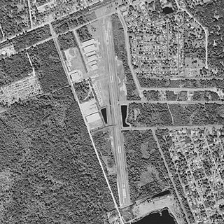
TSTC Waco Airport is a public use airport located eight nautical miles northeast of the central business district of Waco, a city in McLennan County, Texas, United States. Before 1968, it was known as James Connally Air Force Base. The airport is owned by Texas State Technical College. It is included in the National Plan of Integrated Airport Systems for 2021–2025, which categorized it as a general aviation facility.
Massey Ranch Airpark is a general aviation airport in Edgewater, Florida, United States. The airport is part of an airport community, with homes located on the airport, and hangars built next to most homes. The airport was opened in 1957 and is open to the public.
Fort Worth Spinks Airport is a city-owned, public-use airport located 14 nautical miles (26 km) south of the central business district of Fort Worth, in Tarrant County, Texas, United States. It is the newest of the three airports that are owned by the City of Fort Worth and it serves the cities of Fort Worth, Burleson, and Mansfield. The airport is located at the intersection of Interstate 35W and HWY 1187 and serves as a reliever airport for Fort Worth Meacham International Airport and Dallas–Fort Worth International Airport and has Class D designation.
Cardiff Brothers Airport was an airport located in unincorporated Fort Bend County, Texas, United States, east of the city of Fulshear and south of the city of Katy.
Hoffpauir Airport was an airport in an unincorporated area of Harris County, Texas in the United States. It was located east of the city of Katy and west of the city of Houston. The owner was Stanley C. Hoffpauir.
Creasy Airport is an airport located in unincorporated Galveston County, Texas, United States. The airport is located southwest of Santa Fe and west of Hitchcock.
Houston Fort Bend Airport is a privately owned, public use airport located in unincorporated Fort Bend County, Texas, United States. The airport is located east of Beasley and 33 nautical miles (61 km) southwest of the central business district of Houston. It was formerly known as Happy Landings Airport.
Skyway Manor Airport is a public-use airport located three nautical miles west of the central business district of Pearland and in Brazoria County, Texas, United States. The airport is privately owned by Skyway Manor.

Tokeen Seaplane Base is a public use seaplane base located in Tokeen, in the Prince of Wales-Hyder Census Area in the U.S. state of Alaska.
Lakeway Airpark is a public use airport in Travis County, Texas, United States. The airport is 17 nautical miles west of the central business district of Austin. It is privately owned by Lakeway Airpark, Inc. and is located in Lakeway, Texas.

Curtis Field is a city-owned airport three miles northeast of Brady, in McCulloch County, Texas. The airport is named for Mayor Harry L. Curtis of Brady, who proposed the site as an auxiliary field for the United States Army Air Forces (USAAF). The FAA's National Plan of Integrated Airport Systems for 2009–2013 calls it a general aviation facility.
Figure 2 Ranch Airport is a private airport located 24 miles north of Van Horn, Culberson County, Texas, USA. It is located on the Figure 2 Ranch formerly owned by James M. West Sr. and his descendants who installed the airport.
