Related Research Articles

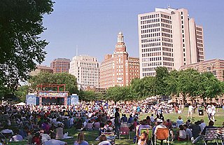
New Haven is a city in New Haven County, Connecticut, United States. It is located on New Haven Harbor on the northern shore of Long Island Sound and is part of the New York City metropolitan area. With a population of 135,081 as determined by the 2020 U.S. census, New Haven is the third largest city in Connecticut after Bridgeport and Stamford, the largest city in the South Central Connecticut Planning Region, and the principal municipality of Greater New Haven, which had a total population of 864,835 in 2020. Prior to 1960, it was the county seat of New Haven County until the county governments were abolished that year.

New Haven County is a county in the south central part of the U.S. state of Connecticut. As of the 2020 census, the population was 864,835, making it the third-most populous county in Connecticut. Two of the state's five largest cities, New Haven (3rd) and Waterbury (5th), are part of New Haven County.

Hamden is a town in New Haven County, Connecticut, United States. The town's nickname is "The Land of the Sleeping Giant". The town is part of the South Central Connecticut Planning Region. The population was 61,169 at the 2020 census.

Regicides Trail is a Blue-Blazed hiking trail, about 7 miles (11 km) long, roughly following the edge of a diabase, or traprock, cliff northwest of New Haven, Connecticut. It is named for two regicides, Edward Whalley and his son-in-law William Goffe, who signed the death warrant of King Charles I of England. Upon the restoration of Charles II to the throne and the persecution of the regicides, the pair hid in Judges Cave near the south end of the trail in 1660. The Regicides is widely known to be one of the most technical trails within the CT Blue-Blazed trail system.
The Flats is a neighborhood located in the southeastern end of Woodbridge, Connecticut, in the West River valley area that runs between the hilly western part of town and the rock formation known as West Rock. The West River valley continues into the city of New Haven. The Flats is bounded on the northeast by West Rock Ridge, on the south by the Amity neighborhood of New Haven, and on the northwest by an incline in elevation above which lies the highlands of Woodbridge. This region was called “Shushuck” by Native Americans.
Fair Haven Heights, or simply the Heights, is a residential and light industrial neighborhood in the eastern part of the city of New Haven, Connecticut, United States, located east of the Quinnipiac River. Fair Haven Heights is not to be confused with the adjacent Fair Haven neighborhood west of the river. The area is bordered on the west by the Quinnipiac River, on the north by Route 80, on the east by the town of East Haven, and on the south by Ferry Street and Warwick Avenue. The main through routes are Quinnipiac Avenue, East Grand Avenue, and Eastern Street
Quinnipiac Meadows, also known as Bishop Woods, is a neighborhood in the northeast corner of the city of New Haven, Connecticut located east of the Quinnipiac River and north of Fair Haven and Fair Haven Heights. It contains a considerable wetlands area which is a nature preserve. The area is bordered on the north by the town of North Haven, on the east by the town of East Haven, on the south by Route 80, on the southwest by Interstate 91, and on the west by the Amtrak railroad tracks. The portion of the area west of I-91 is also part of the community known as Cedar Hill.

The Mill River is a river in New Haven County, Connecticut, United States.

Connecticut's 3rd congressional district is a congressional district in the U.S. state of Connecticut. Located in the central part of the state, the district includes the city of New Haven and its surrounding suburbs.

Albertus Magnus College is a private Roman Catholic university in New Haven, Connecticut, United States. It was founded in 1925 by the Dominican Sisters of St. Mary of the Springs. Its campus is in the Prospect Hill neighborhood of New Haven, near the border with Hamden.

Connecticut Route 10 is a state highway that runs from Interstate 95 (I-95) in New Haven Massachusetts state line, where it continues as Massachusetts Route 10, which in turn continues directly to New Hampshire Route 10.
Amity is a residential and commercial neighborhood of the city of New Haven, Connecticut, United States. It is bounded on the northeast by West Rock Ridge, on the south by the Westville neighborhood of New Haven, and on the northwest by the Flats in the town of Woodbridge, Connecticut. The official New Haven neighborhood planning maps include the traditionally separate neighborhoods of West Hills and Beverly Hills within the Amity neighborhood. The neighborhood lies in the glacier-carved valley of the West River. The river flows in a southerly direction, bisecting the neighborhood.

Cedar Hill is a neighborhood in New Haven, Connecticut. It includes portions of the city-designated neighborhoods of East Rock, Quinnipiac Meadows, and Mill River. Cedar Hill was named for cedar trees that were once plentiful there in 1665. The area was divided from the local surroundings by the construction of I-91 in the 1960s. Cedar Hill's boundary runs from James Street, up the Mill River, to Rice Field, over Indian Head Rock, to the Hamden town line, across to Middletown Avenue, to the Eastern side of State Street, back up to James Street.
Mill River is a primarily industrial neighborhood in the city of New Haven, Connecticut located between the Wooster Square and Fair Haven neighborhoods.
East Shore is a neighborhood in the city of New Haven, Connecticut. The East Shore contains the Morris Cove Historic District. Its name is derived from its geographic location on the east side of New Haven Harbor. It is bordered on the north by Upson Terrace and The Annex neighborhood, on the east by the town of East Haven, on the west and south by Long Island Sound. The area contains several city parks, most notably Lighthouse Point Park, East Shore Park, and Nathan Hale Park. Tweed-New Haven Airport is also located partly in the area. East Shore was originally part of the town of East Haven before being annexed by New Haven. The main thoroughfares of the neighborhood are Townsend Avenue and Woodward Avenue.

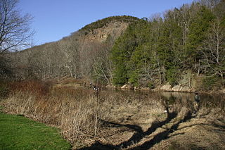
West Rock Ridge State Park is a public recreation area located in New Haven, Hamden, and Woodbridge, Connecticut. The state park is named for the 400-to-700-foot trap rock West Rock Ridge, which is part of the Metacomet Ridge extending from Long Island Sound to the Vermont border. The park's 7 miles (11 km) of open west-facing cliffs offer vistas encompassing Metropolitan New Haven and suburban towns to the west. The park includes Judges Cave, a colonial era historic site; Lake Wintergreen; and the 7-mile (11 km) Regicides Trail, part of the Connecticut Forest and Park Association's Blue Trail system. The park is part of a larger area of protected open space including state, municipal, and non-profit owned land.

The Quinnipiac Trail is a 24-mile (39 km) Blue-Blazed hiking trail in New Haven County, Connecticut. It is the product of the evolution and growth of the first 10.6-mile (17.1 km) trail designated in Connecticut's Blue-Blazed Hiking Trail system, with its light-blue rectangular vertical painted blazes.
Dixwell is a neighborhood of New Haven, Connecticut. Named for Dixwell Avenue, the main thoroughfare of the neighborhood which in turn was named for regicide judge John Dixwell, it is situated generally northwest of and adjacent to Downtown New Haven.

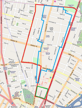
Prospect Hill is a neighborhood of the city of New Haven, Connecticut located in the north central portion of the city, directly north of Downtown New Haven. The neighborhood contains residences, institutional buildings of Albertus Magnus College and a portion of the main campus of Yale University, including the Science Hill area, the Hillhouse Avenue area and the Yale Peabody Museum. The City of New Haven defines the neighborhood to be the region bounded by the town of Hamden in the north, Winchester Avenue in the west, Munson Street/Hillside Place/Prospect Street in the southwest, Trumbull Street in the south, and Whitney Avenue in the east. Prospect Street is the main thoroughfare through the neighborhood.
The Naugatuck Trail is a 6.8-mile (10.9 km) Blue-Blazed hiking trail "system" in the eastern central-lower Naugatuck River Valley in New Haven County, Connecticut, USA. It is almost entirely contained in the Naugatuck State Forest. The mainline trail is primarily east to west with three short side or spur trails. Composed of four trails, at its western end the trail ends with a section alongside Route 8 and the Naugatuck River. During the 1930s and 1940s, it was much larger. But post–World War II housing developments of the Connecticut Blue-Blazed Trails, led to its drastic reduction.
References
- 1 2 Breen, Thomas (2021-06-28). "Housing Rebuilds Mark Candidate's Tenure". The New Haven Independent. Retrieved 2021-10-21.
- ↑ Bass, Paul (2014-05-04). "New Haven-Hamden "Berlin Wall" Coming Down". The New Haven Independent. Retrieved 2021-10-22.