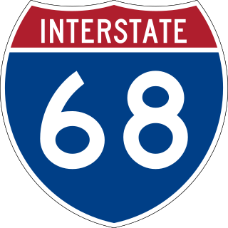
Interstate 68 (I-68) is a 113.15-mile (182.10 km) Interstate Highway in the U.S. states of West Virginia and Maryland, connecting I-79 in Morgantown, West Virginia, east to I-70 in Hancock, Maryland. I-68 is also Corridor E of the Appalachian Development Highway System (ADHS). From 1965 until the freeway's construction was completed in 1991, it was designated as U.S. Route 48 (US 48). In Maryland, the highway is known as the National Freeway, an homage to the historic National Road, which I-68 parallels between Keysers Ridge and Hancock. The freeway mainly spans rural areas and crosses numerous mountain ridges along its route. A road cut at Sideling Hill exposed geological features of the mountain and has become a tourist attraction.

U.S. Route 19 or U.S. Highway 19 (US 19) is a north–south United States Numbered Highway in the Eastern United States. Despite encroaching Interstate Highways, the route has remained a long-haul road, connecting the Gulf of Mexico with Lake Erie.

Interstate 515 (I-515) is a 14.44-mile-long (23.24 km) spur route of I-15 in the US state of Nevada that runs from the junction of I-11, I-215, and State Route 564 (SR 564) at the Spaghetti Bowl Interchange in Henderson to the junction of I-15, U.S. Route 93 (US 93), and US 95 at the Las Vegas Spaghetti Bowl Interchange in Downtown Las Vegas. The freeway connects traffic headed from Boulder City and Henderson to Downtown Las Vegas via a direct, high-speed route, and it runs concurrently with, US 93, and US 95 along its entire length.

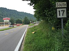
U.S. Route 117 (US 117) is a north–south United States Highway located completely within the state of North Carolina. A spur route of US 17, the highway runs for 114 miles (183 km) from the Port of Wilmington, south of downtown Wilmington, to US 301 near Wilson. From its southern terminus, US 117 runs along Shipyard Boulevard and College Road, concurrent with North Carolina Highway 132 (NC 132) through Wilmington. US 117 intersects the eastern terminus of Interstate 40 (I-40) and parallels the interstate until reaching Faison, passing through Burgaw, Wallace, and Warsaw. The highway diverges from I-40 in Faison, running north-northeast through Mount Olive, Goldsboro, and Pikeville to its northern terminus. US 117 meets the southern end of I-795 in Goldsboro, and parallels that route before reaching its northern terminus at US 301 south of Wilson.

U.S. Route 119 (US 119) is a spur of US 19. It is a north–south route that was an original United States highway of 1926. It is Corridor G of the Appalachian Development Highway System (ADHS) east of US 23 and KY 80 in Kentucky to Interstate 64 at Charleston, West Virginia.

U.S. Route 220 (US 220) is a spur route of US 20. It runs in a north–south layout in the eastern United States, unlike its parent route as well as conventionally even-numbered highways which run east-west. US 220 extends for 678 miles (1,091 km) from an intersection with US 1 in Rockingham, North Carolina, to its interchange with the Southern Tier Expressway in South Waverly, Pennsylvania. Some sections of the route are part of the Appalachian Development Highway System's Corridor O as well as I-73 in North Carolina. US 220 is designated as a spur route of US 20 but the route does not intersect US 20 or connect to other spurs of US 20.
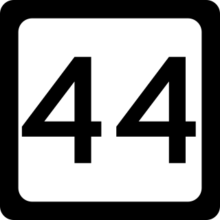
West Virginia Route 44 is a north–south state highway located within Logan County, West Virginia. The southern terminus of the route is at U.S. Route 52 one mile south of Mountain View. The northern terminus is at West Virginia Route 73 in Logan. It is marked as the Jerry West Highway after the basketball player who had jersey 44.
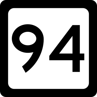
West Virginia Route 94 is a 10-mile (16 km) long north–south route connecting Marmet and Racine in West Virginia. The southern terminus of the route is at West Virginia Route 3 in Racine. The northern terminus is at West Virginia Route 61 in Marmet.

West Virginia Route 214 is a north–south state highway located in the western portion of the U.S. state of West Virginia. Although the route maintains an east–west routing for most of its length, the route is signed as north–south. The southern terminus of the route is at West Virginia Route 3 southeast of Griffithsville. The northern terminus is at an interchange with U.S. Route 119 south of South Charleston, where the roadway continues northward as West Virginia Route 601.

U.S. Route 11E (US 11E) is a divided highway of US 11 in the U.S. states of Tennessee and Virginia. The United States Numbered Highway, which is complemented by US 11W to the north and west, runs 120.94 miles (194.63 km) from US 11, US 11W, and US 70 in Knoxville, Tennessee, north and east to US 11, US 11W, US 19, and US 421 in Bristol, Virginia. US 11E connects Knoxville and the twin cities of Bristol, Virginia, and Bristol, Tennessee, with the East Tennessee communities of Morristown, Greeneville, and Johnson City. The U.S. Highway runs concurrently with US 70 and US 25W east of Knoxville, US 321 from Greeneville and Johnson City, and both US 19W and US 19 between Johnson City and Bristol. US 11E also has an unsigned concurrency with State Route 34 (SR 34) for almost all of its course in Tennessee.

U.S. Route 30 (US 30) is a U.S. Highway that runs east–west across the southern part of Pennsylvania, passing through Pittsburgh and Philadelphia on its way from the West Virginia state line east to the Benjamin Franklin Bridge over the Delaware River into New Jersey.

U.S. Route 52 (US 52) skirts the western fringes of the U.S. state of West Virginia. It runs from the Virginia state line near Bluefield, where it is concurrent with Interstate 77 (I-77), in a general northwest and north direction to I-64 at Kenova. There it turns east, overlapping I-64 for five miles (8.0 km) before splitting off onto the West Huntington Expressway into Ohio via the West Huntington Bridge. Despite having an even number, US 52 is signed north–south in West Virginia. In some other states along its route, it is signed east-west. The West Virginia segment is signed such that US 52 north corresponds to the general westward direction of the highway, and vice versa. For a while, US 52 parallels US 23, which is on the other side of the Big Sandy River in Kentucky. This continues into Ohio, where US 52 travels on the Ohio side of the Ohio River while US 23 travels on the Kentucky side.
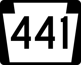
Pennsylvania Route 441 is a 32-mile-long (51 km) state route that is located in central Pennsylvania in the United States. It primarily parallels the Susquehanna River through Lancaster and Dauphin counties.
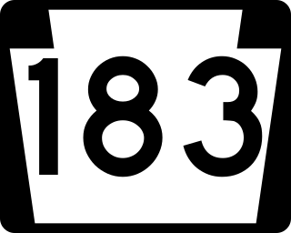
Pennsylvania Route 183 (PA 183) is a 31.7-mile-long (51.0 km) route that runs north to south in southeastern Pennsylvania. The southern terminus is at U.S. Route 422 Business in Reading in Berks County. Its northern terminus is at PA 61 near Schuylkill Haven in Schuylkill County. The road passes through developed areas near Reading before continuing north through rural areas, crossing from Berks County into Schuylkill County at Blue Mountain. PA 183 serves the communities of Bernville, Strausstown, and Cressona.

U.S. Route 40 in the U.S. state of Maryland runs from Garrett County in Western Maryland to Cecil County in the state's northeastern corner. With a total length of 221 miles (356 km), it is the longest numbered highway in Maryland. Almost half of the road overlaps or parallels with Interstate 68 (I-68) or I-70, while the old alignment is generally known as US 40 Alternate, US 40 Scenic, or Maryland Route 144. West of Baltimore, in the Piedmont and Appalachian Mountains / Blue Ridge region of the Western Maryland panhandle of the small state, the portions where it does not overlap an Interstate highway are mostly two-lane roads. The portion northeast of Baltimore going toward Wilmington in northern Delaware and Philadelphia in southeastern Pennsylvania is a four-lane divided highway, known as the Pulaski Highway. This section crosses the Susquehanna River at the north end of the Chesapeake Bay on the Thomas J. Hatem Memorial Bridge.
U.S. Route 30 Business is a 19-mile (31 km) business route of US 30 in Chester County, Pennsylvania. The route follows the former alignment of US 30 between Sadsbury Township and East Whiteland Township, passing through Coatesville, Downingtown, and Exton. US 30 follows a freeway bypass between these two points. The present alignment of US 30 Bus. was originally part of a turnpike called the Philadelphia and Lancaster Turnpike that was completed in 1794. The state took over the turnpike at the beginning of the 20th century. In 1913, present-day US 30 Bus. was incorporated into the Lincoln Highway, an auto trail that ran from San Francisco east to New York City. The Lincoln Highway through Pennsylvania became Pennsylvania Route 1 (PA 1) in 1924. US 30 was designated concurrent with PA 1 west of Philadelphia in 1926, with the PA 1 designation removed two years later. US 30 was widened into a multilane road through Chester County in the 1930s. In the 1960s, US 30 was moved to a freeway bypass around Coatesville and Downingtown, with US 30 Bus. designated onto the former alignment of US 30. In 1995, US 30 Bus. was extended east when US 30 was extended to bypass Exton.

U.S. Route 13 (US 13) runs along the Atlantic coastline for over 500 miles (800 km), passing through five states. Along its route, it possessed numerous special routes, which are all loops off the mainline US 13. At present, there are at least 15 special routes in existence: two in North Carolina, five in Virginia, two in Maryland, four in Delaware, and two in Pennsylvania. 13 others have existed in the past but have been deleted.
U.S. Route 119 (US 119) travels through Connellsville, Greensburg, and Punxsutawney, and bypasses Uniontown and Indiana. There are numerous other boroughs and villages along its 133-mile (214 km) route in the Keystone State. The southern entrance of US 119 is at the West Virginia state line one-half-mile south of Point Marion. The northern terminus is at US 219 two miles (3 km) south of DuBois, Pennsylvania. US 119 is in the National Highway System from the West Virginia state line to Exit 0 of PA Turnpike 66, and from US 22 to US 219. From US 22 to US 219, the highway carries the name of the Buffalo-Pittsburgh Highway; from US 22 to PA 56, it is also known as the Patrick J. Stapleton Highway; near Uniontown, it bears the name George C. Marshall Parkway.
Stollings is an unincorporated community and census-designated place (CDP) in central Logan County, West Virginia, United States. As of the 2010 census, it had a population of 316.
The Russellville Bypass is a beltway around Russellville in Logan County in south central Kentucky. The 12.260-mile-long (19.731 km) highway comprises overlapping portions of U.S. Route 68 and Kentucky Route 80, US 79, and US 431. The north side of the circumferential highway was conceived in the 1980s to relieve traffic in downtown Russellville and as part of greater improvements along the US 68 corridor. The first two phases of the ring road, from US 79 on the west side to US 68 on the east side, were constructed in the 1990s. The state decided to complete the orbital road in the 2000s to resolve continuing traffic bottlenecks along US 431 and US 79 on the south side. The second two phases of the beltline were started in 2010 and completed in 2017. Construction of the Russellville Bypass led to a series of route changes over 20 years involving the city's U.S. Highways, special routes, and state-numbered highways.