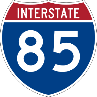
Interstate 85 (I-85) is a major Interstate Highway in the Southeastern United States. Its southern terminus is at an interchange with I-65 in Montgomery, Alabama; its northern terminus is an interchange with I-95 in Petersburg, Virginia, near Richmond. It is nominally north–south as it carries an odd number, but it is physically oriented northeast–southwest and covers a larger east-west span than north-south. While most Interstates that end in a "5" are cross-country, I-85 is primarily a regional route serving five southeastern states: Virginia, North Carolina, South Carolina, Georgia, and Alabama.

U.S. Route 60 is a major east–west United States highway, traveling 2,655 miles (4,273 km) from southwestern Arizona to the Atlantic Ocean coast in Virginia. The highway's eastern terminus is in Virginia Beach, Virginia, where it is known as Pacific Avenue, in the city's Oceanfront resort district at the intersection of 5th Street and Winston-Salem Avenue. Its original western terminus was in Springfield, Missouri; it was then extended to Los Angeles, California, but in 1964, it was truncated to end southwest of Brenda, Arizona, at an interchange with Interstate 10 (I-10) after the US 60 highway designation was removed from California. I-10 replaced US 60 from Beaumont, California, to Arizona, and California State Route 60 (SR 60) replaced US 60 from Los Angeles to Beaumont.

U.S. Route 3 (US 3) is a United States Numbered Highway running 277.90 miles (447.24 km) from Cambridge, Massachusetts, through New Hampshire, to the Canada–United States border near Third Connecticut Lake, where it connects to Quebec Route 257.
Route 9 is a 135.310-mile-long (217.760 km) major east–west state highway in Massachusetts, United States. Along with U.S. Route 20, Route 2, and Interstate 90, Route 9 is one of the major east–west routes of Massachusetts. The western terminus is near the center of the city of Pittsfield. After winding through the small towns along the passes of the Berkshire Mountains, it crosses the college towns of the Pioneer Valley and then south of the Quabbin Reservoir and the rural areas of western Worcester County. Entering the city of Worcester from the southwest corner of the city, it passes through the center of the city and forms the major commercial thoroughfare through the MetroWest suburbs of Boston, parallel to the Massachusetts Turnpike. Crossing the Route 128 freeway circling Boston, it passes through the inner suburbs of Newton and Brookline along Boylston Street, and enters Boston on Huntington Avenue, before reaching its eastern terminus at Copley Square.

U.S. Route 522 is a spur route of US 22 in the states of Virginia, West Virginia, Maryland, and Pennsylvania. The U.S. Highway travels in a north-south direction, and runs 308.59 miles (496.63 km) from US 60 near Powhatan, Virginia, to its northern terminus at US 11 and US 15 near Selinsgrove, Pennsylvania. US 522 serves many small cities and towns in the Piedmont, Blue Ridge Mountains, and northern Shenandoah Valley of Virginia. The highway serves the Virginia communities of Goochland, Mineral, Culpeper, the town of Washington, and Front Royal and the independent city of Winchester. US 522 then follows the Ridge-and-Valley Appalachians north and then east through the Eastern Panhandle of West Virginia, a 2-mile-wide (3.2 km) stretch of Western Maryland, and South Central Pennsylvania to its terminus in the Susquehanna Valley. The highway serves Berkeley Springs, West Virginia; Hancock, Maryland; and the Pennsylvania communities of McConnellsburg, Mount Union, Lewistown, and Middleburg.

U.S. Route 340 is a spur route of US 40, and runs from Greenville, Virginia, to Frederick, Maryland. In Virginia, it runs north–south, parallel and east of US 11, from US 11 north of Greenville via Waynesboro, Grottoes, Elkton, Luray, Front Royal, and Berryville to the West Virginia state line. A short separate piece crosses northern Loudoun County on its way from West Virginia to Maryland.

U.S. Route 258 is a spur of US 58 in the U.S. states of North Carolina and Virginia. The U.S. Highway runs 220.15 miles (354.30 km) from US 17 Business and NC 24 Business in Jacksonville, North Carolina north to Virginia State Route 143 at Fort Monroe in Hampton, Virginia. In North Carolina, US 258 connects Jacksonville with the Inner Banks communities of Kinston, Snow Hill, Farmville, Tarboro, and Murfreesboro. The U.S. Highway continues through the Virginia city of Franklin, where the highway intersects US 58, and the town of Smithfield on its way to the Hampton Roads metropolitan area. US 258 crosses the James River on the James River Bridge and follows Mercury Boulevard through Newport News and Hampton.
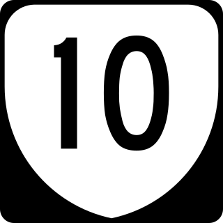
State Route 10 is a primary state highway in the U.S. state of Virginia. The state highway runs 93.58 miles (150.60 km) from U.S. Route 360 in Richmond east to SR 337 in Suffolk. SR 10 is a major suburban highway through Chesterfield County between the Southside of Richmond and Hopewell. Between Hopewell and Smithfield, which is served by SR 10 Business, the state highway passes through rural Prince George, Surry, and Isle of Wight counties, following the route of an old stagecoach road through an area that features many of the preserved James River plantations. SR 10 runs concurrently with US 258 and SR 32 between Smithfield and Suffolk.

West Virginia Route 45 is a state highway in the U.S. state of West Virginia. The state highway runs 25.8 miles (41.5 km) from the Virginia state line near Glengary east to WV 230 and WV 480 in Shepherdstown. WV 45 connects the communities of Glengary and Arden in southwestern Berkeley County with the county seat of Martinsburg. The state highway also connects Shepherdstown in northern Jefferson County with Martinsburg, where the highway meets Interstate 81 (I-81), U.S. Route 11, and WV 9.

West Virginia Route 51 is a state highway that runs west to east from Berkeley County to Jefferson County in West Virginia's Eastern Panhandle. The western terminus is at WV 45 northwest of Gerrardstown. The eastern terminus is at an interchange with U.S. Route 340 and WV 9 east of downtown Charles Town. US 340 continues to the east on the same roadway as WV 51.

U.S. Route 422 (US 422) is a 271-mile-long (436 km) spur route of US 22 split into two segments in the U.S. states of Ohio and Pennsylvania. The western segment of US 422 runs from downtown Cleveland, Ohio, east to Ebensburg, Pennsylvania. The eastern segment, located entirely within Pennsylvania, runs from Hershey east to King of Prussia, near Philadelphia. US 422 Business serves as a business route into each of four towns along the way.
Virginia State Route 3 is a primary state highway in the U.S. state of Virginia that extends from the town of Culpeper south and eastwardly to Gloucester in Virginia's Middle Peninsula region. For many years, a portion was named "Historyland Highway".

U.S. Route 30 (US 30) is a U.S. Highway that runs east–west across the southern part of Pennsylvania, passing through Pittsburgh and Philadelphia on its way from the West Virginia state line east to the Benjamin Franklin Bridge over the Delaware River into New Jersey.
State Route 420 is an unsigned primary state highway in the U.S. state of Virginia. The state highway is known as Seminary Road and Janneys Lane on its 2.75-mile (4.43 km) course from Interstate 395 (I-395) east to SR 7 within the independent city of Alexandria.

U.S. Route 1 (US 1) is a major north–south U.S. Route that serves the East Coast of the United States. In the U.S. state of Virginia, US 1 runs north–south through South Hill, Petersburg, Richmond, Fredericksburg, and Alexandria on its way from North Carolina to the 14th Street bridges into the District of Columbia. It is completely paralleled by Interstate Highways in Virginia—Interstate 85 (I-85) south of Petersburg, I-95 north to Alexandria, and I-395 into the District of Columbia—and now serves mainly local traffic. At its north end, on the approach to the 14th Street bridges, US 1 is concurrent with I-395; the rest of US 1 is on surface roads.

U.S. Route 13 (US 13) is a north–south United States Numbered Highway established in 1926 that runs for 518 miles (834 km) from Interstate 95 (I-95) just north of Fayetteville, North Carolina, north to US 1 in Morrisville, Pennsylvania, a northeastern suburb of Philadelphia. In the U.S. state of Virginia, US 13 runs north–south through the Hampton Roads and Eastern Shore regions of the state, using the Chesapeake Bay Bridge–Tunnel to get between the two. In the Hampton Roads area, it uses Military Highway to bypass the city centers. It is most usually a four-lane highway, sometimes up to freeway or expressway standards with controlled access.
U.S. Route 250 is a part of the U.S. Highway System that runs from Sandusky, Ohio to Richmond, Virginia. In Virginia, the highway runs 166.74 miles (268.34 km) from the West Virginia state line near Hightown east to its eastern terminus at US 360 in Richmond. US 250 is the main east–west highway of Highland County, which is known as Virginia's Little Switzerland; the highway follows the path of the 19th century Staunton and Parkersburg Turnpike. From Staunton east to Richmond, the highway serves as the local complement to Interstate 64 (I-64), roughly following the 18th century Three Notch'd Road through Waynesboro and Charlottesville on its way through the Shenandoah Valley, its crossing of the Blue Ridge Mountains at Rockfish Gap, and the Piedmont. In the Richmond metropolitan area, US 250 is known as Broad Street, a major thoroughfare through the city's West End and downtown areas.

