Western Head, Nova Scotia

Last updated

Western Head is a community in the Canadian province of Nova Scotia, located in the Region of Queens Municipality. The Meteorological Service of Canada maintains a weather station in Western Head ID: CWWE.

Western Head is prone to tropical storms and hurricanes that track up the East Coast. However, effects are usually quick and minimal as the cool waters may weaken the storm, and storms usually move very quickly across Western Head. For example, Hurricane Earl made landfall near Western Head as a large Category One hurricane in 2010.
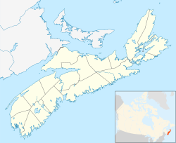
Coordinates: 44°0′0″N64°40′0″W / 44.00000°N 64.66667°W / 44.00000; -64.66667 (Western Head, Nova Scotia)

Related Research Articles

<span class="mw-page-title-main">Hurricane Juan</span> Category 2 Atlantic hurricane in 2003

Hurricane Juan was a significant tropical cyclone that heavily damaged parts of Atlantic Canada in late September 2003. Juan is also the first hurricane name and one of two to be requested to be retired by the Meteorological Service of Canada. It was the tenth named storm and the sixth hurricane of the 2003 Atlantic hurricane season. Juan formed southeast of Bermuda on September 24 from a tropical wave that had tracked across the subtropical Atlantic Ocean. It tracked northward and strengthened over the warm waters of the Gulf Stream, reaching Category 2 strength on the Saffir-Simpson hurricane scale on September 27. The hurricane peaked in intensity with sustained winds of 105 mph (165 km/h) that same day, losing some strength as it raced over cooler waters toward the coast of Nova Scotia. Juan made landfall between Shad Bay and Prospect in the Halifax Regional Municipality early on September 29 as a Category 2 hurricane with winds of 100 mph (160 km/h). Juan retained hurricane strength while crossing Nova Scotia from south to north, though it weakened to a Category 1 storm over Prince Edward Island. It was absorbed by another extratropical low later on September 29 near Anticosti Island in the northern Gulf of Saint Lawrence.

<span class="mw-page-title-main">1959 Escuminac disaster</span> Category 1 Atlantic hurricane in 1959

The 1959 Escuminac disaster was considered the worst fishing-related disaster in New Brunswick in 100 years. It occurred due to the extratropical remnants of an Atlantic hurricane. The storm was the third tropical cyclone and first hurricane of the 1959 Atlantic hurricane season, and developed from a tropical wave in the central Gulf of Mexico on June 18. It headed rapidly northeastward and struck Florida later that day. Shortly after entering the Atlantic Ocean, it strengthened into a tropical storm later on June 18. By the following day, it had strengthened into a hurricane. However, it transitioned into an extratropical cyclone about six hours later. The remnants struck Atlantic Canada, once in Nova Scotia and again in Newfoundland before dissipating on June 21.

<span class="mw-page-title-main">1936 Atlantic hurricane season</span> Hurricane season in the Atlantic Ocean

The 1936 Atlantic hurricane season was fairly active, with 20 tropical cyclones recorded, 17 of which became tropical storms. Seven storms became hurricanes, of which one became a major hurricane. In addition, the season was unusual in the fact that no storms moved across large portions of the Caribbean Sea. Seven storms, including three hurricanes, struck the United States.

<span class="mw-page-title-main">St. Margarets Bay, Nova Scotia</span>

St. Margarets Bay is a bay located on the Atlantic coast of Nova Scotia, Canada on the border of Halifax County and Lunenburg County.

<span class="mw-page-title-main">Hurricane Carrie</span> Category 4 Atlantic hurricane in 1957

Hurricane Carrie was the strongest tropical cyclone of the 1957 Atlantic hurricane season. The third named storm and second hurricane of the year, Carrie formed from an easterly tropical wave off the western coast of Africa on September 2, a type of tropical cyclogenesis typical of Cape Verde-type hurricanes. Moving to the west, the storm gradually intensified, reaching hurricane strength on September 5. Carrie intensified further, before reaching peak intensity on September 8 as a Category 4 hurricane with maximum sustained winds of 140 mph (220 km/h) in the open Atlantic Ocean. The hurricane curved northwards and fluctuated in intensity as it neared Bermuda on September 14. However, Carrie passed well north of the island and turned to the northeast towards Europe. Weakening as it reached higher latitudes, the storm transitioned into an extratropical cyclone on September 23, prior to affecting areas of the British Isles, and subsequently dissipated on September 28.

<span class="mw-page-title-main">1991 Perfect Storm</span> Noreaster and Category 1 Atlantic hurricane in 1991

The 1991 Perfect Storm, also known as The No-Name Storm and the Halloween Gale/Storm, was a nor'easter that absorbed Hurricane Grace, and ultimately evolved into a small unnamed hurricane itself late in its life cycle.

<span class="mw-page-title-main">Halifax Nova Scotia Temple</span>

The Halifax Nova Scotia Temple is the 64th operating temple of the Church of Jesus Christ of Latter-day Saints.

<span class="mw-page-title-main">Tropical Storm Beryl (2006)</span> Atlantic tropical storm in 2006

Tropical Storm Beryl was the third tropical storm of the 2006 Atlantic hurricane season. Developing from a tropical disturbance on July 18, it tracked generally northward, and strengthened to attain peak winds of 60 mph (95 km/h) under generally favorable conditions. After turning to the northeast, Beryl weakened over cooler waters. On July 21 it struck the island of Nantucket, and shortly thereafter it became extratropical. The extratropical remnants continued northeastward through Nova Scotia, and on July 22 it merged with an approaching cold front.

<span class="mw-page-title-main">1927 Nova Scotia hurricane</span> Category 3 Atlantic hurricane in 1927

The 1927 Nova Scotia hurricane was the deadliest tropical cyclone striking Canada in the 20th century. The first observed storm of the season, this cyclone developed from a tropical wave over the deep tropics of the Atlantic Ocean on August 18. Initially a tropical storm, it moved west-northwestward and intensified into a Category 1 hurricane on the modern day Saffir–Simpson hurricane wind scale by August 19. The storm intensified significantly over the next few days, and by August 22, it peaked as a Category 3 hurricane with maximum sustained winds of 125 mph (205 km/h). Around that time, the system began curving northwestward and later northward. By August 23, it turned to the north-northeast and then began weakening on August 24. Thereafter, the storm accelerated toward Atlantic Canada. Late on August 24, the hurricane struck near Yarmouth, Nova Scotia, as a Category 2 hurricane, just before becoming extratropical.

<span class="mw-page-title-main">White Juan</span>

White Juan is the unofficial name given to the hurricane-strength nor'easter blizzard of February 2004 that affected most of Atlantic Canada and the Eastern United States between February 17 and 20, 2004—five months after Hurricane Juan devastated Nova Scotia and Prince Edward Island.

<span class="mw-page-title-main">Hurricane Karen (2001)</span> Category 1 Atlantic hurricane in 2001

Hurricane Karen was a hurricane of non-tropical origin that formed in October of the 2001 Atlantic hurricane season. It developed out of the interaction between a cold front and an upper level trough on October 10 located to the south of Bermuda, and quickly strengthened as an extratropical storm. The storm passed near Bermuda on October 12, producing hurricane-force winds on the island. It then organized, becoming a subtropical cyclone on the 12th and a tropical cyclone on the 13th. Karen strengthened to reach 80 mph (130 km/h) winds as a Category 1 hurricane on the Saffir-Simpson Hurricane Scale, and after weakening over cooler waters, it made landfall on Nova Scotia as a tropical storm. It quickly became extratropical.

Digby Neck is a Canadian peninsula extending into the Bay of Fundy in Digby County, Nova Scotia.

<span class="mw-page-title-main">1924 Atlantic hurricane season</span> Hurricane season in the Atlantic Ocean

The 1924 Atlantic hurricane season featured the earliest known Category 5 hurricane – a tropical cyclone with maximum sustained winds exceeding 155 mph (250 km/h). The first system, Tropical Storm One, was first detected in the northwestern Caribbean Sea on June 18. The final system, an unnumbered tropical depression, dissipated on November 24. These dates fall within the period with the most tropical cyclone activity in the Atlantic. Of the 13 tropical cyclones of the season, six existed simultaneously. The season was average with 11 tropical storms, five of which strengthened into hurricanes. Further, two of those five intensified into major hurricanes, which are Category 3 or higher on the Saffir–Simpson hurricane wind scale.

There are various Black Lakes in Nova Scotia, Canada. They vary widely in size, depth and usability. Many counties, such as Cumberland, Halifax, Inverness, and Pictou Counties have more than one Black Lake so named, while other counties mentioned in this article have only one named Black Lake.

<span class="mw-page-title-main">Hurricane Bill (2009)</span> Category 4 Atlantic hurricane in 2009

Hurricane Bill was a large Atlantic tropical cyclone that brought minor damage across mainly Atlantic Canada and the East Coast of the United States during August 2009. The second named storm, first hurricane, and first major hurricane of the annual hurricane season, Bill originated from a tropical wave in the eastern Atlantic on August 15. Initially a tropical depression, the cyclone intensified within a favorable atmospheric environment, becoming Tropical Storm Bill six hours after formation. Steered west-northwest around the southern periphery of a subtropical ridge to the northeast of the cyclone, Bill passed through the central Atlantic. At 0600 UTC on August 17, the cyclone strengthened into a Category 1 hurricane on the Saffir–Simpson hurricane wind scale; within 36 hours, Bill entered a period of rapid deepening and intensified into a major hurricane with winds of 115 mph (185 km/h). Passing well northeast of the Lesser Antilles, Bill attained its peak intensity with maximum sustained winds of 130 mph (215 km/h) and a minimum barometric pressure of 943 mb on August 19 and August 20, respectively. Thereafter, an approaching trough induced higher vertical wind shear across the region, causing slow weakening of the hurricane; this same trough resulted in an accelerated motion and curve northward. As the storm passed Bermuda, it contained sustained winds equal to a Category 2, and ultimately struck Newfoundland as a tropical storm. After moving inland and weakening to a tropical storm, Bill began an extratropical transition; this alteration in structure was completed by 1200 UTC on August 24. Two days later, Bill's remnant low was absorbed into a larger extratropical system over the Northern Atlantic.

<span class="mw-page-title-main">1873 Atlantic hurricane season</span> Hurricane season in the Atlantic Ocean

The 1873 Atlantic hurricane season was quiet, with only two tropical storms and three hurricanes, two of which were major hurricanes, being recorded. However, in the absence of modern satellite and other remote-sensing technologies, only storms that affected populated land areas or encountered ships at sea were recorded, so the actual total could be higher. An undercount bias of zero to six tropical cyclones per year between 1851 and 1885 and zero to four per year between 1886 and 1910 has been estimated. Of the known cyclones, large alterations were made to the tracks of Hurricane Two and Hurricane Five in 1995 by Jose Fernandez-Partagas and Henry Diaz, who also proposed smaller changes to the known track of Hurricane Three. All of the tropical cyclones, other than Hurricane Two, made landfall in Florida.

Collège de l'Île is a Francophone post-secondary community college in the Canadian province of Prince Edward Island with headquarters in the community of Wellington. It was originally a campus of Collège de l'Acadie which served Nova Scotia and Prince Edward Island. When the Nova Scotia operations became part of Université Sainte-Anne, its operations in Prince Edward Island were renamed Collège Acadie Î.-P.-É and subsequently Collège de l'Île.

<span class="mw-page-title-main">1926 Nova Scotia hurricane</span> Category 3 Atlantic hurricane in 1926

The 1926 Nova Scotia hurricane was one of the deadliest Canadian hurricanes in the 20th century. The second tropical cyclone and second hurricane of the season, the storm developed from a trough situated well east of the Leeward Islands on July 29. Over the next few days, it moved west-northwest, becoming a tropical storm by July 31. The cyclone turned to the northwest on August 1 and began strengthening rapidly, reaching hurricane intensity by the early afternoon. The next day, it became a major hurricane—equivalent to Category 3 intensity on the modern-day Saffir–Simpson hurricane wind scale. Over the next few days, the storm's track varied between north-northwest and northwest. Early on August 5, it peaked with winds of 120 mph (190 km/h). The hurricane then began weakening as it curved northward. The storm began losing tropical characteristics while approaching Atlantic Canada, transitioning into an extratropical cyclone on August 8. The remnants soon made landfall near Port Hawkesbury, Nova Scotia, with winds of 75 mph (121 km/h), before being last noted over Newfoundland later that day.

References