Related Research Articles

Port of Spain, officially the City of Port of Spain, is the capital of Trinidad and Tobago and the third largest municipality, after Chaguanas and San Fernando. The city has a municipal population of 37,074 (2011), an urban population of 81,142 and a transient daily population of 250,000. It is located on the Gulf of Paria, on the northwest coast of the island of Trinidad and is part of a larger conurbation stretching from Chaguaramas in the west to Arima in the east with an estimated population of 600,000.

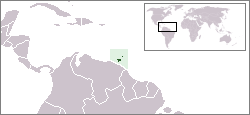
Tobago is an island and ward within the Republic of Trinidad and Tobago. It is located 35 kilometres (22 mi) northeast of the larger island of Trinidad and about 160 kilometres (99 mi) off the northeastern coast of Venezuela. It lies to the southeast of Grenada.

Aldwyn Roberts HBM DA, better known by the stage name Lord Kitchener, was a Trinidadian calypsonian. He has been described as "the grand master of calypso" and "the greatest calypsonian of the post-war age".
Trinidad and Tobago has a unique history and its food is influenced by Indian-South Asian, West African, Creole, European, American, Chinese, Amerindian, and Latin American culinary styles. Trinidadian and Tobagonian food is dominated by a wide selection of dishes, most notably, doubles, roti, pelau, callaloo and curried crab and dumplings. Trinidad and Tobago is also known for its prepared provisions, such as dasheen, sweet potato, eddoes, cassava, yam, soups and stews, also known as blue food across the country. Corresponding to the Blue Food Day event held annually in Trinidad and Tobago.

Scarborough is a major town of the Island of Tobago as well as the eleventh-most-populous in Trinidad and Tobago. Scarborough was the capital of Tobago in 1769 before it was unified with Trinidad changing the capital to Port of Spain. Situated in western Tobago, Scarborough is the economic and cultural centre of the island of Tobago. The estimated population in 2011 was 17,537. Scarborough is ranked as one of Trinidad and Tobago's most densely populated towns alongside Port of Spain, San Fernando, Chaguanas and Arima. The town's skyline is dominated by Fort King George, an 18th-century fortification named after King George III, which now hosts a historic and archaeologic museum. Scarborough's deepwater harbour was built in 1991; before that ships were forced to anchor offshore.

San Fernando, officially the City of San Fernando, is the most populous city and second most populous municipality in Trinidad and Tobago, after Chaguanas. Sando, as it is known to many local Trinidadians, occupies 19 km2 and is located in the southwestern part of the island of Trinidad. It is bounded to the north by the Guaracara River, the south by the Oropouche River, the east by the Sir Solomon Hochoy Highway, and the west by the Gulf of Paria. The former borough was elevated to the status of a city corporation on 18 November 1988. The motto of San Fernando is: "Sanitas Fortis" - In a Healthy Environment We Will Find Strength. San Fernando is called Trinidad and Tobago's "industrial capital" because of its proximity to the Pointe-à-Pierre oil refinery and many other petrochemical, LNG, iron and steel and aluminium smelters in places such as Point Lisas in Couva, Point Fortin, and La Brea.

The Borough of Chaguanas is the largest municipality and fastest-growing town in Trinidad and Tobago. Located in west-central Trinidad, south of Port of Spain, north of Couva and San Fernando, and named after the indigenous tribe who originally settled there, it grew in size due to its proximity to the Woodford Lodge sugar refinery. It remained a minor town until the 1980s when it began to grow rapidly as it drew people for its bargain shopping and moderately priced housing. Its rapid growth has seen property values increase dramatically, however.

Arima, officially The Royal Chartered Borough of Arima is the easternmost and second largest in area of the three boroughs of Trinidad and Tobago. It is geographically adjacent to Sangre Grande and Arouca at the south central foothills of the Northern Range. To the south is the Caroni–Arena Dam. Coterminous with Town of Arima since 1888, the borough of Arima is the fourth-largest municipality in population in the country. The census estimated it had 33,606 residents in 2011.

Laventille is a Suburb of Port of Spain in Trinidad and Tobago. It is administered by the San Juan–Laventille Regional Corporation.
Couva is a town in west-central Trinidad, south of Port of Spain and Chaguanas and north of San Fernando and Point Fortin. It is the capital and main urban centre of Couva–Tabaquite–Talparo, and the Greater Couva area includes the Point Lisas industrial estate and the port of Point Lisas. It is one of the fastest-growing towns in the country. Couva's southern boundary is at the village of California and Point Lisas, and to the north Couva stretches to McBean. To the east of Couva is Preysal. To the west of Couva is the road to Waterloo and Carli Bay, which are located on the Gulf of Paria. Couva was part of the Caroni County. Couva is considered a major power base for the United National Congress, whose headquarters was previously located here.

San Juan is a town in Trinidad and Tobago. Located in San Juan–Laventille region in Saint George County, it lies within the East-West Corridor Metropolitan Area, between Laventille and Saint Joseph.

The Trinidad and Tobago Guardian is the oldest daily newspaper in Trinidad and Tobago. The paper is considered the newspaper of record for Trinidad and Tobago.

Saint James is a district of Port of Spain, Trinidad and Tobago. Port of Spain's last major municipal expansion occurred in 1938, when the St. James district north of Woodbrook and west of St. Clair was incorporated into the city limits. In the late 19th century, Indian indentured labourers on nearby sugar estates established houses here, and St. James gradually became the centre of Port of Spain's Indian population, with many streets named after cities and districts in British India. Western Main Road, the area's major thoroughfare, has long been the city's main nightlife district, sometimes nicknamed "the city that never sleeps".
The Lady Young Road is a major roadway in Trinidad and Tobago linking the Eastern Main Road in Barataria to the Queen's Park Savannah in Port of Spain. It is also an important connector between the Churchill-Roosevelt Highway and uptown Port of Spain.

The following outline is provided as an overview of and topical guide to Trinidad and Tobago:

Goat Island is an island in the Republic of Trinidad and Tobago. It is located off the coast of Speyside, between Tobago and Little Tobago.

Originating in the Caribbean with Indian roots, a roti is a wrap style sandwich filled with either curried or sometimes stewed meats or vegetables wrapped inside a dhalpuri, paratha, or dosti roti. Roti is eaten widely across the Caribbean. As Indo-Caribbeans immigrated to other countries, especially in North America and Europe, they brought with them the roti and opened roti shops to sell it.
Vehicle registration plates in Trinidad and Tobago are categorised using prefixes based on the type of vehicle and feature up to four succeeding digits. Registration plates in Trinidad and Tobago are supposed to be either white figures on a black background or black figures on a white background. All motor vehicles that are operating in the roads of Trinidad and Tobago are required by law to have a registration plate affixed to the front and rear of the vehicle at all times except during very specific situations. This current system has been present for over 40 years.
Crusoe Cave is a sea cave on Crown Point, on the island of Tobago in Trinidad and Tobago. The cave is named for the titular main character of the 1719 novel Robinson Crusoe by English writer Daniel Defoe. In the novel, Crusoe is shipwrecked on an unnamed island described as within sight of Trinidad; it is believed by some that Crusoe's island was based on Tobago. The cave has been referred to by this name as early as 1890.
References
- ↑ Dominique De-Light and Polly Thomas (2001). The rough guide to Trinidad and Tobago. Rough Guides. p. 91. ISBN 1-85828-747-2.
| Freeways & major highways | |
|---|---|
| Trunk roads & minor highways | |
| Main roads | |
| | This Trinidad and Tobago road article is a stub. You can help Wikipedia by expanding it. |