Related Research Articles
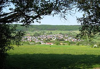
The Westerwald is a low mountain range on the right bank of the river Rhine in the German federal states of Rhineland-Palatinate, Hesse and North Rhine-Westphalia. It is a part of the Rhenish Massif. Its highest elevation, at 657 m above sea level, is the Fuchskaute in the High Westerwald.
The Westerwaldkreis is a district (Kreis) in the north-east of Rhineland-Palatinate, Germany. Neighbouring districts are Altenkirchen, Lahn-Dill, Limburg-Weilburg, Rhein-Lahn, the district-free city Koblenz, Mayen-Koblenz and Neuwied.

The Franconian Jura is an upland in Franconia, Bavaria, Germany. Located between two rivers, the Danube in the south and the Main in the north, its peaks reach elevations of up to 600 metres (2,000 ft) and it has an area of some 7053.8 km2.

The Lahn is a 245.6-kilometre-long (152.6 mi), right tributary of the Rhine in Germany. Its course passes through the federal states of North Rhine-Westphalia (23.0 km), Hesse (165.6 km), and Rhineland-Palatinate (57.0 km).

The Mecklenburg Lake Plateau or Mecklenburg Lakeland is the largest coherent lake and canal region in Germany and is sometimes called "the land of a thousand lakes". There are several nature parks and well-known lakes with unique flora and fauna in the region, such as the Müritz, the biggest German lake lying entirely within Germany, the Plauer See, the Fleesensee, the Tollensesee, the Schmaler Luzin and the Kölpinsee.

This division of Germany into major natural regions takes account primarily of geomorphological, geological, hydrological, and pedological criteria in order to divide the country into large, physical units with a common geographical basis. Political boundaries play no part in this, apart from defining the national border.
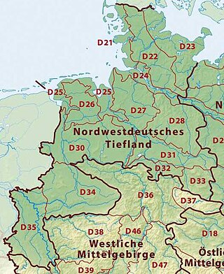
The Westphalian Lowland, also known as the Westphalian Basin is a flat landscape that mainly lies within the German region of Westphalia, although small areas also fall within North Rhine and in Lower Saxony. Together with the neighbouring Lower Rhine Plain to the west, it represents the second most southerly region of the North German Plain, after the Cologne Bight. It is variously known in German as the Westfälische Bucht, the Münsterländer or Westfälische Tieflands- or Flachlandsbucht.

The Gladenbach Uplands, named after their central town of Gladenbach, is a range of hills up to 609 m high in the Rhine Massif in Germany, on the junction of the Rothaar Mountains, Westerwald (southwest), (Eastern) Hintertaunus and West Hesse Highlands in the east. It lies in Central Hesse within the districts of Marburg-Biedenkopf, Lahn-Dill and Gießen within the so-called Lahn-Dill-(Dietzhölze-) loop. Small parts of the Upper Lahn Valley in the northwest belong, together with the town of Bad Laasphe, also to the district of Siegen-Wittgenstein, North Rhine-Westphalia.
The Waldeck Plateau is a natural 'upper main unit' in the German state of Hesse between the rivers Eder and Diemel, the East Sauerland Hills in the west and the East Waldeck Basin in the east.
The Franconian Keuper-Lias Plains or Franconian Keuper-Lias Lands are a major natural region in the South German Scarplands in Upper Franconia and to a lesser extent in the north, in the Thuringian district of Hildburghausen. As the name indicates, the term embraces both the Keuper landscapes and lias landscapes in Franconia. In addition, the fore-land of the Franconian Jura, in which part of the Brown Jurassic occurs, as well as parts of the former volcanic region of Heldburger Gangschar belong to this region.

The Haar or Haarstrang is a ridge of hills on the southern edge of the Westphalian Basin in the German state of North Rhine-Westphalia. From a natural region perspective it is the southern, submontane part of the Hellweg Börde, which stands opposite the northern area of the Süder Uplands, north of the Möhne and Ruhr rivers.

The High Fichtel Mountains, or High Fichtel, form a mountainous and heavily forested range consisting of several mountain chains in the shape of a horseshoe, the Fichtel Mountain Horseshoe (Fichtelgebirgs-Hufeisen), that rings the Selb-Wunsiedel Plateau.
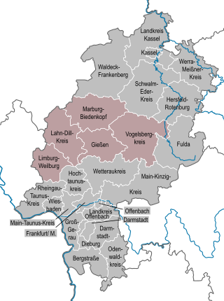
The region of Middle Hesse is one of three planning regions in the German state of Hesse, alongside North and South Hesse. Its territory is identical with that of the administrative province of Gießen and covers the counties of Limburg-Weilburg, Lahn-Dill-Kreis, Gießen, Marburg-Biedenkopf and Vogelsbergkreis. The Middle Hesse Regional Assembly, which decides on the regional plan, currently consists of 31 members chosen by the five counties and the three towns with special status: Gießen, Marburg and Wetzlar. The regional assembly has tasked the governing president (Regierungspräsident) with delivering regional management. The Mid-Hesse Regional Management Association was founded on 22 January 2003.

The Holzstöcke is an elongated, densely forested, mountain range running from north to south in the German state of Baden-Württemberg. It is up to about 700 m above sea level (NN) and covers and area of 381.9 square kilometres. It is a large, terraced landscape that is part of the Iller-Lech Plateau in the Alpine Foreland of south Germany. It lies southwest of the city of Ulm in the counties of Alb-Donau-Kreis and Biberach in Upper Swabia and rises above the valley floors by about 75 metres.

The Bauland is a Gäu landscape in the northeast of the German state of Baden-Württemberg. It is a natural region within the Neckar and Tauber Gäu Plateaus in the South German Scarplands.
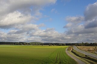
The North Brandenburg Plateaux and Upland is a natural region in the northwest of Brandenburg and, to a lesser extent, the southwest of Mecklenburg-Vorpommern and northeast of Saxony-Anhalt in Germany. It is major unit group no. 77 in the natural regional divisions of Germany. The Brandenburg portion of the North Brandenburg Plateaux and Upland is largely coextensive with the natural region of Prignitz and Ruppin Land in the structural atlas of the state of Brandenburg.
The Venn Foreland is a region of the North Eifel on the northwestern edge of the High Fens and in its transition zone with the Jülich-Zülpich Börde. Also part of the region are the areas around the city of Aachen and town of Stolberg as well as parts of Eschweiler. It is a heavily built-up area and includes the largest part of the Aachen Municipal Region. Even parts of the High Fens-Eifel Nature Park belong to it. The valley of the river Inde forms its boundary with the High Fens. The region is hilly with an average height of 200 metres and rising to just over 350 metres above sea level. Its highest point is the Brandenberg in the Aachen Forest at 355.4 m above sea level (NHN).
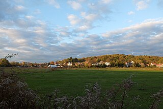

The Salzungen Werra Upland is a natural region in Germany that forms part of the East Hesse Highlands in the German states of Hesse and Thuringia.

The Lower Westerwald is a region, over 1,300 km2 in area, in the west of the German hill range, the Westerwald, in the north of the state of Rhineland-Palatinate and, for small elements, in the south of the state of North Rhine-Westphalia. It reaches a height of 544 metres, 12 km northeast of Koblenz at the Montabaur Heights. From a natural region perspective the Lower Westerwald is major unit 324 within the major unit group of Westerwald (32). In the south it also includes the historical cultural landscape of the Kannenbäckerland.
References
- ↑ Landschaften in Rheinland-Pfalz: Westerwald
- ↑ Map and legend for the Westerwald in the Environmental Atlas of Hesse (Umweltatlas Hessen)
- ↑ Map service of the BfN
- ↑ Map service of Rhineland-Palatinate with maps of natural/landscape regions (→ Landschaftserleben → Landschaften in Rheinland-Pfalz)
