Related Research Articles
Kenai Peninsula Borough is a borough of the U.S. state of Alaska. As of the 2020 census, the population was 58,799, up from 55,400 in 2010. The borough seat is Soldotna, the largest city is Kenai, and the most populated community is the census-designated place of Kalifornsky.

Bear Creek is a census-designated place (CDP) in Kenai Peninsula Borough, Alaska, United States. At the 2020 census the population was 2,129 up from 1,956 in 2010. Bear Creek is a few miles north of Seward near the stream of the same name and its source, Bear Lake.
Diamond Ridge is a census-designated place (CDP) just outside Homer in Kenai Peninsula Borough, Alaska, United States. At the 2010 census the population was 1,156, down from 1,802 in 2000.
Fritz Creek is a census-designated place (CDP) in the Kenai Peninsula Borough, Alaska, United States, northeast of Homer. At the 2020 census the population was 2,248, up from 1,932 in 2010.

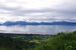
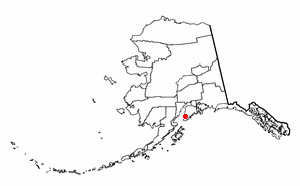
Kachemak, locally known as Kachemak City, is a small second-class city in the southern portion of the Kenai Peninsula Borough, Alaska, United States. The city consists of several subdivisions and other miscellaneous properties along an approximately 2-mile (3.2 km) stretch of East End Road, adjoining the northeast corner of the much larger city of Homer. The population grew from 431 as of the 2010 census to 576 at the 2020 census.

Kalifornsky is a census-designated place (CDP) in Kenai Peninsula Borough, Alaska, United States. The population was 8,487 at the 2020 census, up from 7,850 in 2010. It is the most populated locality in the borough.
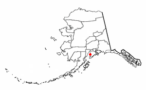
Kasilof is a census-designated place (CDP) in Kenai Peninsula Borough, Alaska, United States. At the 2020 census the population was 525, down from 549 in 2010.
Ridgeway is a census-designated place (CDP) in Kenai Peninsula Borough, Alaska, United States. At the 2020 census the population was 2,136, up from 2,022 in 2010.

The Yentna River (Dena'ina: Yentnu) is a river in South Central Alaska, formed by its East Fork and West Fork at 62°16′50″N151°46′26″W, flows South-East to Susitna River, 30 miles (48 km) North-West of Anchorage, Alaska; Cook Inlet Low.

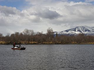
The Kasilof River or Ggasilatnu in the Dena'ina language is a river on the western Kenai Peninsula in southern Alaska. The name is an anglicization of Reka Kasilova, the name given to the river by early Russian settlers in the area. It begins at Tustumena Lake and flows northwest to Cook Inlet near Kasilof. The upper section of the river is very swift, with several sections considered Class II whitewater, and underwater hazards are difficult to detect, due to the silty nature of the glacial runoff that comprises most of the river. The entire river has powerful currents and is very cold. There is public access to the lower section from the Sterling Highway. Drift and bank fishing for salmon is popular on the lower Kasilof.
The Talachulitna River is a river in Alaska.
Alexander Creek, also known as Taguntna Creek, is a 35 miles (56 km) long stream from Alexander Lake which merges with the big Susitna River near the village of Alexander Creek, Alaska also known as Alexander, Alaska, an Alaska Native and Alaska Bush community, in Matanuska-Susitna Borough, Alaska.
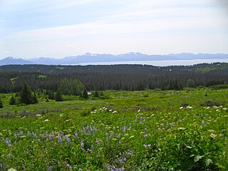
Kachemak Bay National Estuarine Research Reserve, on the western coast of the Kenai Peninsula in Alaska, is part of the National Estuarine Research Reserve System and is managed jointly by the U.S. National Oceanic and Atmospheric Administration and the Alaska Department of Fish and Game. Covering more than 370,000 acres (1,500 km2), it is the largest reserve in the system, encompassing one of the most diverse and intensively used estuaries in Alaska. The local community pursued the designation of Kachemak Bay as a National Estuarine Research Reserve to preserve the lifestyle and economy of the region.

The Alcan–Beaver Creek Border Crossing is a border crossing point between the United States and Canada. It is located on the historic Alaska Highway, which was built during World War II for the purpose of providing a road connection between the contiguous United States and Alaska through Canada. Beaver Creek, located on the Canadian side of the border in the Yukon, is the westernmost community in the country.
Queer Creek is a stream in Matanuska-Susitna Borough, Alaska, in the United States. It is 4 miles (6.4 km) in length.
Coarse Money Creek is a stream in Southeast Fairbanks Census Area, Alaska, in the United States.
Atlasta Creek is a stream in Valdez–Cordova Census Area, Alaska, in the United States.
Stariski Creek is a stream in Kenai Peninsula Borough, Alaska, in the United States. The creek is located at 59° 52' 55" N, 151° 47' 50" W and flows west into Cook Inlet at Cape Starichkof, approximately 19 miles northwest of Homer, Alaska.
References
- ↑ U.S. Geological Survey Geographic Names Information System: Wetbutt Creek
- ↑ Orth, Donald J. (1967). Dictionary of Alaska Place Names. U.S. Government Printing Office. p. 1039.
62°23′10″N151°10′57″W / 62.3861°N 151.1826°W