White Eyes Creek

Last updated

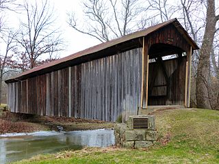
White Eyes Creek is a stream located entirely within Muskingum County, Ohio. [1]

Stream A body of surface water flowing down a channel

A stream is a body of water with surface water flowing within the bed and banks of a channel. The stream encompasses surface and groundwater fluxes that respond to geological, geomorphological, hydrological and biotic controls.

Muskingum County, Ohio County in the United States

Muskingum County is a county located in the U.S. state of Ohio. As of the 2010 census, the population was 86,074. Its county seat is Zanesville. Nearly bisected by the Muskingum River, the county name is based on a Delaware American Indian word translated as "town by the river" or "elk's eye".

White Eyes Creek was named for White Eyes, a Delaware Indian chief. [2]

White Eyes, named Koquethagechton, was a leader of the Lenape (Delaware) people in the Ohio Country during the era of the American Revolution. Sometimes known as George White Eyes, or Captain Grey Eyes al. Sir William, his given name in Lenape was rendered in many spelling variations in colonial records.

Lenape indigenous people originally from Lenapehoking, now the Mid-Atlantic United States

The Lenape, also called the Leni Lenape, Lenni Lenape and Delaware people, are an indigenous people of the Northeastern Woodlands, who live in Canada and the United States. Their historical territory included present-day New Jersey and eastern Pennsylvania along the Delaware River watershed, New York City, western Long Island, and the Lower Hudson Valley. Today, Lenape people belong to the Delaware Nation and Delaware Tribe of Indians in Oklahoma; the Stockbridge-Munsee Community in Wisconsin; and the Munsee-Delaware Nation, Moravian of the Thames First Nation, and Delaware of Six Nations in Ontario.

See also

Related Research Articles

Chandlersville, Ohio human settlement in Ohio, United States of America

Chandlersville is an unincorporated community in western Salt Creek Township, Muskingum County, Ohio, United States. Although it is unincorporated, it has a post office, with the ZIP code of 43727. It lies along State Route 146 at its intersection with State Routes 284 and 313.

Ellis is an unincorporated community in Muskingum County, in the U.S. state of Ohio.

Salt Creek (Muskingum County, Ohio)

Salt Creek is a stream located entirely within Muskingum County, Ohio.

Gilbert is an unincorporated community in Muskingum County, in the U.S. state of Ohio.

Bridgeville is an unincorporated community in Muskingum County, in the U.S. state of Ohio.

Sonora is an unincorporated community in Muskingum County, in the U.S. state of Ohio.

Sundale is an unincorporated community in Muskingum County, in the U.S. state of Ohio.

Blue Rock Creek is a stream in the U.S. state of Ohio.

Gaysport is an unincorporated community in Muskingum County, in the U.S. state of Ohio.

Rix Mills is an unincorporated community in Muskingum County, in the U.S. state of Ohio.

Freeland is an unincorporated community in Muskingum County, in the U.S. state of Ohio.

Meigs Creek is a stream in the U.S. state of Ohio. It is a tributary of the Muskingum River.

Young Hickory is an unincorporated community in Muskingum County, in the U.S. state of Ohio.

Museville is an unincorporated community in Muskingum County, in the U.S. state of Ohio.

High Hill is an unincorporated community in Muskingum County, in the U.S. state of Ohio.

Coal Hill is an extinct town in Muskingum County, in the U.S. state of Ohio. The GNIS classifies it as a populated place.

Zeno, Ohio human settlement in United States of America

Zeno is an extinct town in Muskingum County, in the U.S. state of Ohio. The GNIS classifies it as a populated place.

Bloomfield is an unincorporated community in Muskingum County, in the U.S. state of Ohio.

Otsego, Muskingum County, Ohio unincorporated community in Muskingum County, Ohio, United States

Otsego is an unincorporated community in Muskingum County, in the U.S. state of Ohio.

Stovertown is an unincorporated community in Muskingum County, in the U.S. state of Ohio.

References

Coordinates: 39°55′4″N81°51′52″W / 39.91778°N 81.86444°W / 39.91778; -81.86444

Geographic coordinate system Coordinate system

A geographic coordinate system is a coordinate system that enables every location on Earth to be specified by a set of numbers, letters or symbols. The coordinates are often chosen such that one of the numbers represents a vertical position and two or three of the numbers represent a horizontal position; alternatively, a geographic position may be expressed in a combined three-dimensional Cartesian vector. A common choice of coordinates is latitude, longitude and elevation. To specify a location on a plane requires a map projection.