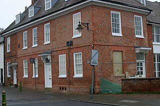
The Red House is a Queen Anne style house built around 1710 opposite the intersection of Norfolk Road and High Street in Buntingford, Hertfordshire, England. It was inhabited by artist and stage designer Claud Lovat Fraser, who designed the Buntingford war memorial and other aspects of the town. The building was used by estate agency Churchills, but currently appears unoccupied. It is a Grade II Listed Building.

Broadway is a street in the City of Westminster in London that runs between Petty France, Queen Anne's Gate, Carteret Street and Tothill Street in the north and Victoria Street in the south. It is joined on the west side by St Ermin's Hill and Caxton Street, and on the east side by Dacre Street.
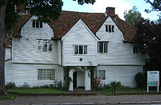
Whitehall is a timber-framed historic house museum in the centre of Cheam Village, Sutton, Greater London. It is thought to have been a wattle and daub yeoman farmer's house originally. It is Grade II* listed on Historic England's National Heritage List.

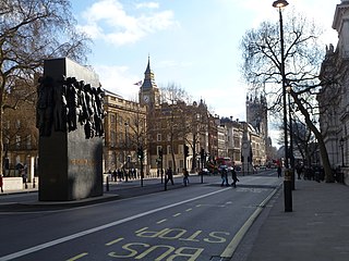
Great Scotland Yard is a street in the St. James's district of Westminster, London, connecting Northumberland Avenue and Whitehall. It is best known as the location of the rear entrance to the original headquarters of the Metropolitan Police Service of London, giving it the name "Scotland Yard".
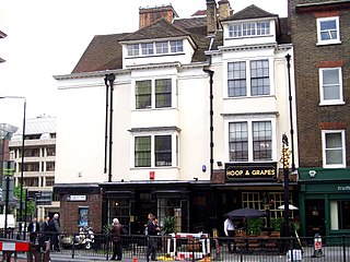
The Hoop and Grapes is a Grade II* listed public house at Aldgate High Street in the City of London.

The Red Lion is a Grade II listed public house at Royal Lane, Hillingdon, London.
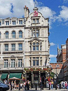
The Red Lion is a Grade II listed public house at 48 Parliament Street, London SW1.

A Grade II-listed bronze statue of Robert Clive, 1st Baron Clive, by John Tweed, is located in King Charles Street, Whitehall, London. The statue was unveiled in 1912 outside Gwydyr House, also in Whitehall, and was moved to its current location in 1916.
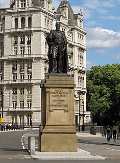
The statue of the Duke of Devonshire is a Grade II-listed outdoor bronze sculpture of Spencer Cavendish, 8th Duke of Devonshire, the leader of three British political parties between 1875 and 1903, and is located at the entrance to Horse Guards Avenue, Whitehall, London, England. A work of the sculptor Herbert Hampton, it was unveiled in 1911.

Southdown House is a Grade II* listed building in Patcham, Brighton and Hove. It is a Georgian house made out of brick and flint, and is now situated at 51 Old London Road.

The Royal Tank Regiment Memorial is a sculpture by Vivien Mallock in Whitehall Court, London. It commemorates the Royal Tank Regiment.

The Rose and Crown is a public house in St Michael's Street, St Albans, Hertfordshire, England. The building appears to be eighteenth century and is listed Grade II with Historic England. It has been designated as an asset of community value.

The Lower Red Lion is a public house at 34 and 36 Fishpool Street in St Albans, Hertfordshire, England. The building is seventeenth century and is designated Grade II with Historic England.

The Hare and Hounds is a public house at 104 Sopwell Lane in St Albans, Hertfordshire, England. The timber framed building has a plastered exterior. It is listed Grade II with Historic England and is dated "seventeenth century or earlier".

The Fleur de Lys was a public house in French Row, St Albans, Hertfordshire, England. The building has a C18th brick facade, but it dates from the Middle Ages and is listed grade II with Historic England. The building was refurbished and renamed "The Snug" in 2007, to become part of the Snug bar chain.

The Lion is a former public house on the corner of Barnet Road and Southgate Road in Potters Bar, Hertfordshire, England, and a grade II listed building with Historic England. It became Potty Pancakes some time after 2008.

The White Horse, now known as The Cask and Stillage, is a public house in High Street, Potters Bar, England, and a grade II listed building with Historic England.

Wyllyotts Manor is a public house and restaurant in Potters Bar, England, and a grade II listed building with Historic England. It consists of a late 16th-century barn, possibly built for Robert Taylor between 1594 and 1603, and a house that dates from around 1800.

The George is a Grade II listed public house in Twickenham, in the London Borough of Richmond upon Thames. It is in three adjoining buildings at 32–36 King Street, parts of which date from the late 17th century.

The Green Man is a grade II listed public house in Mill Green Lane, Hatfield, Hertfordshire, England. The building is based on a seventeenth-century timber frame with later additions.