Related Research Articles

The Waimakariri River is one of the largest rivers in Canterbury, on the eastern coast of New Zealand's South Island. It flows for 151 kilometres (94 mi) in a generally southeastward direction from the Southern Alps across the Canterbury Plains to the Pacific Ocean.
The Ashley Gorge is a river gorge of the Ashley River / Rakahuri in Canterbury, New Zealand. The river is bridged at the mouth of the gorge by the Inland Scenic Route, formerly designated State Highway 72. A popular picnic ground and camping area is adjacent to the bridge. Upstream of the gorge the river flows through the Lees Valley.

The Kaiapoi River is a minor river of north Canterbury, in New Zealand's South Island. Originally called the Cam River, it is a tributary of the Waimakariri River, which it joins at the larger river's estuary. The river is 16 kilometres (10 mi) long, and its drainage area is about 430 square kilometres (170 sq mi).

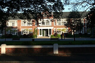
Christchurch West High School existed prior to 1966 on the site of Hagley College in Hagley Avenue, in Christchurch, New Zealand. In that year 'West' amalgamated with Technical High School to become Hagley High School. As part of that amalgamation, the maroon, black and white colours were changed to teal.

Travis Wetland is a wetland in the suburb of Burwood in Christchurch, New Zealand. An ecological restoration programme is being undertaken to restore the wetland. It covers 116 ha of land formerly drained and used as a dairy farm. In 2009 it won the "Urban Sustainability" category in the Green Ribbon Awards awarded by the Minister for the Environment.

The Glentui River is a river in the Canterbury region of New Zealand. It arises on the slopes of Mount Richardson and flows south-east through the locality of Glentui and into Ashley River / Rakahuri, which exits in the Pacific Ocean. The river was earlier called Tui Creek, and the locality named from the station Glentui established by H.C.H. Knowles in 1854.
The Hawkins River is a river in New Zealand. A major tributary of Canterbury's Selwyn River, it flows generally southeast from its source to the southwest of Springfield, reaching the Selwyn 10 kilometres (6 mi) west of Burnham.
The Hororata River is a river of Canterbury, in the South Island of New Zealand. A tributary of the Selwyn River, the Hororata has its sources in rough hill country north of Windwhistle, and flows east through the township of Hororata before reaching the Selwyn 12 kilometres (7 mi) northwest of Dunsandel.
The Karetu River is a river of New Zealand's eastern South Island. It flows south from the slopes of Mount Karetu before its outflow into the Okuku River at the edge of the Canterbury Plains 40 kilometres (25 mi) northwest of Christchurch.

The L II River is a small spring-fed river in Canterbury, New Zealand. It rises near Lincoln and flows through very flat farmland, mostly fed by land drainage ditches before emptying into Lake Ellesmere / Te Waihora just east of the mouth of the Selwyn River / Waikirikiri.
The Lilburne River is a river of northern Canterbury, New Zealand. Formerly known as the Lillburn River, its spelling was corrected in 2003. It rises in the Puketeraki Range, flowing south then east to join Ashley River / Rakahuri.
The Makerikeri River is a river of the north Canterbury region of New Zealand's South Island. It flows south from its headwaters 15 kilometres (9 mi) west of Amberley, reaching the Ashley River / Rakahuri close to Rangiora.

The Okuku River is a river of the north Canterbury region of New Zealand's South Island. It flows predominantly south from several sources in and close to the eastern edge of the Puketeraki Range west of Waikari, flowing through a steep gorge in the Okuku Range before flowing into the Ashley River / Rakahuri 20 kilometres (12 mi) east of Oxford.

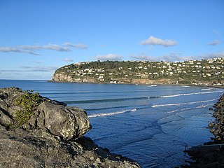
Te Onepoto / Taylors Mistake is an area in New Zealand's South Island, at the southeastern extremity of the city of Christchurch Taylors Mistake is a bay adjacent to the locality, on the north side of Awaroa / Godley Head, on the northern edge of Banks Peninsula.

Cracroft is a south-west suburb of Christchurch, Canterbury, New Zealand.

Scarborough is a hillside suburb above Sumner in Christchurch, New Zealand.

The Canterbury District Health Board was a district health board with the focus on providing healthcare to the Canterbury region of New Zealand, north of the Rangitata River. It was responsible for roughly 579,000 residents, or 12% of New Zealand's population. The Canterbury District Health Board covered a territory of 26,881 square kilometers and was divided between six territorial local authorities. In July 2022, the Canterbury DHB was merged into the national health service Te Whatu Ora.
The 1990 Eisenhower Trophy took place 25 to 28 October at the Christchurch Golf Club near Christchurch, New Zealand. It was the 17th World Amateur Team Championship for the Eisenhower Trophy. The tournament was a 72-hole stroke play team event with 33 four-man teams. The best three scores for each round counted towards the team total.
Arthur's Stone, located near Kerikeri, is recognised as New Zealand's earliest monument to a Pākehā (European). It was erected in November 1840, by Reverend Richard Taylor in memory of his 10-year-old son Arthur who died at the site as a result of a fall from a horse. The stone was entered into the Heritage New Zealand list of historic places on 14 May 2008, as a Category 1 List No:7743.
Lansdowne, also spelled Lansdown, is a locality south of Christchurch, New Zealand.
References
- ↑ "Place name detail: Whitewash Head". New Zealand Gazetteer. New Zealand Geographic Board . Retrieved 5 February 2011.
43°34′9.72″S172°46′31.72″E / 43.5693667°S 172.7754778°E