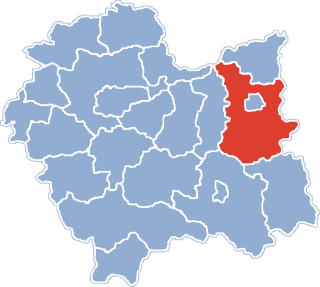
Wojnicz is an ancient historic town in Tarnów County, Lesser Poland Voivodeship. In the early medieval period of the Polish state, it became one of the most important centres in the province of Lesser Poland, as part of the system of Dunajec river castles. It became the seat of a Castellan and prospered from the 13th-century to the first half of the 17th-century, being on an international trade route bordering Hungary and the Ottoman Empire. It had town and market rights, its church was raised to collegiate status with links to the Jagiellonian University in Kraków 64km away.

Polichty is a village in the administrative district of Gmina Gromnik, within Tarnów County, Lesser Poland Voivodeship, in southern Poland. It lies approximately 26 kilometres (16 mi) south of Tarnów and 75 km (47 mi) east of the regional capital Kraków.
Zabłędza is a village in the administrative district of Gmina Tuchów, within Tarnów County, Lesser Poland Voivodeship, in southern Poland. It lies approximately 4 kilometres (2 mi) north of Tuchów, 13 km (8 mi) south-east of Tarnów, and 82 km (51 mi) east of the regional capital Kraków.
Biadoliny Radłowskie is a village in the administrative district of Gmina Wojnicz, within Tarnów County, Lesser Poland Voivodeship, in southern Poland. It lies approximately 5 kilometres (3 mi) north-west of Wojnicz, 17 km (11 mi) west of Tarnów, and 62 km (39 mi) east of the regional capital Kraków.
Dębina Łętowska is a village in the administrative district of Gmina Wojnicz, within Tarnów County, Lesser Poland Voivodeship, in southern Poland. It lies approximately 1 kilometre (1 mi) south-west of Wojnicz, 15 km (9 mi) south-west of Tarnów, and 65 km (40 mi) east of the regional capital Kraków.
Grabno is a village in the administrative district of Gmina Wojnicz, within Tarnów County, Lesser Poland Voivodeship, in southern Poland. It lies approximately 8 kilometres (5 mi) south-west of Wojnicz, 22 km (14 mi) south-west of Tarnów, and 62 km (39 mi) east of the regional capital Kraków.
Isep is a village in the administrative district of Gmina Wojnicz, within Tarnów County, Lesser Poland Voivodeship, in southern Poland. It lies approximately 4 kilometres (2 mi) south of Wojnicz, 16 km (10 mi) south-west of Tarnów, and 67 km (42 mi) east of the regional capital Kraków.
Łopoń is a village in the administrative district of Gmina Wojnicz, within Tarnów County, Lesser Poland Voivodeship, in southern Poland. It lies approximately 5 kilometres (3 mi) north-west of Wojnicz, 17 km (11 mi) west of Tarnów, and 62 km (39 mi) east of the regional capital Kraków.
Łukanowice is a village in the administrative district of Gmina Wojnicz, within Tarnów County, Lesser Poland Voivodeship, in southern Poland. It lies approximately 4 kilometres (2 mi) east of Wojnicz, 12 km (7 mi) south-west of Tarnów, and 69 km (43 mi) east of the regional capital Kraków.
Milówka is a village in the administrative district of Gmina Wojnicz, within Tarnów County, Lesser Poland Voivodeship, in southern Poland. It lies approximately 7 kilometres (4 mi) south-west of Wojnicz, 20 km (12 mi) south-west of Tarnów, and 63 km (39 mi) east of the regional capital Kraków.
Olszyny is a village in the administrative district of Gmina Wojnicz, within Tarnów County, Lesser Poland Voivodeship, in southern Poland. It lies approximately 10 kilometres (6 mi) south of Wojnicz, 22 km (14 mi) south-west of Tarnów, and 66 km (41 mi) east of the regional capital Kraków.
Sukmanie is a village in the administrative district of Gmina Wojnicz, within Tarnów County, Lesser Poland Voivodeship, in southern Poland. It lies approximately 8 kilometres (5 mi) south of Wojnicz, 20 km (12 mi) south-west of Tarnów, and 66 km (41 mi) east of the regional capital Kraków.
Więckowice is a village in the administrative district of Gmina Wojnicz, within Tarnów County, Lesser Poland Voivodeship, in southern Poland. It lies approximately 4 kilometres (2 mi) south of Wojnicz, 18 km (11 mi) south-west of Tarnów, and 65 km (40 mi) east of the regional capital Kraków.
Zakrzów is a village in the administrative district of Gmina Wojnicz, within Tarnów County, Lesser Poland Voivodeship, in southern Poland. It lies approximately 2 kilometres (1 mi) east of Wojnicz, 14 km (9 mi) south-west of Tarnów, and 67 km (42 mi) east of the regional capital Kraków.
Bieśnik is a village in the administrative district of Gmina Zakliczyn, within Tarnów County, Lesser Poland Voivodeship, in southern Poland. It lies approximately 4 kilometres (2 mi) south of Zakliczyn, 28 km (17 mi) south-west of Tarnów, and 68 km (42 mi) south-east of the regional capital Kraków.
Kończyska is a village in the administrative district of Gmina Zakliczyn, within Tarnów County, Lesser Poland Voivodeship, in southern Poland. It lies approximately 2 kilometres (1 mi) south of Zakliczyn, 26 km (16 mi) south-west of Tarnów, and 68 km (42 mi) east of the regional capital Kraków.
Lusławice is a village in the administrative district of Gmina Zakliczyn, within Tarnów County, Lesser Poland Voivodeship, in southern Poland. It lies approximately 1 kilometre (1 mi) south-west of Zakliczyn, 25 km (16 mi) south-west of Tarnów, and 68 km (42 mi) east of the regional capital Kraków.
Roztoka is a village in the administrative district of Gmina Zakliczyn, within Tarnów County, Lesser Poland Voivodeship, in southern Poland. It lies approximately 2 kilometres (1 mi) north of Zakliczyn, 23 km (14 mi) south-west of Tarnów, and 67 km (42 mi) east of the regional capital Kraków.
Lusławice is a village in the administrative district of Gmina Zakliczyn, within Tarnów County, Lesser Poland Voivodeship, in southern Poland. It lies approximately 1 kilometre (1 mi) south-west of Zakliczyn, 25 km (16 mi) south-west of Tarnów, and 68 km (42 mi) east of the regional capital Kraków.