
Pieskowa Skała, is a limestone cliff in the valley of river Prądnik, Poland, best known for its Renaissance castle. It is located within the boundaries of the Ojców National Park, 27 km north of Kraków, near the village of Sułoszowa. The castle was first mentioned in Latin documents of Polish king Władysław I the Elbow-high before 1315, as "castrum Peskenstein".

Bryłówek is a village in the administrative district of Gmina Wiązów, within Strzelin County, Lower Silesian Voivodeship, in south-western Poland.
Częstocice is a village in the administrative district of Gmina Wiązów, within Strzelin County, Lower Silesian Voivodeship, in south-western Poland.
Hubenice is a village in the administrative district of Gmina Gręboszów, within Dąbrowa County, Lesser Poland Voivodeship, in southern Poland. It lies approximately 16 kilometres (10 mi) north-west of Dąbrowa Tarnowska and 68 km (42 mi) east of the regional capital Kraków.
Żydów is a village in the administrative district of Gmina Igołomia-Wawrzeńczyce, within Kraków County, Lesser Poland Voivodeship, in southern Poland. It lies approximately 5 kilometres (3 mi) west of Wawrzeńczyce and 25 km (16 mi) east of the regional capital Kraków.
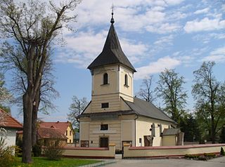
Władysław is a village in the administrative district of Gmina Iwanowice, within Kraków County, Lesser Poland Voivodeship, in southern Poland. It lies approximately 5 kilometres (3 mi) north of Iwanowice and 23 km (14 mi) north of the regional capital Kraków.
Radziszów is a village in the administrative district of Gmina Skawina, within Kraków County, Lesser Poland Voivodeship, in southern Poland. It lies approximately 6 kilometres (4 mi) south of Skawina and 17 km (11 mi) south-west of the regional capital Kraków.
Sułoszowa is a village in Kraków County, Lesser Poland Voivodeship, in southern Poland. It is the seat of the gmina called Gmina Sułoszowa. It lies approximately 29 km (18 mi) north-west of the regional capital Kraków.
Wola Kalinowska is a village in the administrative district of Gmina Sułoszowa, within Kraków County, Lesser Poland Voivodeship, in southern Poland. It lies approximately 10 kilometres (6 mi) south-east of Sułoszowa and 21 km (13 mi) north-west of the regional capital Kraków.
Sieniczno is a village in the administrative district of Gmina Olkusz, within Olkusz County, Lesser Poland Voivodeship, in southern Poland. It lies approximately 5 kilometres (3 mi) south-east of Olkusz and 33 km (21 mi) north-west of the regional capital Kraków.
Wisłowiec is a village in the administrative district of Gmina Stary Zamość, within Zamość County, Lublin Voivodeship, in eastern Poland. It lies approximately 8 kilometres (5 mi) east of Stary Zamość, 11 km (7 mi) north of Zamość, and 69 km (43 mi) south-east of the regional capital Lublin.
Zagórowa is a village in the administrative district of Gmina Trzyciąż, within Olkusz County, Lesser Poland Voivodeship, in southern Poland. It lies approximately 5 kilometres (3 mi) south-east of Trzyciąż, 18 km (11 mi) east of Olkusz, and 28 km (17 mi) north of the regional capital Kraków.
Przemęczany is a village in the administrative district of Gmina Radziemice, within Proszowice County, Lesser Poland Voivodeship, in southern Poland. It lies approximately 2 kilometres (1 mi) north of Radziemice, 9 km (6 mi) north-west of Proszowice, and 32 km (20 mi) north-east of the regional capital Kraków.
Kończyska is a village in the administrative district of Gmina Zakliczyn, within Tarnów County, Lesser Poland Voivodeship, in southern Poland. It lies approximately 2 kilometres (1 mi) south of Zakliczyn, 26 km (16 mi) south-west of Tarnów, and 68 km (42 mi) east of the regional capital Kraków.

Otfinów is a village in the administrative district of Gmina Żabno, within Tarnów County, Lesser Poland Voivodeship, in southern Poland. It lies approximately 8 kilometres (5 mi) north-west of Żabno, 22 km (14 mi) north-west of Tarnów, and 65 km (40 mi) east of the regional capital Kraków.

Szerzyny is a village in Tarnów County, Lesser Poland Voivodeship, in southern Poland. It is the seat of the gmina called Gmina Szerzyny. It lies approximately 31 kilometres (19 mi) south-east of Tarnów and 99 km (62 mi) east of the regional capital Kraków.
Targanice is a village in the administrative district of Gmina Andrychów, within Wadowice County, Lesser Poland Voivodeship, in southern Poland. It lies approximately 6 kilometres (4 mi) south of Andrychów, 16 km (10 mi) south-west of Wadowice, and 53 km (33 mi) south-west of the regional capital Kraków.
Tarnowo Pałuckie is a village in the administrative district of Gmina Wągrowiec, within Wągrowiec County, Greater Poland Voivodeship, in west-central Poland. It lies approximately 5 kilometres (3 mi) east of Wągrowiec and 52 km (32 mi) north-east of the regional capital Poznań.
Rękusy is a village in the administrative district of Gmina Ełk, within Ełk County, Warmian-Masurian Voivodeship, in northern Poland. It lies approximately 7 kilometres (4 mi) west of Ełk and 117 km (73 mi) east of the regional capital Olsztyn.


