
Sandton is a former municipality in the northern part of the City of Johannesburg Metropolitan Municipality. Sandton's name came from the combination of two of its suburbs, Sandown and Bryanston. Although being part of the City of Johannesburg, Sandton is still considered a city with its own Central business district.
Centurion is an area with 236,580 inhabitants in the Gauteng Province of South Africa, between Pretoria and Midrand. Formerly an independent municipality, with its own town council, it has been part of the City of Tshwane Metropolitan Municipality since 2000. Its heart is at the intersection of the N1 and N14 freeways. The R21 freeway also passes through the eastern part of Centurion.

Bryanston, Gauteng is an affluent residential suburb of Sandton, South Africa north of Johannesburg. First named as an area in 1949, it was established in 1969 as a suburb of Sandton and provided with tarred roads and municipal services, but after municipal boundaries were revised following the end of Apartheid, Sandton was merged with Johannesburg to form part of the City of Johannesburg Metropolitan Municipality. The multi-lane N1 Western Johannesburg Bypass freeway forms its northern boundary with access at William Nicol offramp. It is located in Region E of the City of Johannesburg Metropolitan Municipality.

The R55 is a north-south provincial route in Gauteng, South Africa that connects Sandton with Pretoria. It passes Woodmead, Kyalami, Olievenhoutbosch, Heuweloord, Sunderland Ridge, Erasmia, Laudium/Claudius, West Park, the Daspoort Tunnel and Danville. It connects with the M1, N14, and R80 highways. It is also designated as the P66-1 and K71 by the Gauteng Provincial Government.
The Hill is a suburb of Johannesburg, South Africa. The area lies to the south of the Johannesburg CBD and is surrounded by the suburbs of Regents Park, Rosettenville and Linmeyer. It is located in Region F of the City of Johannesburg Metropolitan Municipality.
Farmall is a rural settlement in Gauteng, South Africa. It is located in Region A of the City of Johannesburg. Farmall is mainly an agricultural suburb of Randburg made up of small holdings.
Lone Hill is a suburb north of Johannesburg, South Africa. It is located in Region E. Lone Hill is in the Gauteng province and is a suburb in Sandton.
Wierda Valley is a suburb of Johannesburg, South Africa. It is named after Sytze Wierda, the first architect and engineer to the South African Republic. It is located in Region E of the City of Johannesburg Metropolitan Municipality.

Newtown is a suburb of Johannesburg, South Africa. It is located in the capital city of Gauteng Province and the Region F of the City of Johannesburg Metropolitan Municipality. It has the coordinates of 26.204°S and 28.034°E. The suburb originated as a manufacturing district for brick production.
Newlands is a suburb of Johannesburg, South Africa. It is located in the province of Gauteng.
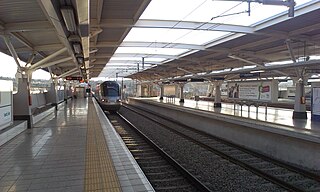
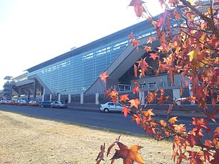
Marlboro is a metro station on the Gautrain rapid transit system in Marlboro, Gauteng. It opened on 8 June 2010 with service to OR Tambo International Airport.

Sytze Wopkes Wierda was a Dutch architect and engineer who played an important role in the architecture of the South African Republic in the late 19th and early 20th centuries.
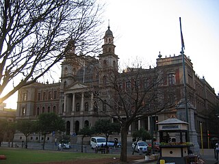
The Palace of Justice forms part of the northern façade of Church Square in Pretoria. The building dates to the nineteenth century and was designed by the Dutch architect Sytze Wierda. It is currently the headquarters of the Gauteng Division of the High Court of South Africa.
The R114 is a regional route in Gauteng, South Africa that runs from Muldersdrift to Centurion. The designation R114 is applied to sections of road that were previously part of the N14 that have been replaced by newly built freeway sections.
The 2016 Johannesburg flood was a natural disaster in South Africa that took place on 9 November 2016. The flooding, which occurred in the area east of Johannesburg, affected both Johannesburg and Ekurhuleni. The storm and flash floods caused significant damage to the township of Alexandra, while the suburb of Buccleuch was declared a disaster area. The flooding was caused by a significant cloud burst from a convective system.
Danville is a predominantly White suburb, to the west of central Pretoria, in the City of Tshwane Metropolitan Municipality.
Bassonia is a southern suburb of Johannesburg, South Africa.
The M10 road is a long metropolitan route in the City of Tshwane in Gauteng, South Africa. It connects Sunderland Ridge with Mamelodi via Lyttelton and Garsfontein.
The M37 road is a short metropolitan route in the City of Tshwane in Gauteng, South Africa. It is in the city of Centurion, connecting Wierdapark with the Noordwyk suburb of Midrand via Rooihuiskraal and The Reeds. For much of its route, it is named Rooihuiskraal Road.
The M34 road is a metropolitan route in the City of Tshwane in Gauteng, South Africa. It is in the city of Centurion, connecting Eldoraigne with Irene via Clubview, Die Hoewes and Doringkloof.

