| Wildwood Dam | |
|---|---|
| Official name | Wildwood Dam |
| Coordinates | 43°15′45.97″N81°4′26.44″W / 43.2627694°N 81.0740111°W Coordinates: 43°15′45.97″N81°4′26.44″W / 43.2627694°N 81.0740111°W |
| Construction began | 1962 |
| Opening date | 1965 |
| Construction cost | $3.5 million |
| Dam and spillways | |
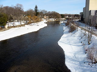
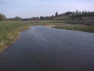
| Impounds | Thames River |
| Length | 9.3 kilometres |
Wildwood Dam is a dam located on Trout Creek in Perth South, Ontario, which flows into the North Thames River near the Town of St. Marys. Wildwood Dam is designed for flood control and flow augmentation purposes.

A dam is a barrier that stops or restricts the flow of water or underground streams. Reservoirs created by dams not only suppress floods but also provide water for activities such as irrigation, human consumption, industrial use, aquaculture, and navigability. Hydropower is often used in conjunction with dams to generate electricity. A dam can also be used to collect water or for storage of water which can be evenly distributed between locations. Dams generally serve the primary purpose of retaining water, while other structures such as floodgates or levees are used to manage or prevent water flow into specific land regions. The earliest known dam is the Jawa Dam in Jordan, dating to 3,000 BC.

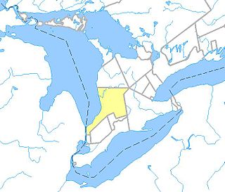
The Township ofPerth South is a lower-tier municipality in southwestern Ontario, Canada. It is in Perth County at the confluence of the River Thames and the Avon River. The Township was created on January 1, 1998 from the amalgamation of the former Township of Blanshard and the former Township of Downie. The land area of Perth South is 393.14 square kilometers. The population in 2016 was 3,810.

St. Marys is a town in southwestern Ontario, Canada. It is located at the junction of Thames River and Trout Creek southwest of Stratford, and is surrounded by the Township of Perth South in Perth County, Ontario. St. Marys operates under its own municipal government that is independent from the County's government. Nonetheless, the three entities "enjoy a large degree of collaboration and work together to grow the region as a leading location for industry and people". Census data published for Perth County by Statistics Canada includes St. Marys and most Perth County publications also do, at least in some sections of the document.
It cost: $2 million to build—Provincial government 37.5%, Federal government 37.5%, UTRCA 25% (benefitting watershed municipalities) [1] It is one of three dams on the Thames River (Ontario) and its tributaries.
The Thames River is located in southwestern Ontario, Canada.