
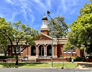
Wagga Wagga is a major regional city in the Riverina region of New South Wales, Australia. Straddling the Murrumbidgee River, with an urban population of more than 56,000 as of June 2018, Wagga Wagga is the state's largest inland city, and is an important agricultural, military, and transport hub of Australia. The ninth largest inland city in Australia, Wagga Wagga is located midway between the two largest cities in Australia—Sydney and Melbourne—and is the major regional centre for the Riverina and South West Slopes regions.

Hay is a town in the western Riverina region of south western New South Wales, Australia. It is the administrative centre of Hay Shire local government area and the centre of a prosperous and productive agricultural district on the wide Hay Plains.

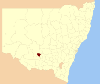
The Riverina is an agricultural region of south-western New South Wales, Australia. The Riverina is distinguished from other Australian regions by the combination of flat plains, warm to hot climate and an ample supply of water for irrigation. This combination has allowed the Riverina to develop into one of the most productive and agriculturally diverse areas of Australia. Bordered on the south by the state of Victoria and on the east by the Great Dividing Range, the Riverina covers those areas of New South Wales in the Murray and Murrumbidgee drainage zones to their confluence in the west.
Griffith is a major regional city in the Murrumbidgee Irrigation Area that is located in the north-western part of the Riverina region of New South Wales, known commonly as the food bowl of Australia. It is also the seat of the City of Griffith local government area. Like the Australian capital, Canberra, and extensions to the nearby town of Leeton, Griffith was designed by Walter Burley Griffin and Marion Mahony Griffin. Griffith was named after Arthur Hill Griffith, the then New South Wales Secretary for Public Works. Griffith was proclaimed a city in 1987, and had a population of 20,251 in June 2018.

St Francis De Sales Regional College is an independent Roman Catholic co-educational secondary day and boarding school, located in the Riverina town of Leeton, New South Wales, Australia. Founded in 1956 by the Marist Brothers, the College is one of three secondary schools serving Leeton, most enrolments come from Leeton, with students also drawn from around the region as a result of the school's boarding program. These include Griffith, Narrandera, Deniliquin, Coleambally and Hay. The school is situated on Yanco Avenue on the southern approach to Leeton.

De Bortoli Wines is a wine-producing private company based in Australia. Its range of wines includes the sweet white Noble One.

Moulamein is a small town in New South Wales, Australia, in the Murray River Council local government area. At the 2016 census, Moulamein had a population of 484. Moulamein is the oldest town in the Riverina.
Joseph Alexander Lawson was an Australian politician, elected as a member of the New South Wales Legislative Assembly.
Wade High School was a government-funded co-educational comprehensive secondary day school, located in Griffith, in the Riverina region of New South Wales, Australia.
Group 17 is a rugby league competition based in the Riverina and Central West regions of New South Wales, Australia. The competition collapsed in 2006 and reformed in 2018 as the Western Riverina Community Cup with six teams.
The City of Griffith is a local government area in the Riverina region of south-western New South Wales, Australia. The area comprises 1,640 square kilometres (630 sq mi) and is located in the Murrumbidgee Irrigation Area and on Kidman Way.
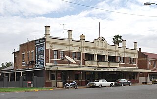
Yenda is a town in the Riverina district of New South Wales, Australia. The town is located about 16 kilometres (9.9 mi) east of Griffith, 65 kilometres (40 mi) north-west of Narrandera, and 550 kilometres (340 mi) west of Sydney in the Murrumbidgee Irrigation Area of southern New South Wales. Although most of the original 15-acre farms have been consolidated into large vineyards and most farmhouses have disappeared, farm roads are named after the original settlers. In 1940 Yenda had two clothing stores, two bakers, two butchers, two grocery stores, two barbers, one newsagency, one pharmacy, one cinema, one Greek restaurant and one bank but residents now do their shopping in nearby Griffith. At the 2011 census, Yenda had a population of 1,503.
Blighty is a small town in the Riverina region of New South Wales, Australia. The town lies on the Riverina Highway between the towns of Finley and Deniliquin. It is located in the Edward River Council local government area. At the 2011 census, Blighty and the surrounding area had a population of 396.
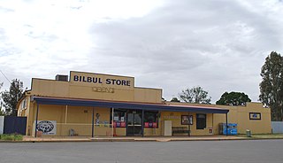
Bilbul is a village in the Australian state of New South Wales. It lies in the central part of the Riverina and situated about 6 kilometres north-east of Griffith and 6 kilometres south-west of Yenda. Bilbul was named in honor of William T Bull, an early landowner from the 1880s. The William Bull Brewery is located at Bilbul and named after William Bull, and thus indirectly also after Bilbul. The town had a population at the 2011 census census of 672 people.

Booroorban is a locality in the central part of the Riverina. It is in the Edward River Council local government area and on the Cobb Highway between Hay and Deniliquin, around 769 kilometres (478 mi) south west of the state capital, Sydney. At the 2016 census, Booroorban had a population of 33.
Mossgiel is a location in New South Wales, Australia, in Carrathool Shire. It was a township on the coach route between the Lachlan and Darling Rivers, 50 km southeast of Ivanhoe near the junction with the road to Hillston. The settlement experienced a steady decline during the 20th century. Nowadays Mossgiel township consists of one house and a community hall.

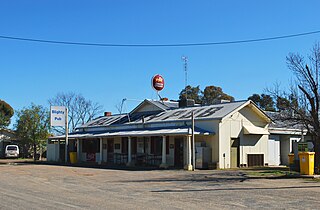
One Tree is a location on the Cobb Highway on the flat plain between Hay and Booligal in the Riverina district of New South Wales, Australia. In 1862 a public house was built there, originally called Finch's Inn and the locality developed as a coach changing-stage and watering-place between the Murrumbidgee and Lachlan rivers. One Tree village was surveyed and proclaimed in 1882, though the location remained as just an amenity on the plain, centred on the hotel.

New South Wales wine is Australian wine produced in New South Wales, Australia. New South Wales is Australia's most populous state and its wine consumption far outpaces the region's wine production. The Hunter Valley, located 130 km (81 mi) north of Sydney, is the most well-known wine region but the majority of the state's production takes place in the Big Rivers zone-Perricoota, Riverina and along the Darling and Murray Rivers. The wines produced from the Big Rivers zone are largely used in box wine and mass-produced wine brands such as Yellow Tail. A large variety of grapes are grown in New South Wales, including Cabernet Sauvignon, Chardonnay, Shiraz and Sémillon.

Deniliquin is a town in the Riverina region of New South Wales, Australia, close to the border with Victoria. It is the largest town in the Edward River Council local government area.

St Anne's Anglican Church is a heritage-listed church at Evanslea Road, Jondaryan, Toowoomba Region, Queensland, Australia. It is also known as the Jondaryan Homestead Church and St Anne's Church of England. It was built in 1859 by Hugh Bradford as a private chapel for the former Jondaryan pastoral station, and the first service was held by preacher Benjamin Glennie late that year. The church also served the new township of Jondaryan, and was moved to its present site, with alterations, in 1893.
