Dandridge is a town in Jefferson County, Tennessee, United States. It had a population of 2,812 at the 2010 census. It is the county seat of Jefferson County. The town is part of the Morristown, Tennessee Metropolitan Statistical Area.
Mechanicsville is a neighborhood in Knoxville, Tennessee, United States, located northwest of the city's downtown area. One of the city's oldest neighborhoods, Mechanicsville was established in the late 1860s for skilled laborers working in the many factories that sprang up along Knoxville's periphery. The neighborhood still contains a significant number of late-19th-century Victorian homes, and a notable concentration of early-20th-century shotgun houses. In 1980, several dozen properties in Mechanicsville were added to the National Register of Historic Places as the Mechanicsville Historic District. The neighborhood was also designated as a local historic district in 1991, subject to historic zoning and design standards.

The Hill is the colloquial name for the location of various academic buildings on the University of Tennessee, Knoxville's campus. It comprises the oldest part of the university, and is located at the eastern side of the campus. There are two concentric roads around the Hill. University buildings ring both routes, with Ayres Hall located at the apex. The sweeping lawn in front of Ayres Hall that drops to Cumberland Avenue is one of the largest open spaces on the campus. Programmatically, the Hill is populated primarily by engineering and science programs. Other university programs, as well as the dormitories and administrative headquarters, are located west of the Hill.

Sequoyah Hills is a neighborhood in Knoxville, Tennessee, United States. It is located off Kingston Pike between the city's downtown area and West Knoxville. Initially developed in the 1920s, Sequoyah Hills was one of Knoxville's first suburbs, and today is home to some of the city's most affluent residents. The neighborhood contains numerous notable examples of mid-20th century residential architecture, with houses designed by architects such as Charles I. Barber, Benjamin McMurry, and Francis Keally. Sequoyah Hills is named for the Cherokee scholar Sequoyah, inventor of the Cherokee alphabet.
The Stokely Athletic Center was an on-campus arena located at the University of Tennessee in Knoxville, Tennessee, United States. It was home to the men's and women's basketball teams from 1958 until the opening of Thompson-Boling Arena in 1987. In 2008, the Lady Vol volleyball team also left Stokely for Thompson–Boling Arena. It is located about a block from both the new arena and Neyland Stadium. It replaced Alumni Gymnasium, a 3,200-seat arena-auditorium built in 1931 which had hosted the SEC basketball tournament four times.
The Mabry Hood House, also known as the Mabry Hood Mansion, was a historic antebellum style home located on the south side of Kingston Pike at the intersection of Mabry Hood Road in Knox County, Tennessee. The vacant home sat in the path of Pellissippi Parkway and was demolished when the construction commenced on the limited access highway in the 1990s.

Bleak House is an antebellum Classical Revival style house in Knoxville, Tennessee. It is on the National Register of Historic Places.

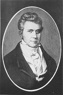
The Blount Mansion, also known as William Blount Mansion, located at 200 West Hill Avenue in downtown Knoxville, Tennessee, was the home of the only territorial governor of the Southwest Territory, William Blount (1749–1800). Blount, also a signer of the United States Constitution and a U.S. Senator from Tennessee, lived on the property with his family and ten African-American slaves. The mansion served as the de facto capitol of the Southwest Territory. In 1796, much of the Tennessee Constitution was drafted in Governor Blount's office at the mansion. Tennessee state historian John Trotwood Moore once called Blount Mansion "the most important historical spot in Tennessee."
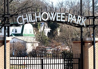
Chilhowee Park is a public park, fairgrounds and exhibition venue in Knoxville, Tennessee, United States, located off Magnolia Avenue in East Knoxville. Developed in the late 19th century, the park is now home to the Tennessee Valley Fair, and hosts several dozen expositions annually. The park covers 81 acres (33 ha), and includes a 57,100-square-foot (5,300 m2) exposition center, a 1910-era bandstand, a 4,500-seat amphitheater, and a 3-acre (1.2 ha) lake, Lake Ottosee. The park is also home to The Muse Knoxville, a children's science museum formerly known as the East Tennessee Discovery Center.

Cornstalk Heights is a neighborhood in Harriman, Tennessee, United States. Platted in the early 1890s as a residential area for Harriman's upper and professional classes, the neighborhood contains over 100 buildings added to the National Register of Historic Places in 1991 as a historic district for their architectural and historical significance. The neighborhood is named for the home of Harriman founder Frederick Gates, which once stood near the eastern end of the district.
South Knoxville is the section of Knoxville, Tennessee, United States, that lies south of the Tennessee River. It is concentrated along Chapman Highway, Alcoa Highway, Maryville Pike, Sevierville Pike, and adjacent roads, and includes the neighborhoods of Lindbergh Forest, Island Home Park, Old Sevier, South Haven, Vestal, Lake Forest, South Woodlawn and Colonial Village. South Knoxville is connected to Downtown Knoxville via four vehicle bridges: the James C. Ford Memorial Bridge, the Gay Street Bridge, the Henley Bridge,by some incorrectly called the Henley Street Bridge, and the J. E. "Buck" Karnes Bridge. Parts of South Knoxville were annexed by Knoxville in 1917.
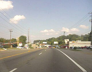
East Knoxville is the section of Knoxville, Tennessee, USA, that lies east of the city's downtown area. It is concentrated along Magnolia Avenue (US-70/US-11), Martin Luther King, Jr., Boulevard, Dandridge Avenue, and adjacent streets, and includes the neighborhoods of Parkridge, Chilhowee Park, Morningside, Five Points, and Burlington. East Knoxville is home to Zoo Knoxville, the Knoxville Botanical Garden and Arboretum, and Chilhowee Park.
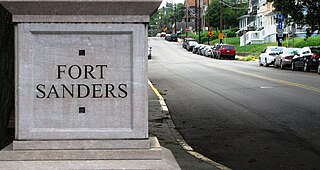
Fort Sanders is a neighborhood in Knoxville, Tennessee, USA, located west of the downtown area and immediately north of the main campus of the University of Tennessee. Developed in the late 19th century as a residential area for Knoxville's growing upper and middle classes, the neighborhood now provides housing primarily for the university's student population. The neighborhood still contains a notable number of its original Victorian-era houses and other buildings, several hundred of which were added to the National Register of Historic Places in 1980 as the Fort Sanders Historic District.

Fourth and Gill is a neighborhood in Knoxville, Tennessee, United States, located north of the city's downtown area. Initially developed in the late nineteenth century as a residential area for Knoxville's growing middle and professional classes, the neighborhood still contains most of its original Victorian-era houses, churches, and streetscapes. In 1985, 282 houses and other buildings in the neighborhood were added to the National Register of Historic Places as the Fourth and Gill Historic District.
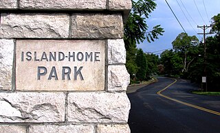
Island Home Park is a neighborhood in Knoxville, Tennessee, United States, located in the southeastern part of the city along the Tennessee River. Developed as a streetcar suburb in the early 1900s, the neighborhood retains most of its original houses and streetscapes, and is home to the city's largest concentration of Bungalow-style houses. In 1994, several dozen houses in Island Home Park were added to the National Register of Historic Places as the Island Home Park Historic District.

Oakwood-Lincoln Park is a residential and commercial neighborhood in Knoxville, Tennessee, United States that was developed in the early 20th century as two suburban neighborhoods.

Lindbergh Forest is a neighborhood in Knoxville, Tennessee, United States, located off Chapman Highway (US-441) in South Knoxville, that is listed on the National Register of Historic Places as an historic district. Initially developed in the late 1920s as one of Knoxville's first automobile suburbs, the neighborhood is now noted for its late-1920s and early-1930s residential architecture, and the use of East Tennessee marble detailing. The neighborhood also contains two of Knoxville's five surviving Lustron houses. In 1998, several of its houses were added to the National Register of Historic Places as the Lindbergh Forest Historic District.
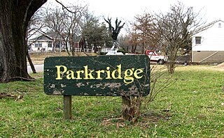
Parkridge is a neighborhood in Knoxville, Tennessee, United States, located off Magnolia Avenue east of the city's downtown area. Developed as a streetcar suburb for Knoxville's professional class in the 1890s, the neighborhood was incorporated as the separate city of Park City in 1907, and annexed by Knoxville in 1917. In the early 1900s, the neighborhood provided housing for workers at the nearby Standard Knitting Mills factory.

Gay Street is a street in Knoxville, Tennessee, United States, that traverses the heart of the city's downtown area. Since its development in the 1790s, Gay Street has served as the city's principal financial and commercial thoroughfare, and has played a primary role in the city's historical and cultural development. The street contains Knoxville's largest office buildings and oldest commercial structures. Several buildings on Gay Street have been listed on the National Register of Historic Places.