Wilsonville Memorial Park

Last updated
Wilsonville Memorial Park

Wilsonville Memorial Park play area.JPG

Play area at Murase Plaza in Memorial Park
Type Public, city
Location Wilsonville, Oregon
United States
Coordinates 45°17′52″N122°45′31″W / 45.29778°N 122.75861°W / 45.29778; -122.75861 Coordinates: 45°17′52″N122°45′31″W / 45.29778°N 122.75861°W / 45.29778; -122.75861
Area 126 acres (510,000 m2)
Created 1969
Operated by Wilsonville Parks & Recreation
Status open
Website Memorial Park

Wilsonville Memorial Park is a large municipal park in Wilsonville, Oregon, United States. Opened in 1969, the 126-acre (51 ha) park is the largest and oldest in the city. Located off Wilsonville Road east of Interstate 5, the park includes a plaza with water features, athletic fields and courts, trails, a skatepark, picnic areas, a dog park, and playground equipment. Part of the park fronts the Willamette River and includes a public boat dock.

Wilsonville, Oregon City in Oregon, United States

Wilsonville is a city primarily in Clackamas County, Oregon, United States. A portion of the northern section of the city is in Washington County. It was founded as Boones Landing because of the Boones Ferry which crossed the Willamette River at the location; the community became Wilsonville in 1880. The city was incorporated in 1969 with a population of approximately 1,000. The population was 13,991 at the 2000 census, and grew to 19,509 as of 2010. Slightly more than 90% of residents at the 2000 census were white, with Hispanics comprising the largest minority group.

Oregon State of the United States of America

Oregon is a state in the Pacific Northwest region on the West Coast of the United States. The Columbia River delineates much of Oregon's northern boundary with Washington, while the Snake River delineates much of its eastern boundary with Idaho. The parallel 42° north delineates the southern boundary with California and Nevada. Oregon is one of only three states of the contiguous United States to have a coastline on the Pacific Ocean.

Interstate 5 (I-5) in the U.S. state of Oregon is a major Interstate Highway that traverses the state from north to south. It travels to the west of the Cascade Mountains, connecting Portland to Salem, Eugene, Medford, and other major cities in the Willamette Valley and across the northern Siskiyou Mountains. The highway runs 308 miles (496 km) from the California state line near Ashland to the Washington state line in northern Portland, forming the central part of Interstate 5's route between Mexico and Canada.

Contents

History

Wilsonville residents voted to incorporate as a city in 1968, with the city forming the next year. That year the city purchased about 61 acres (25 ha) along the Willamette River on the east side of Interstate 5 to be used as a park, named Wilsonville Memorial Park. [1] [2] In June 1987, residents approved a bond measure to build a library and add 41.5 acres (16.8 ha) to Memorial Park. [3] This land was located along the Willamette River west of the original part of the park and was purchased from Nike, Inc. for $1.1 million. [3] The next year the city built new restrooms at the park near the river. [4]

Nike, Inc. American athletic equipment company

Nike, Inc. is an American multinational corporation that is engaged in the design, development, manufacturing, and worldwide marketing and sales of footwear, apparel, equipment, accessories, and services. The company is headquartered near Beaverton, Oregon, in the Portland metropolitan area. It is the world's largest supplier of athletic shoes and apparel and a major manufacturer of sports equipment, with revenue in excess of US$24.1 billion in its fiscal year 2012. As of 2012, it employed more than 44,000 people worldwide. In 2014 the brand alone was valued at $19 billion, making it the most valuable brand among sports businesses. As of 2017, the Nike brand is valued at $29.6 billion. Nike ranked No. 89 in the 2018 Fortune 500 list of the largest United States corporations by total revenue.

In January 1989, Wilsonville renamed the park as Phillip R. Balsiger Memorial Park in honor of the city’s first mayor and promoter of incorporating the community. [5] Balsiger, who died the year before, served four terms as mayor and worked to create and design the park. [5] Some residents objected to the name change and lack of public participation in the decision. [2] This led to a petition drive to restore the park's original name, which the city council voted in favor of restoring the original name in November 1989. [6]

Initiative means by which a petition signed by a certain minimum number of registered voters can force a public vote

In political science, an initiative is a means by which a petition signed by a certain minimum number of registered voters can force a government to choose to either enact a law or hold a public vote in parliament in what is called indirect initiative, or under direct initiative, the proposition is immediately put to a plebiscite or referendum, in what is called a Popular initiated Referendum or citizen-initiated referendum).

Trail and natural area at the park Wilsonville Memorial Park trail.JPG
Trail and natural area at the park
Murase Plaza at night Wilsonville park night.jpg
Murase Plaza at night

Wilsonville hired design firm Walker and Macy to create a master plan for the park in September 1990. [7] At that time 40 of the 102 acres (0.41 km2) in the park were undeveloped, with the developed portion containing four baseball/softball fields along with children’s play equipment. [7] In January 1991, the city approved plans to develop the park’s western section. [8] The first phase of this development was to include new roads, new parking lots, a playground, a lighted tennis court, and a softball field at a cost of almost $825,000. [9] Wilsonville’s city council approved $500,000 for the project in May 1991, but issues with drainage in the park created problems with the plans. [10] In July 1992, plans were finalized and construction began on some of the original improvements. [11] Costing about $423,000, the improvements included expanding the drainage system, a new ball field, and preparations for adding a playground and snack bar. [11]

Wilsonville purchased the Boozier property at the north end of the park in 1993, land totaling 22 acres (8.9 ha). [12] City voters rejected a $940,000 bond measure in 1995 that would have added more athletic fields to the park along with an amphitheater. [13] In 1996, a Boy Scout Eagle Project re-opened the community garden at Memorial Park after the original garden program ended in the 1980s due to lack of interest. [14] Later in 1996, a full-size and half-size basketball courts were added to the park after donations by Nike and Hollywood Entertainment, who both had large operations in the city at that time. [15] In April 1998, the city approved adding a skatepark at Memorial Park north of the tennis courts. [16] The skatepark opened in 2000, [17] paid for in part by private donations. [18]

Movie Gallery US video rental chain

Movie Gallery, Inc. was the second largest movie and game rental company in the United States and Canada, behind Blockbuster Video. The company rented and sold Blu-ray Discs, DVDs, VHS tapes, and video games. Founded in Dothan, Alabama, the company was headquartered in Dothan, and later in Wilsonville, Oregon.

In 2000, the city started Wilsonville Celebration Days to replace the Boones Ferry Days, with the new event centered on activities at Memorial Park, as the old event had as well. [19] [20] Beginning in 2001, the city has entertained proposals for building an aquatic center in Memorial Park. [21] A new city hall was proposed for the city to be located next to the northern end of the park near Wilsonville Road in 2002. [12] [22] However, citizen opposition led to the scrapping of that plan and recall attempts against the mayor and two city councilors. [22] A new city hall opened in September 2006 a few blocks north of Memorial Park. [22]

Boones Ferry

Boones Ferry was a cable ferry which crossed the Willamette River near present-day Wilsonville, Oregon, United States, from 1847 to 1954. It was part of a major land-based thoroughfare in pioneer times linking fledgling Portland with the pre-territorial government at Champoeg, and later Salem. It was eventually made obsolete by the Boone Bridge on Interstate 5.

During the summer of 2006, Murase Plaza was opened at the northwest corner of the park. [23] Originally named City Center Park, the area added a water feature and amphitheater to Memorial Park. [23] In June 2006, the water features at Murase Plaza were temporarily closed due to unhealthy water. [24] The city purchased 11 acres (45,000 m2) of land across Wilsonville Road in November 2007 for $4.2 million in order to build an affordable senior housing complex. [25] Most of this land is wetlands and has slopes that cannot be used for the complex, which will be added to Memorial Park. [25] In September 2008, the Stein Homestead Barn re-opened after nearly $430,000 in restorations and improvements. [26]

Amenities

Skatepark in Memorial Park Wilsonville Memorial Park skatepark.JPG
Skatepark in Memorial Park
Interactive water feature in Murase Plaza Wilsonville Memorial Park fountains.JPG
Interactive water feature in Murase Plaza

Memorial Park at 126 acres (51 ha) is Wilsonville’s largest park, and is also the oldest park. [1] [27] Located between the Willamette River (including 0.5 miles (0.80 km) of river frontage) and Wilsonville Road, Boeckman Creek flows through the park on its way to emptying into the Willamette. [1] The park includes a trail system, athletic facilities, forested areas, picnic areas, parking, restrooms, and a skatepark among other features. [28] Murase Plaza is in the northwest corner and includes an amphitheater and water features. [1] The plaza was named after Robert Murase who designed the plaza and died before it opened. [29]

Athletic facilities at the park include several fields and courts. [1] Courts include one full-sized basketball court, a half-sized basketball court, two tennis courts, and a beach volleyball court. [1] The fields include one baseball field, four softball fields, and three soccer fields that overlay the softball diamonds’ outfields. [1] Memorial Park also includes the only skatepark in the city. [1]

Other developed amenities in the park include picnic shelters, a dog park, restrooms, parking lots, picnic tables, a community center, a boat dock, and children’s play equipment. [1] Memorial Park has two main picnic shelters, the River Shelter with a capacity of 200 people and the smaller Forest Shelter that seats 150. [30] A third shelter is located at the athletic fields. [1] The dog park area is the only off-leash area in the city. [1] Stein Homestead Barn serves as a community space used for a variety of events. [31] The wooden barn was built in 1901 by Gustave Stein and renovated in 2008, with improvements that included adding a sink and restoring the original shake roof. [31]

Natural areas include forested portions, wetlands, and a community garden. [1] A portion of the park on the northern edge is forested and nicknamed as Owl Woods due to the presence of a great horned owl. [32] Other birds that inhabit the park include wrens, pileated woodpeckers, grosbeaks, red-tailed hawks, and bald eagles on occasion. [32] The park includes the Ernest Kolbe Giant Sequoia, selected as one of the city’s heritage trees. [33]

Events

During the summers the park is home to the city’s Art in the Park program for children. [34] The crafts program is held once a week and started in 2004. [34] In July and August each year, the park is the host of Movies in the Park. [35] The program shows free movies on select Fridays during those months. [35] An annual Easter Egg hunt is held at the park as well. Wilsonville Celebration Days used to be held at the park, but is now staged at Town Center Park.

See also

Related Research Articles

The Albany Parks & Recreation is a city agency in Albany, Oregon, United States responsible for maintaining the local city parks as well as organizing cultural events. Its headquarters are at City Hall, 333 Broadalbin Street SW. One goal of the City of Albany is to have all residents live within 2 miles (3 km) of a park.

Tom McCall Waterfront Park

Governor Tom McCall Waterfront Park is a 36.59-acre (148,100 m2) park located in downtown Portland, Oregon, along the Willamette River. After the 1974 removal of Harbor Drive, the park was opened to the public in 1978. The park covers 13 tax lots is owned by the City of Portland. The park was renamed in 1984 to honor Tom McCall, the Oregon governor who pledged his support for the beautification of the west bank of the Willamette River—harkening back to the City Beautiful plans at the turn of the century that envisioned parks and greenways along the river. The park is bordered by RiverPlace to the south, the Steel Bridge to the north, Naito Parkway to the west, and Willamette River to the east. In October 2012, Waterfront Park was voted one of America's ten greatest public spaces by the American Planning Association.

Robert Murase was an American landscape architect. He worked throughout the Pacific Northwest in the field of landscape design.

Oregon Vietnam Veterans Memorial

The Oregon Vietnam Veterans Memorial is an 8-acre (0.03 km2) outdoor war memorial dedicated to Oregonians who served in the Vietnam War. It is located in Portland, Oregon's Washington Park at 45.5120°N 122.71857°W. The memorial was dedicated in 1987, inspired in 1982 by visits to the national Vietnam Veterans Memorial by five veterans and the parents of a Marine killed in Vietnam. Landscape architecture firm Walker Macy of Portland designed the memorial, while construction labor and materials were almost entirely volunteer donations.

Tualatin River National Wildlife Refuge

The Tualatin River National Wildlife Refuge is a 1,856 acres (751 ha) wetlands and lowlands sanctuary in the northwestern part of the U.S. state of Oregon. Established in 1992 and opened to the public in 2006, it is managed by the United States Fish and Wildlife Service. Located in southeastern Washington County, 15 miles (24 km) southwest of Portland, the refuge is bordered by Sherwood, Tualatin and Tigard. A newer area, extending into northern Yamhill County, is located further west near the city of Gaston surrounding the former Wapato Lake.

Noble Woods Park

Noble Woods Park is a wooded city park in Hillsboro, Oregon, United States. Located on approximately 40 acres (160,000 m2) along Rock Creek, the nature park with wetlands and forests is situated between West Baseline Road on the north and Southwest Borwick Road to the south near the Orenco neighborhood. The city acquired the land for the park in 1992 and opened the park in the eastern section of the city in 1998. Noble Woods has two entrances, a picnic area, and hiking trails.

Gabriel Park

Gabriel Park is a 90.65-acre (366,800 m2) public park in Portland, Oregon, United States. It features a baseball field, softball field, soccer field, basketball courts, tennis courts, skatepark, volleyball courts, disabled access play area, disabled access restrooms, dog off-leash area, paved and unpaved paths, reservable picnic sites, and WiFi. The park is located between the Maplewood, Multnomah, and Hillsdale neighborhoods of Southwest Portland at 45th Avenue and Vermont Street.

Oregon Korean War Memorial

The Oregon Korean War Memorial is a war memorial located in Wilsonville, Oregon, United States. Completed in 2000, it honors the Oregon soldiers and the Korean people from the Korean War. The memorial is located within a 5.5-acre (22,000 m2) city park and features a 109-foot (33 m)-long granite wall that includes the names of those Oregonians who died or were listed as missing from the war.

Willamette Mission State Park state park in the U.S. state of Oregon

Willamette Mission State Park is a state park in the U.S. state of Oregon, located about four miles (6 km) north of Keizer adjacent to the Wheatland Ferry and east of the Willamette River. It includes Willamette Station Site, Methodist Mission in Oregon, which is listed by the National Register of Historic Places.
Bagley Park

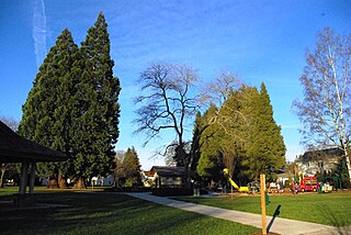
Bagley Park is a two-acre municipal park in downtown Hillsboro, Oregon, United States. Opened in 1926, the park covers a half-block at northeast Second Avenue and Jackson Street north of the Washington County Courthouse. After a major renovation project ending in 2008, the park includes a picnic shelter, a playground, restrooms, and several sports facilities.

Rood Bridge Park

Rood Bridge Park is a municipal park in southeast Hillsboro, Oregon, United States. Opened in 1999, the park encompasses 60 acres (24 ha) on the north bank of the Tualatin River at its confluence with Rock Creek. Rood Bridge is near Hillsboro High School and sits across the river from Meriwether National Golf Course. The park is the city’s largest, and contains tennis courts, a meeting facility, trails, a canoe launch, and a rhododendron garden among other features.

Magnolia Park (Hillsboro, Oregon) city park in Hillsboro, Oregon, United States

Magnolia Park is a municipal park in the Tanasbourne neighborhood of Hillsboro, Oregon, United States. Opened in 2008, the 3.11 acres (12,600 m2) community park is off northwest 192nd avenue between Walker and Cornell roads near The Streets of Tanasbourne shopping center. The park includes a basketball court, children’s play equipment, picnic shelter, tennis court, and water fountain designed for cooling among other amenities.
Reedville Creek Park

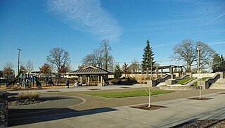
Reedville Creek Park is a municipal park in the Reedville neighborhood of Hillsboro, Oregon, United States. Opened in 2003, the 9.6-acre (39,000 m2) park is along Cornelius Pass Road at Francis Street in the southeast area of the city. The park includes basketball courts, children’s play equipment, a picnic shelter, tennis courts, and sports fields among other amenities. Reedville Creek was the first and is the only park in Hillsboro with a skatepark.

Hamby Park

U. J. Hamby Park is a nearly seven acre municipal park in northwest Hillsboro, Oregon, United States. Opened in 1990, the park includes nature trails along a small creek as well as a basketball court and grass lawn. The park is named after the longtime Chevrolet dealership owner, whose family donated the land to the city in 1986. The natural portion of the park includes wetlands and woodlands.

Town Center Park

Town Center Park is a small municipal park in Wilsonville, Oregon, United States. Located in the middle of Wilsonville's town center, the 5-acre (2.0 ha) park cost $4.5 million to complete. The park includes the Oregon Korean War Memorial, a visitor's center, paths, a play area, picnic tables, and an amphitheater among other features. Completed in 2005, Town Center Park is also home to Wilsonville's first interactive water feature.
53rd Avenue Park

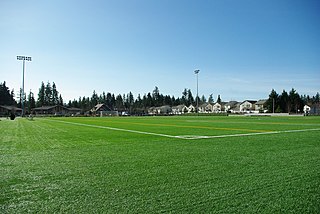
53rd Avenue Park is a municipal park under development in Hillsboro, Oregon, United States. Partially opened in 2008, the park covers 43.5 acres (17.6 ha) along northeast 53rd Avenue in the middle of the city. Currently the park includes two multi-purpose sports fields covered with artificial turf with other sports amenities and a water fountain under construction. Plans call for a large indoor recreation center at the park including pools, basketball courts, tennis courts, and exercise facilities to go along with outdoor park items that include children's play equipment and walking trails. Land for the park was purchased from exercise equipment maker Soloflex beginning in 2001.

Wilsonville Public Library library

The Wilsonville Public Library (WPL) is the single-location public library of the city of Wilsonville in the U.S. state of Oregon. Established in 1982, the library moved to its present location near Wilsonville Memorial Park in 1988. WPL is a part of the Library Information Network of Clackamas County and serves a population of about 21,900. The library has approximately 155,000 items in its collection with a total circulation of approximately 515,000.

Graham Oaks Nature Park

Graham Oaks Nature Park is a 250 acres (100 ha) nature park in Wilsonville in the U.S. state of Oregon. Opened in 2010, the park is owned and operated by Metro, the regional government in the Oregon portion of the Portland metropolitan area.
Orenco Woods Nature Park

Orenco Woods Nature Park is a park located in Hillsboro, Oregon, United States. The site was formerly nine-hole Orenco Woods Golf Course in the Orenco neighborhood owned by the Hillsboro Elks. The eastern edge is bounded by Cornelius Pass Road and the tracks for the MAX Blue Line form the northern boundary. Rock Creek flows through the 42-acre (17 ha) site between Orchard Park upstream and Noble Woods Park downstream, with the Rock Creek Trail planned to connect all three parks.

References

  1. 1 2 3 4 5 6 7 8 9 10 11 12 Memorial Park. City of Wilsonville. Retrieved on June 21, 2009.
  2. 1 2 Brinkley, Pam (November 14, 1989). "Wilsonville group seeks new name". The Oregonian . p. B2.
  3. 1 2 "South Metro: Wilsonville officials pleased with interest rate bid on bonds". The Oregonian. August 27, 1987. p. 7.
  4. "South Metro: Improvements for Wilsonville's riverside parks set". The Oregonian. October 1, 1987. p. 9.
  5. 1 2 Brinkley, Pam (January 18, 1989). "Wilsonville council to rename park for late leader Phillip R. Balsiger". The Oregonian. p. B5.
  6. Brinkley, Pam (November 22, 1989). "Wilsonville park to go back to its original name". The Oregonian. p. B2.
  7. 1 2 Wuorio, Jeff (September 20, 1990). "Wilsonville authorizes master plan for city park". The Oregonian. p. D2.
  8. "Hearing on park plan amendment scheduled". The Oregonian. February 28, 1991. p. B2.
  9. Wuorio, Jeff (May 3, 1991). "Panel seeks $350,000 for Wilsonville Memorial Park". The Oregonian. p. D2.
  10. Wuorio, Jeff (June 5, 1991). "Wilsonville park work plans unsettled". The Oregonian. p. B2.
  11. 1 2 "West Zoner: Wilsonville park bid better than expected". The Oregonian. July 9, 1992. p. 11.
  12. 1 2 Bella, Rick (March 22, 2002). "Site plan sketches new civic center for Wilsonville". The Oregonian. p. C2.
  13. Kohler, Vince (September 20, 1995). "Wilsonville turns down library, park measures". The Oregonian. p. B2.
  14. "Wilsonville gets community garden going once again". The Oregonian. April 12, 1996. p. B2.
  15. "Southwest Zoner: What's happening Dream Hoops: Community Snapshot". The Oregonian. September 23, 1996. p. B4.
  16. "Community Snapshot: Wilsonville skateboard area gets approval, but the city keeps its involvement low". The Oregonian. April 8, 1998. p. C2.
  17. Haight, Abby (January 3, 2008). "Metro South Neighbors: Skateboarders can help wheels of progress turn". The Oregonian. p. 11.
  18. Amick, Steven (September 13, 1996). "A vision of Wilsonville". The Oregonian. p. B2.
  19. Tims, Dana (January 28, 2000). "Wilsonville's annual festival will leave past behind; Organizers aim to appeal to the interests of the 31-year-old city's many newcomers, many from out of state". The Oregonian. p. D2.
  20. "Southwest Zoner: Boones Ferry Days". The Oregonian. July 31, 1997. p. 1.
  21. Bella, Rick (December 26, 2005). "Wilsonville's aquatic center: finally?". The Oregonian. p. B1.
  22. 1 2 3 Mortenson, Eric (September 14, 2006). "Metro Southwest Neighbors: City Hall will close, only to open in new location". The Oregonian. p. 9.
  23. 1 2 Church, Foster (March 23, 2006). "Metro Southwest Neighbors: Fast growth may force city to consider new levy". The Oregonian. p. 10.
  24. Mortenson, Eric (June 6, 2007). "Unhealthy water cited in fountains' closure". The Oregonian. p. C2.
  25. 1 2 Haight, Abby (November 22, 2007). "Metro Southwest Neighbors: Crisis spurs action on affordable senior housing". The Oregonian. p. 6.
  26. "Metro Southwest Neighbors: Lake Oswego: Celebration puts shine on old barn's new face", The Oregonian, p. 16, September 11, 2008
  27. Dunlap, Sarah (July 24, 2008). "Metro Southwest Neighbors: Have a splash in the 'burbs". The Oregonian. p. 11.
  28. Ruder, Ian (July 26, 2001). "Southwest Zoner: Area Parks; Wilsonville". The Oregonian. p. 7.
  29. Tims, Dana (August 17, 2006). "Metro Southwest Neighbors: City's new park occupies 15 'nontraditional' acres". The Oregonian. p. 7.
  30. Ericson, Cathie (March 27, 2008). "Metro Southwest Neighbors: Plan ahead if you want to picnic, play on field". The Oregonian. p. 18.
  31. 1 2 Owen, Wendy (September 4, 2008). "Metro Southwest Neighbors: Visit 107-year-old barn and travel back in time". The Oregonian. p. 6.
  32. 1 2 Ruder, Ian (September 7, 2006). "Metro Southwest Neighbors: Recreation; Bird-watchers get ready for a walk in the park". The Oregonian. p. 22.
  33. Haight, Abby (March 20, 2008). "Metro Southwest Neighbors: Heritage tree program cites living landmarks". The Oregonian. p. 6.
  34. 1 2 Ericson, Cathie (July 17, 2008). "Metro Southwest Neighbors: 'Art in the Park' will be 'very crafty this year'". The Oregonian. p. 20.
  35. 1 2 Haight, Abby (August 23, 2007). "Metro Southwest Neighbors: 'Free Willy' will be shown for free at park". The Oregonian. p. 7.