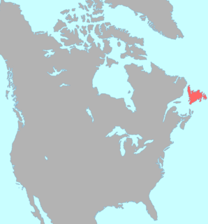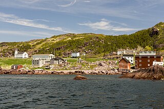
The Beothuk were a group of indigenous people who lived on the island of Newfoundland.

Bonavista is a town on the Bonavista Peninsula, Newfoundland in the Canadian province of Newfoundland and Labrador. Unlike many Newfoundland coastal settlements, Bonavista was built on an open plain, not in a steep cove, and thus had room to expand to its current area of 31.5 km2 (12.2 sq mi).

St. George's Bay - informally referred to as Bay St. George due to its French translation Baie St-George - is a large Canadian bay in the province of Newfoundland and Labrador. It is located on the west coast of the island of Newfoundland and comprises a sub-basin of the Gulf of St. Lawrence.

Glovers Harbour, also written as Glover's and formerly known as Thimble Tickle(s), is an unincorporated community and harbour in Notre Dame Bay, on the northern coast of Newfoundland, Canada. It is delineated as a designated place for statistical purposes.

Open Hall-Red Cliffe is a designated place in the province of Newfoundland and Labrador, Canada.

The East Coast Trail (ECT) is a long-distance coastal footpath located in the Canadian province of Newfoundland and Labrador. It is a developed trail over 336 kilometres (209 mi) long, creation of which began in 1994. It is made up of 25 linked wilderness paths and passes through more than 30 communities. It was named one of the best adventure destinations by National Geographic in 2012 and is extended and improved yearly.
Tom Dawe, is a Canadian writer from Newfoundland and Labrador.
Musgrave Harbour is a Canadian town in the province of Newfoundland and Labrador.

Nipper's Harbour is a town located on the east coast of the Baie Verte Peninsula of Newfoundland in the Canadian province of Newfoundland and Labrador. This incorporated community of 85 people is located on a rocky inlet that combines Nipper's Harbour and Noble's Cove, and where the primary industry is the inshore fishery.

The Drake House is a two-story house with a low-pitched gable roof. It is located at 319 Main Road, Arnold's Cove, Newfoundland and Labrador, Canada.

Admirals Beach is a rural community located in Newfoundland and Labrador, Canada.

Pinware is a town in the Canadian province of Newfoundland and Labrador. The town has a population of 88, according to the Canada 2016 Census.

The Connaigre Peninsula is a Canadian peninsula located on the south coast of the island of Newfoundland in the province of Newfoundland and Labrador.
Lodge Bay(52°13′00″N55°37′59″W AST) is a permanent community located along the southeast coast of Labrador, part of the province of Newfoundland and Labrador, Canada. Encompassing a population of less than one hundred residents, the community has uniquely evolved from both early European colonization of Labrador, and the inimitable patterns of land and resource use by the migratory Inuit population. The name Lodge Bay originated from the title Ranger Lodge, which was the name given to the area by trader and explorer, Captain George Cartwright in the late 18th century. "Ranger" was the name of the wooden-mercantile ship Cartwright used to trade, map and explore the Labrador coast, while "Lodge" was the name given to English hunting camps in Great Britain at that time.

Haystack was a former fishing settlement located on the northern portion of Long Island, Placentia Bay of the island of Newfoundland in the province of Newfoundland and Labrador, Canada. It was resettled during the resettlement program of the 1950s and 60s.
John C. Butt is a former politician in Newfoundland. He represented Conception Bay South in the Newfoundland House of Assembly from 1979 to 1989.
Division No. 1, Subdivision B is an unorganized subdivision on the Avalon Peninsula in Newfoundland and Labrador, Canada. It is in Division 1 and contains the unorganized communities of Iona, Little Barasway, Placentia Junction, Point Verde and Ship Harbour.

Division No. 1, Subdivision G is an unorganized subdivision on the Avalon Peninsula in Newfoundland and Labrador, Canada. It is in Division 1 and contains the unincorporated communities of Baccalieu Island, Besom Cove, Bradley's Cove, Burnt Point, Caplin Cove, Daniel's Cove, Grates Cove, Gull Island, Job's Cove, Kingston, Long Beach, Lower Island Cove, Low Point, Northern Bay, Ochre Pit Cove, Red Head Cove, Riverhead, Smooth Cove and Western Bay.

Long Island is a long narrow island located in the inner portion of Placentia Bay. The longest axis of the island lies in a north-south direction. It is approximately 24 kilometres long and just over 3 kilometres at its widest point. Long Island along with Merasheen Island and Red Island make up the majority of the islands in Placentia Bay. Long Island is located approximately 22 kilometres northwest of Argentia. It is separated from Merasheen Island to the west by a 24 kilometre long channel that narrows to within 2.12 kilometres. Red Island is approximately 10 kilometres to the southwest of Long Island.

Lockesporte, also spelled Lockesport or Lockport and originally known as Lock's Harbour, was a fishing village and logging community on the eastern coast of Seal Bay, within the much larger Notre Dame Bay, Newfoundland, Canada.


