Wishka Hirka

Last updated
Wishka Hirka

Laguna Conococha.jpg

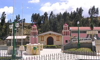
Qiwllarahu with Wishka Hirka (on the left) and the lake Quñuqqucha in the foreground
Highest point
Elevation 4,934 m (16,188 ft) [1]
Coordinates 9°57′58″S77°16′48″W / 9.96611°S 77.28000°W / -9.96611; -77.28000 Coordinates: 9°57′58″S77°16′48″W / 9.96611°S 77.28000°W / -9.96611; -77.28000
Geography
Peru physical map.svg
Red triangle with thick white border.svg
Wishka Hirka
Peru
Location Peru, Ancash Region
Parent range Andes, Cordillera Blanca

Wishka Hirka (Ancash Quechua wishka viscacha, hirka mountain, [2] "viscacha mountain") or Wishpa Hirka (Ancash Quechua wishpa influenza, "influenza mountain", Hispanicized spelling Huishpajirca) is a 4,934-metre-high (16,188 ft) mountain in the southern part of the Cordillera Blanca in the Andes of Peru. It is located in the Ancash Region, Recuay Province, Catac District. Wishka Hirka lies southwest of Qiwllarahu. [1] [3]

Ancash Quechua, or Huaylay, is a Quechua variety, spoken in the department of Ancash by approximately 1,000,000 people. Like Wanka Quechua, it belongs to Quechua I.

Viscacha rodent

Viscachas or vizcachas are rodents of two genera in the family Chinchillidae. They are native to South America and look similar to, but are not closely related to rabbits. The viscacha looks much like a rabbit due to convergent evolution.

Influenza infectious disease

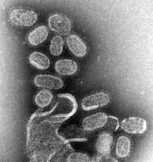
Influenza, commonly known as the flu, is an infectious disease caused by an influenza virus. Symptoms can be mild to severe. The most common symptoms include: high fever, runny nose, sore throat, muscle pains, headache, coughing, sneezing, and feeling tired. These symptoms typically begin two days after exposure to the virus and most last less than a week. The cough, however, may last for more than two weeks. In children, there may be diarrhea and vomiting, but these are not common in adults. Diarrhea and vomiting occur more commonly in gastroenteritis, which is an unrelated disease and sometimes inaccurately referred to as "stomach flu" or the "24-hour flu". Complications of influenza may include viral pneumonia, secondary bacterial pneumonia, sinus infections, and worsening of previous health problems such as asthma or heart failure.

See also

Related Research Articles

Aija Province Province in Ancash, Peru

The Aija Province is one of 20 provinces of the Ancash Region in Peru.

Huaraz Province Province in Ancash, Peru

The Huaraz Province is one of twenty provinces of the Ancash Region in Peru. It was created on August 5, 1857 during the presidency of Ramón Castilla. Geographically, the province is located over the Callejón de Huaylas and the western slopes of the Cordillera Negra.

Aija District District in Ancash, Peru

Aija District is one of 5 districts in Aija Province, Ancash Region, Peru.

Recuay Province Province in Ancash, Peru

The Recuay Province is one of twenty provinces of the Ancash Region in Peru. Its seat is the town of Recuay.

Pomabamba Province Province in Ancash, Peru

The Pomabamba Province is one of twenty provinces of the Ancash Region in Peru. It was formerly called Pumapampa and today it is also known as "The City of Cedars". It is located at the left bank of the Pomabamba river, at 3,063 meters (10,049 ft) above sea level. It was created by law on February 21, 1861.

Catac District District in Ancash, Peru

Catac District is one of ten districts of the province Recuay in Peru. Its seat is Catac.

Pukarahu or Puka Rahu may refer to:

Yana Kunkush

Yana Kunkush is a mountain in the southern part of the Cordillera Negra in the Andes of Peru, about 4,600 metres (15,092 ft) high. It is situated in the Ancash Region, Aija Province, Aija District, and in the Recuay Province, Catac District. Yana Kunkush lies southeast of Sach'a Hirka and east of a lake of that name.

Qiwlla Hirka

Qiwlla Hirka is a mountain in the southern part of the Cordillera Blanca in the Andes of Peru, about 5,000 m (16,000 ft) high. It is located in the Ancash Region, Recuay Province, Catac District. Qiwlla Hirka lies northeast of Qiwllarahu and Challwa, near Pastu Ruri.

Puka Qaqa (Recuay) mountain in Peru

Puka Qaqa is a 4,640-metre-high (15,220 ft) mountain in the Cordillera Negra in the Andes of Peru. It is situated in the Ancash Region, Recuay Province, on the border of the districts of Huayllapampa and Marca. Puka Qaqa lies southwest of Qulluta and Minas Hirka.

Puka Hirka (Bolognesi)

Puka Hirka is a mountain in the Cordillera Blanca in the Andes of Peru, about 4,800 m (15,700 ft) high. It is situated in the Ancash Region, Bolognesi Province, Aquia District, northeast of Pastururi.

Puka Hirka (Aija-Recuay)

Puka Hirka is a mountain in the Cordillera Negra in the Andes of Peru, about 4,600 m (15,100 ft) high. It is situated in the Ancash Region, Aija Province, on the border of the districts of Aija and La Merced, in the Huaraz Province, Huaraz District, and in the Recuay Province, Recuay District.

Puka Hirka or Pukahirka may refer to:

Sacha Hirka mountain in Peru

Sach'a Hirka is a mountain in the Cordillera Negra in the Andes of Peru which reaches a height of approximately 4,600 m (15,100 ft). It lies in the Ancash Region on the border of the Aija Province, Aija District, and the Recuay Province, Catac District. Sach'a Hirka lies northwest of Yana Kunkush.

Kushuru Hirka mountain in Peru

Kushuru Hirka is a mountain in the Cordillera Negra in the Andes of Peru which reaches a height of approximately 4,600 m (15,100 ft). It lies in the Ancash Region, Recuay Province, on the border of the districts of Cotaparaco and Tapacocha.

Kuntur Wayi or Kuntur Wayin may refer to:

Qulluta may refer to:

Puma Wayin may refer to:

Hatun Hirka may refer to:

Qullpa Hirka mountain in Peru

Qullpa Hirka is a mountain in the Cordillera Negra in the Andes of Peru which reaches a height of approximately 4,400 m (14,400 ft). It lies in the Ancash Region, Recuay Province, in the northern part of the Cotaparaco District.

References

  1. 1 2 "Cerro Huishpajirca". IGN, Peru. Retrieved March 14, 2015.
  2. Leonel Alexander Menacho López, Yachakuqkunapa Shimi Qullqa, Anqash Qhichwa Shimichaw (Ministerio de Educación), Wordbook Ancash Quechua-Spanish
  3. escale.minedu.gob.pe - UGEL map of the Recuay Province (Ancash Region)