Radziochy is a village in the administrative district of Gmina Skępe, within Lipno County, Kuyavian-Pomeranian Voivodeship, in north-central Poland. It lies approximately 8 kilometres (5 mi) north of Skępe, 14 km (9 mi) north-east of Lipno, and 49 km (30 mi) east of Toruń.
Kąty is a village in the administrative district of Gmina Dziadkowice, within Siemiatycze County, Podlaskie Voivodeship, in north-eastern Poland. It lies approximately 3 kilometres (2 mi) east of Dziadkowice, 15 km (9 mi) north of Siemiatycze, and 65 km (40 mi) south of the regional capital Białystok.
Nieciecz is a village in the administrative district of Gmina Puławy, within Puławy County, Lublin Voivodeship, in eastern Poland. It lies approximately 15 kilometres (9 mi) north of Puławy and 56 km (35 mi) north-west of the regional capital Lublin.
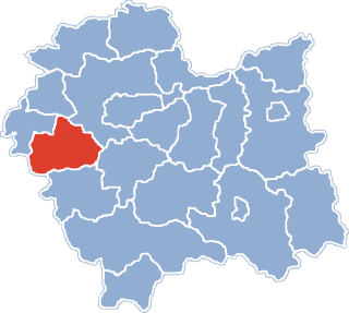
Jaroszowice is a village in the administrative district of Gmina Wadowice, within Wadowice County, Lesser Poland Voivodeship, in southern Poland. It lies approximately 4 kilometres (2 mi) south-east of Wadowice and 37 km (23 mi) south-west of the regional capital Kraków.
Wysoka is a village in the administrative district of Gmina Wadowice, within Wadowice County, Lesser Poland Voivodeship, in southern Poland. It lies approximately 9 kilometres (6 mi) north-east of Wadowice and 30 km (19 mi) south-west of the regional capital Kraków.
Brzeźnica is a village in Wadowice County, Lesser Poland Voivodeship, in southern Poland. It is the seat of the gmina called Gmina Brzeźnica. It lies approximately 14 kilometres (9 mi) north-east of Wadowice and 25 km (16 mi) south-west of the regional capital Kraków.
Marcyporęba is a village in the administrative district of Gmina Brzeźnica, within Wadowice County, Lesser Poland Voivodeship, in southern Poland. It lies approximately 3 kilometres (2 mi) south-west of Brzeźnica, 12 km (7 mi) north-east of Wadowice, and 27 km (17 mi) south-west of the regional capital Kraków.
Sosnowice is a village in the administrative district of Gmina Brzeźnica, within Wadowice County, Lesser Poland Voivodeship, in southern Poland. It lies approximately 7 kilometres (4 mi) east of Brzeźnica, 18 km (11 mi) north-east of Wadowice, and 21 km (13 mi) south-west of the regional capital Kraków.
Leńcze is a village in the administrative district of Gmina Kalwaria Zebrzydowska, within Wadowice County, Lesser Poland Voivodeship, in southern Poland. It lies approximately 5 kilometres (3 mi) north-east of Kalwaria Zebrzydowska, 16 km (10 mi) east of Wadowice, and 24 km (15 mi) south-west of the regional capital Kraków.
Podolany is a village in the administrative district of Gmina Kalwaria Zebrzydowska, within Wadowice County, Lesser Poland Voivodeship, in southern Poland. It lies approximately 9 kilometres (6 mi) north-east of Kalwaria Zebrzydowska, 20 km (12 mi) east of Wadowice, and 21 km (13 mi) south-west of the regional capital Kraków.
Jastrzębia is a village in the administrative district of Gmina Lanckorona, within Wadowice County, Lesser Poland Voivodeship, in southern Poland. It lies approximately 5 kilometres (3 mi) north-east of Lanckorona, 20 km (12 mi) east of Wadowice, and 25 km (16 mi) south-west of the regional capital Kraków.

Jaszczurowa is a village in the administrative district of Gmina Mucharz, within Wadowice County, Lesser Poland Voivodeship, in southern Poland. It lies approximately 9 kilometres (6 mi) south-east of Wadowice and 39 km (24 mi) south-west of the regional capital Kraków.

Mucharz is a village in Wadowice County, Lesser Poland Voivodeship, in southern Poland. It is the seat of the gmina called Gmina Mucharz. It lies approximately 9 kilometres (6 mi) south-east of Wadowice and 39 km (24 mi) south-west of the regional capital Kraków.
Zagórze is a village in the administrative district of Gmina Mucharz, within Wadowice County, Lesser Poland Voivodeship, in southern Poland. It lies approximately 3 kilometres (2 mi) north-east of Mucharz, 8 km (5 mi) south-east of Wadowice, and 37 km (23 mi) south-west of the regional capital Kraków.
Lgota is a village in the administrative district of Gmina Tomice, within Wadowice County, Lesser Poland Voivodeship, in southern Poland. It lies approximately 7 kilometres (4 mi) north-east of Tomice, 8 km (5 mi) north-east of Wadowice, and 31 km (19 mi) south-west of the regional capital Kraków.
Tomice is a village in Wadowice County, Lesser Poland Voivodeship, in southern Poland. It is the seat of the gmina called Gmina Tomice. It lies approximately 3 kilometres (2 mi) north-west of Wadowice and 37 km (23 mi) south-west of the regional capital Kraków.
Zygodowice is a village in the administrative district of Gmina Tomice, within Wadowice County, Lesser Poland Voivodeship, in southern Poland. It lies approximately 8 kilometres (5 mi) north of Wadowice and 33 km (21 mi) west of the regional capital Kraków.
Zabłocie is a village in the administrative district of Gmina Serock, within Legionowo County, Masovian Voivodeship, in east-central Poland. It lies approximately 11 kilometres (7 mi) north-west of Serock, 17 km (11 mi) north of Legionowo, and 38 km (24 mi) north of Warsaw.
Kosino is a village in the administrative district of Gmina Radzanowo, within Płock County, Masovian Voivodeship, in east-central Poland. It lies approximately 5 kilometres (3 mi) south-east of Radzanowo, 16 km (10 mi) east of Płock, and 82 km (51 mi) north-west of Warsaw.